Thalero
Local name: Θαλερό
Located in Xylokastro-Evrostina, Corinthia Coordinates: 38°02′12″ N 22°39′50″ E
- Population
- 162
- 162
- Elevation
- 151 m
- above sea level
- Local time
- UTC+02:00
- Europe/Athens · UTC+02:00
- Airports
- GPA Patras Araxos Agamemnon Airport109 km
- ATH Athens Eleftherios Venizelos International Airport113 km
About Thalero
Thalero is a village. Location: Xylokastro-Evrostina, Corinthia. Population: 162. Elevation: 151 m.
Thalero (Greek: Θαλερό) is a village in Corinthia, Greece. It is located 2 kilometers from the Gulf of Corinth, close to the city of Xylokastro. Its original name was Tholero, the water, but it was changed to Thalero, originating from the ancient Greek word “thalos”, which means blooming. Poet Angelos Sikelianos spent his vacations there and wrote a poem has the name of the village. Its population is around 200 people and the hospitality of its people is famous to all of Corinthia.
Source: Wikipedia · CC BY-SA 4.0
Population of Thalero over time
| 1951 | 192 | |
|---|---|---|
| 1991 | 254 | |
| 2001 | 263 | |
| 2011 | 162 | |
| 2021 | 133 |
Censuses and official estimates; source: Wikidata.
Climate of Thalero
Best months for sightseeingBest months for sightseeing: April–May, September–October.
This month · November
Outside the best season
Day 17° · Night 8° · Rain 98 mm
- Hottest month
- July (day 32°)
- Coldest month
- January (night 4°)
- Wettest month
- December (109 mm)
- Driest month
- July (13 mm)
Bars: average monthly low and high temperature. Below: precipitation. Monthly averages for 1970–2000 at about 18 km resolution, adjusted for elevation. Highlighted months are mild and relatively dry. Source: WorldClim 2.1 (CC BY 4.0).
Show values as a table
| Month | Jan | Feb | Mar | Apr | May | Jun | Jul | Aug | Sep | Oct | Nov | Dec |
|---|---|---|---|---|---|---|---|---|---|---|---|---|
| Average high (°C) | 12° | 13° | 15° | 19° | 25° | 30° | 32° | 32° | 28° | 23° | 17° | 14° |
| Average low (°C) | 4° | 4° | 6° | 9° | 13° | 17° | 19° | 19° | 16° | 12° | 8° | 6° |
| Precipitation (mm) | 85 | 82 | 70 | 49 | 31 | 17 | 13 | 17 | 25 | 71 | 98 | 109 |
Other places to visit in this season: April May September October
How to get to Thalero
The nearest airport is Patras Araxos Agamemnon Airport (GPA), 109 km to the west as the crow flies. For international flights: Athens Eleftherios Venizelos International Airport (ATH) (113 km). The nearest large city is Piraeus, 87 km to the east.
Airports
- Patras Araxos Agamemnon Airport (GPA) Patras 109 kmwest
- Athens Eleftherios Venizelos International Airport (ATH) Spata-Artemida 113 kmeast
- Kalamata Airport (KLX) Kalamata 121 kmsouthwest
Nearby large cities
- Piraeus Population: 163.7K 87 kmeast
- Athens Population: 664K 94 kmeast
- Çiğli Population: 214.1K 389 kmeast
- Konak Population: 332.3K 391 kmeast
- Cordaleo Population: 339.6K 392 kmeast
Straight-line distances; road distances are longer. Airport data: OurAirports.
Day trips from Thalero
Within 100 km: 34 historic and cultural sites, 5 natural sites, 23 lakes, rivers and coasts.
0–25 km3 places
- Phlius Historic site 21 kmS
- Acrocorinth Historic site 24 kmSE
- Archaeological Museum of Ancient Corinth Museum 24 kmSE
25–60 km11 places
- Moní Agíou Ierothéou Attraction 53 kmE
- Ierá Moní Odigítrias Attraction 60 kmN
- Hosios Loukas Attraction 40 kmN
- Nisída Trachíli Island 57 kmSE
60–100 km48 places
- Agistri Island 71 kmSE
- Pnyx Mountain 93 kmE
- Moní Agíon Pánton Attraction 97 kmSE
- Moní Genesíou Theotókou Damástas Attraction 83 kmN
Straight-line distances.
Nearby attractions & nature
Everything nearby-
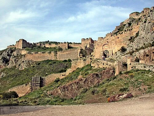 Acrocorinth Historic site, Corinth24 km SE
-
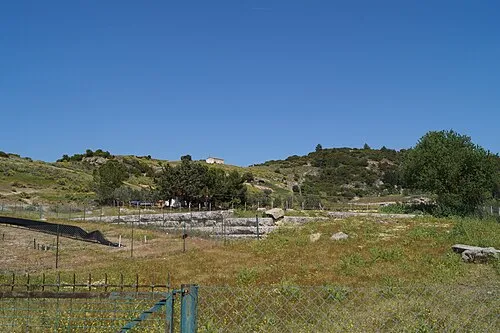 Phlius Historic site, Nemea21 km S
-
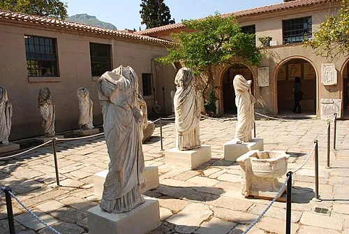 Archaeological Museum of Ancient Corinth Museum, Corinth24 km SE
Sources & licences
Data last updated: · 2 independent sources