Gytheion
Local name: Γύθειο
Located in East Mani, Laconia Coordinates: 36°45′18″ N 22°33′51″ E

- Population
- 4,279
- 4.3K
- Elevation
- 168 m
- above sea level
- Local time
- UTC+02:00
- Europe/Athens · UTC+02:00
- Airports
- KLX Kalamata Airport59 km
- ATH Athens Eleftherios Venizelos International Airport179 km
About Gytheion
Gytheion is a village. Location: East Mani, Laconia. Population: 4,279. Elevation: 168 m.
Gytheio (Greek: Γύθειο [ˈʝiθio]) or Gythio, also the ancient Gythium or Gytheion (Ancient Greek: Γύθειον), is a town on the eastern shore of the Mani Peninsula in the Peloponnese of southern Greece, in the historical and administrative region of Laconia. It is the largest and most important town in Mani. Gytheio is the seat of the municipality of East Mani. Gytheio is significant in the history of Mani and the Maniots. Ancient Gytheio was the seaport of Ancient Sparta, approximately 40 kilometres (25 miles) north.
Source: Wikipedia · CC BY-SA 4.0
Population of Gytheion over time
| 1951 | 5,933 | |
|---|---|---|
| 1991 | 4,255 | |
| 2001 | 4,479 | |
| 2011 | 4,279 | |
| 2021 | 4,070 |
Censuses and official estimates; source: Wikidata.
Climate of Gytheion
Best months for sightseeingBest months for sightseeing: May, October.
This month · November
A wet month
Day 18° · Night 10° · Rain 105 mm
- Hottest month
- July (day 30°)
- Coldest month
- January (night 6°)
- Wettest month
- December (111 mm)
- Driest month
- June (5 mm)
Bars: average monthly low and high temperature. Below: precipitation. Monthly averages for 1970–2000 at about 18 km resolution, adjusted for elevation. Highlighted months are mild and relatively dry. Source: WorldClim 2.1 (CC BY 4.0).
Show values as a table
| Month | Jan | Feb | Mar | Apr | May | Jun | Jul | Aug | Sep | Oct | Nov | Dec |
|---|---|---|---|---|---|---|---|---|---|---|---|---|
| Average high (°C) | 13° | 13° | 15° | 18° | 23° | 28° | 30° | 30° | 27° | 22° | 18° | 14° |
| Average low (°C) | 6° | 6° | 7° | 10° | 14° | 18° | 20° | 20° | 18° | 14° | 10° | 8° |
| Precipitation (mm) | 90 | 80 | 60 | 40 | 16 | 5 | 5 | 8 | 16 | 64 | 105 | 111 |
How to get to Gytheion
The nearest airport is Kalamata Airport (KLX), 59 km to the northwest as the crow flies. For international flights: Athens Eleftherios Venizelos International Airport (ATH) (179 km). The nearest large city is Piraeus, 163 km to the northeast.
Airports
- Kalamata Airport (KLX) Kalamata 59 kmnorthwest
- Athens Eleftherios Venizelos International Airport (ATH) Spata-Artemida 179 kmnortheast
- Patras Araxos Agamemnon Airport (GPA) Patras 185 kmnorthwest
Nearby large cities
- Piraeus Population: 163.7K 163 kmnortheast
- Athens Population: 664K 171 kmnortheast
Straight-line distances; road distances are longer. Airport data: OurAirports.
Day trips from Gytheion
Within 100 km: 18 historic and cultural sites, 2 natural sites, 20 lakes, rivers and coasts.
0–25 km2 places
- Agia Varvara Attraction 12 kmSW
- Moni Golas Attraction 24 kmNW
25–60 km23 places
- Moni Gardikiou Attraction 59 kmNW
- Moní Velanidiás Attraction 52 kmNW
- Moni Dimiovis Attraction 45 kmNW
- Moni Profiti Ioil Attraction 50 kmNW
60–100 km15 places
- Moni Voulkanou Attraction 72 kmNW
- Moní Agíon Pánton Attraction 77 kmNE
- Ierá Moní Agíou Nikoláou Kaltezón Attraction 66 kmN
- Moni Ambelaki Attraction 65 kmNW
Straight-line distances.
Nearby attractions & nature
Everything nearby-
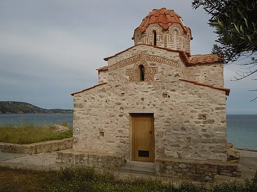 Agia Varvara Attraction, East Mani12 km SW
-
Moni Golas Attraction, Sparti24 km NW
Sources & licences
Data last updated: · 2 independent sources