Myrtonas
Local name: Μυρτώνας
Located in Karpathos, Dodecanese Coordinates: 35°34′52″ N 27°10′04″ E
- Population
- 20
- 20
- Elevation
- 332 m
- above sea level
- Local time
- UTC+02:00
- Europe/Athens · UTC+02:00
- Airports
- AOK Karpathos Airport18 km
- JSH Sitia Airport105 km
About Myrtonas
Myrtonas is a village. Location: Karpathos, Dodecanese. Population: 20. Elevation: 332 m. The best months to visit are May–June, September–October. The nearest airport is Karpathos Airport (18 km). Nearby sights include Nisída Afóti and Nisi.
Climate of Myrtonas
Best months for sightseeingBest months for sightseeing: May–June, September–October.
This month · November
Outside the best season
Day 19° · Night 13° · Rain 76 mm
- Hottest month
- July (day 29°)
- Coldest month
- February (night 9°)
- Wettest month
- January (140 mm)
- Driest month
- July (1 mm)
Bars: average monthly low and high temperature. Below: precipitation. Monthly averages for 1970–2000 at about 18 km resolution, adjusted for elevation. Highlighted months are mild and relatively dry. Source: WorldClim 2.1 (CC BY 4.0).
Show values as a table
| Month | Jan | Feb | Mar | Apr | May | Jun | Jul | Aug | Sep | Oct | Nov | Dec |
|---|---|---|---|---|---|---|---|---|---|---|---|---|
| Average high (°C) | 14° | 14° | 16° | 18° | 23° | 27° | 29° | 29° | 26° | 23° | 19° | 15° |
| Average low (°C) | 9° | 9° | 10° | 12° | 16° | 20° | 22° | 22° | 20° | 17° | 13° | 11° |
| Precipitation (mm) | 140 | 106 | 72 | 33 | 16 | 4 | 1 | 1 | 10 | 56 | 76 | 123 |
Other places to visit in this season: May June September October
How to get to Myrtonas
The nearest airport is Karpathos Airport (AOK), 18 km to the south as the crow flies. For international flights: Rhodes International Airport "Diagoras" (RHO) (123 km). The nearest large city is Aydin, 258 km to the north.
Airports
- Karpathos Airport (AOK) Karpathos Island 18 kmsouth
- Sitia Airport (JSH) Crete Island 105 kmwest
- Rhodes International Airport "Diagoras" (RHO) Rhodes 123 kmnortheast
Nearby large cities
- Aydin Population: 163K 258 kmnorth
- Nazilli Population: 119.4K 279 kmnorth
- Denizli Population: 313.2K 298 kmnortheast
- Merkezefendi Population: 280.3K 298 kmnortheast
- Karabağlar Population: 479.3K 311 kmnorth
Straight-line distances; road distances are longer. Airport data: OurAirports.
Day trips from Myrtonas
Within 100 km: 2 natural sites, 17 lakes, rivers and coasts.
0–25 km5 places
- Nisída Diakóftis Island 16 kmSW
- Nisída Chalkiás Island 14 kmSW
- Nisída Afóti Island 8 kmSE
- Nisi Island 8 kmNW
25–60 km4 places
- Vrachonisída Astakidópoulo Island 45 kmNW
- Vrachonisídes Astakída Island 47 kmNW
- Nisída Pláti Island 39 kmSW
- Nisída Pláka Island 39 kmSW
60–100 km10 places
- Halki Island 81 kmNE
- Pende Vtachi Island 99 kmNE
- Tría Nisiá Island 88 kmNW
- Nisída Chteniés Island 66 kmNE
Straight-line distances.
Nearby attractions & nature
Everything nearby-
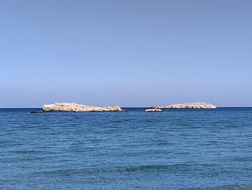 Nisída Afóti Island, Dodecanese8.5 km SE
-
Nisi Island, Dodecanese8.5 km NW
-
Nisída Chalkiás Island, Dodecanese14 km SW
-
Nisída Diakóftis Island, Dodecanese16 km SW
-
Nisída Strongylí Island, Dodecanese21 km SW
Sources & licences
Data last updated: · 2 independent sources