Agkairiá
Local name: Αγκαιριά
Located in Paros, Nomós Kykládon Coordinates: 37°00′05″ N 25°09′07″ E
- Population
- 620
- 620
- Elevation
- 73 m
- above sea level
- Local time
- UTC+02:00
- Europe/Athens · UTC+02:00
- Airports
- JMK Mykonos Island National Airport51 km
- JTR Santorini International Airport73 km
About Agkairiá
Agkairiá is a village. Location: Paros, Nomós Kykládon. Population: 620. Elevation: 73 m.
Agkairia (Greek: Αγκαιριά) is a village and a community in the Cyclades. It is located in the southwestern corner of the island of Paros. At the 2021 census, the population of the village was 343, and of the community 1,302. The community consists of several villages and uninhabited islets. The main villages are Alyki (Greek: Αλυκή, pop. 708), Agkairia, Kamari (pop. 88) and Voutakos (pop. 81).
Source: Wikipedia · CC BY-SA 4.0
Photos of Agkairiá
-
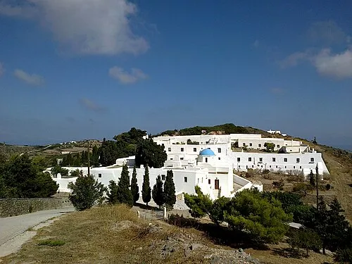
Moni Agiou Arseniou rene boulay · CC BY-SA 3.0

Population of Agkairiá over time
| 1951 | 620 | |
|---|---|---|
| 1991 | 211 | |
| 2001 | 270 | |
| 2011 | 280 | |
| 2021 | 343 |
Censuses and official estimates; source: Wikidata.
Climate of Agkairiá
Best months for sightseeingBest months for sightseeing: May–June, September–October.
This month · November
Outside the best season
Day 18° · Night 14° · Rain 62 mm
- Hottest month
- July (day 28°)
- Coldest month
- February (night 10°)
- Wettest month
- January (73 mm)
- Driest month
- July (1 mm)
Bars: average monthly low and high temperature. Below: precipitation. Monthly averages for 1970–2000 at about 18 km resolution, adjusted for elevation. Highlighted months are mild and relatively dry. Source: WorldClim 2.1 (CC BY 4.0).
Show values as a table
| Month | Jan | Feb | Mar | Apr | May | Jun | Jul | Aug | Sep | Oct | Nov | Dec |
|---|---|---|---|---|---|---|---|---|---|---|---|---|
| Average high (°C) | 14° | 14° | 15° | 19° | 22° | 27° | 28° | 28° | 25° | 22° | 18° | 15° |
| Average low (°C) | 10° | 10° | 11° | 13° | 17° | 21° | 23° | 23° | 21° | 18° | 14° | 11° |
| Precipitation (mm) | 73 | 65 | 54 | 23 | 11 | 3 | 1 | 3 | 6 | 43 | 62 | 71 |
Other places to visit in this season: May June September October
How to get to Agkairiá
The nearest airport is Mykonos Island National Airport (JMK), 51 km to the north as the crow flies. For international flights: Santorini International Airport (JTR) (73 km). The nearest large city is Athens, 167 km to the northwest.
Airports
- Mykonos Island National Airport (JMK) Mykonos 51 kmnorth
- Santorini International Airport (JTR) Santorini Island 73 kmsoutheast
- Athens Eleftherios Venizelos International Airport (ATH) Spata-Artemida 149 kmnorthwest
Nearby large cities
- Athens Population: 664K 167 kmnorthwest
- Piraeus Population: 163.7K 169 kmnorthwest
- Konak Population: 332.3K 232 kmnortheast
- Karabağlar Population: 479.3K 232 kmnortheast
- Izmir Population: 2.9M 235 kmnortheast
Straight-line distances; road distances are longer. Airport data: OurAirports.
Day trips from Agkairiá
Within 100 km: 14 historic and cultural sites, 1 natural site, 49 lakes, rivers and coasts.
0–25 km16 places
- Cyclades Island 22 kmNW
- Moni Agiou Arseniou Attraction 6 kmN
- Aghios Prokopios beach Beach 19 kmNE
- Agiassos beach Beach 25 kmE
25–60 km41 places
- Agia Paraskevi Attraction 54 kmN
- Nisída Káravos Island 42 kmS
- Nisída Kalógeros Island 42 kmS
- Vrékastro Mountain 58 kmN
60–100 km7 places
- Santorini Island 71 kmS
- Christiani Island Island 84 kmS
- Panagia Nikous Attraction 78 kmNW
- Kastro tis Orias Historic site 84 kmNW
Straight-line distances.
Nearby attractions & nature
Everything nearby-
Moni Agiou Arseniou Attraction, Paros5.9 km N
-
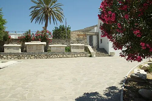 Archaeological Museum of Paros Museum, Paros9.2 km N
-
Livadia Beach Beach, Paros9.8 km N
-
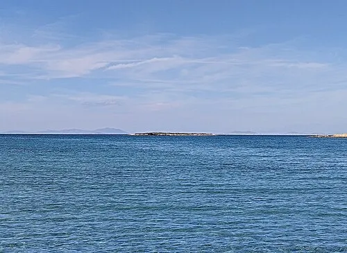 Nisída Galiátsos Island, Nomós Kykládon17 km NE
-
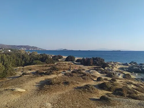 Maragkas beach Beach, Naxos and Lesser Cyclades19 km E
-
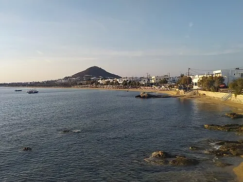 Aghios Prokopios beach Beach, Naxos and Lesser Cyclades19 km NE
Other cities and towns in Paros
-
Parasporos Village, Paros7.8 km N
-
Tsoukalas Village, Paros7.6 km NE
-
Tzanes Village, Paros7.4 km E
-
 Piso Livadi Village, Paros10 km NE
-
Ágios Charalabos Village, Paros11 km N
-
Golden Beach Village, Paros8.2 km E
Sources & licences
Data last updated: · 2 independent sources