Santorini
Local name: Σαντορίνη
Located in Nomós Kykládon, South Aegean Coordinates: 36°24′21″ N 25°27′25″ E
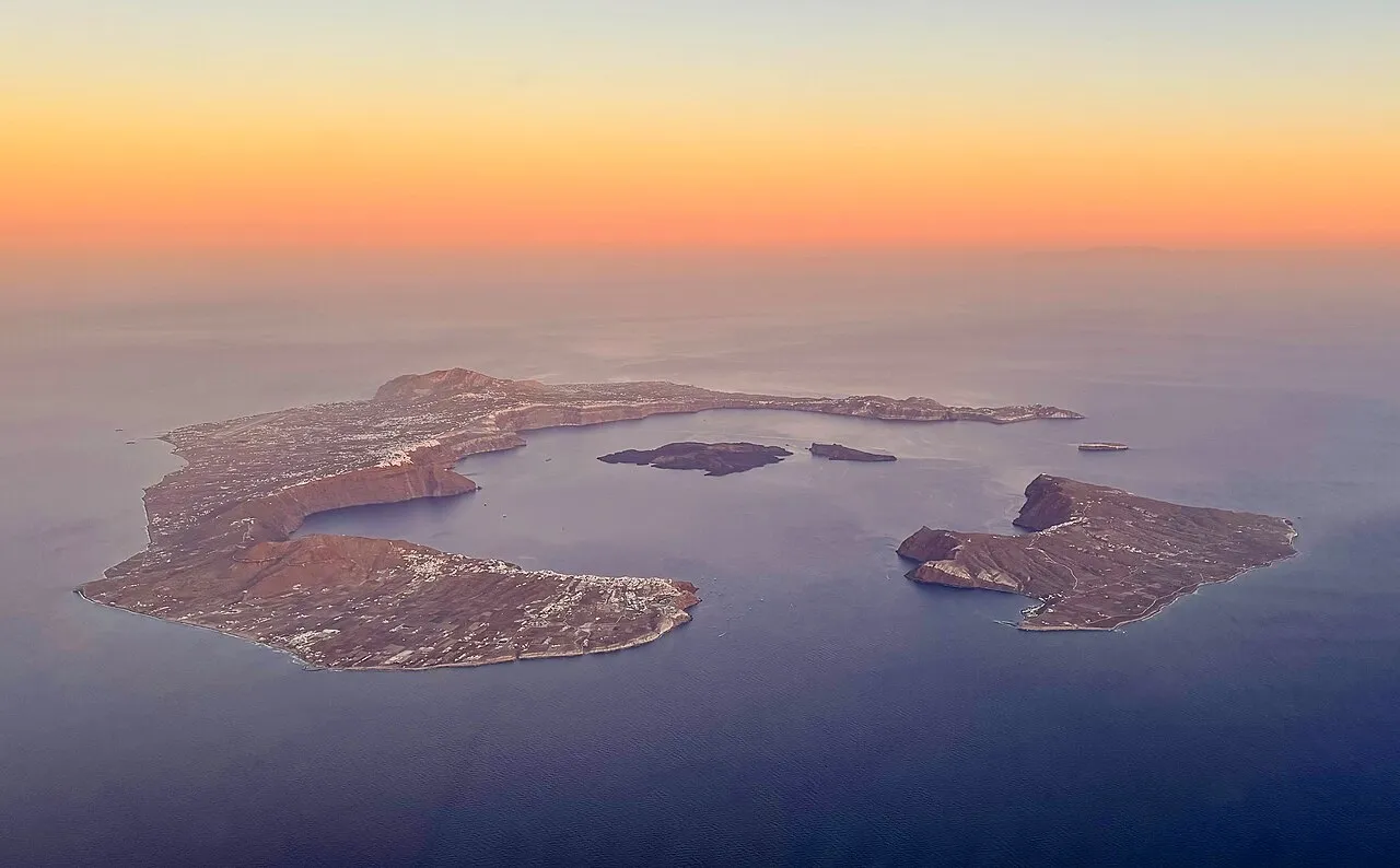
- Elevation
- 100 m
- above sea level
- Local time
- UTC+02:00
- Europe/Athens · UTC+02:00
- Population
- 15,453
- 15.5K
- Airports
- JTR Santorini International Airport2 km
- JMK Mykonos Island National Airport115 km
About Santorini
Santorini is an island. Location: Nomós Kykládon, South Aegean. Population: 15,453.
Santorini, officially Thira or Thera, is a Greek island in the southern Aegean Sea, about 200 km (120 mi) southeast from the mainland. It is the largest island of a small, circular archipelago formed by the Santorini caldera. It is the southernmost member of the Cyclades group of islands, with an area of approximately 73 km2 (28 mi2) and a 2021 census population of 15,480.
Source: Wikipedia · CC BY-SA 4.0
Photos of Santorini
-

Angelo Brathot from Sologne-France · Public domain -

Je-str · CC BY-SA 4.0 -

Vivu Vietnam · CC BY-SA 4.0 -

Angelo Brathot from Sologne-France · Public domain -

Sentinel Hub · CC BY 2.0


Travel notes for Santorini
From Wikivoyage
Santorini is an archipelago of 5 volcanic islands in the Cyclades group of the Greek islands in the southern Aegean Sea, about 200 km southeast of mainland Greece. It used to be a single island, but was obliterated around 1600 BCE by an enormous volcanic explosion that destroyed the earliest settlements on the former island and created the current geological caldera. It is famous for dramatic views, stunning sunsets from white clifftop villages, the ancient city ruins of Thera and Akrotiri, unique wines, artists and craftsmen, an active volcano, and strikingly colorful pebble beaches.
Understand+
Santorini is between Ios and Anafi islands in the southern Cyclades. On a clear day, you may be able to see Crete, about 100 km to the south. The name is a contraction of Saint Irene, after an old church in Perissa.
The Santorini archipelago used to be a single island, until a volcanic eruption around 1600 BCE tore it apart. The eruption was among the most massive in human history. There is a local legend that Santorini was once home to the Lost City of Atlantis, destroyed by the eruption. Most historians dispute this claim, but the myth's parallels to Santorini's explosive past are tantalizing. Eruptions still occur; the central Nea Kameni has grown substantially in modern times, as recently as 1950.
The eruption left behind today's caldera, an expansive crater rimmed by three fragments that survived the eruption, filled in with sea water and the two newer islands. The interior caldera walls are steep, up to 300 m high, and mostly impassable, although a number of villages are built along its ridge. It is one of the most distinctive landscapes in the entire Mediterranean.
Traditional Cycladic architecture — dense clusters of cubic whitewashed stone buildings — fills most of the villages, interspersed with villas and wineries. Much of the island has been restored since a major earthquake in 1956, which spurred this relatively remote outpost to rebuild itself into the iconic tourism destination it is today.
Climate:
Get in+
The main options are ferries from Pireaus (standard ferryboats and high-speed catamarans) and flights from Athens.
Getting in from Athens by air is faster and you avoid possible sea sickness. However, in season air tickets sell out well before most of the ferries.
By plane:
There are regular flights from Athens by Aegean Airlines, Sky Express, and Volotea, with a flight time of 30-45 minutes. Volotea also has a regular service from Thessaloniki.
From May till October many charter airlines fly directly to Santorini from many European airports. Listed below is commercial air service.
1 Santorini (Thira) National Airport (JTR IATA) (north of Monolithos). The airport is very small, so passengers are allowed to drop off their luggage only two hours before their flight. There is a large number of seats outside of the terminal with a cafeteria, where passengers may wait. In the gate areas, seating is very limited. There is a cafeteria upstairs with outdoor tables for a view of planes.
Getting there:
From the airport there are buses to Fira, €2 (2025), where you can change to buses for other towns.
Taxis are also usually waiting at the airport, but competition for them can be keen, €30-40 to Fira (2025).
Many Santorini hotels offer airport transfers, usually for a fee that's more than a taxi would charge you, but some may find it worth it for the convenience.
As the island is very small it's possible to walk from the airport, if you are fit enough (~5.5 km/90 min to the centre of Fira).
By boat:
There are the standard ferryboats that need about 7–9 hours to reach Santorini from Piraeus and the fast ferries or high speed catamarans that take about 4–5 hours to reach the island. Check what you have bought: just because you have a reservation for a ferry, doesn't mean that you have a place to sit. Seats could be at extra cost.
Source: Wikivoyage · CC BY-SA 4.0 · abridged
Climate of Santorini
Best months for sightseeingBest months for sightseeing: May, September–October.
This month · November
Outside the best season
Day 19° · Night 14° · Rain 68 mm
- Hottest month
- July (day 29°)
- Coldest month
- February (night 10°)
- Wettest month
- January (94 mm)
- Driest month
- July (1 mm)
Bars: average monthly low and high temperature. Below: precipitation. Monthly averages for 1970–2000 at about 18 km resolution, adjusted for elevation. Highlighted months are mild and relatively dry. Source: WorldClim 2.1 (CC BY 4.0).
Show values as a table
| Month | Jan | Feb | Mar | Apr | May | Jun | Jul | Aug | Sep | Oct | Nov | Dec |
|---|---|---|---|---|---|---|---|---|---|---|---|---|
| Average high (°C) | 14° | 14° | 16° | 19° | 23° | 27° | 29° | 29° | 26° | 23° | 19° | 16° |
| Average low (°C) | 10° | 10° | 11° | 13° | 16° | 21° | 23° | 23° | 20° | 18° | 14° | 11° |
| Precipitation (mm) | 94 | 78 | 64 | 25 | 12 | 3 | 1 | 2 | 8 | 48 | 68 | 86 |
How to get to Santorini
The nearest airport is Santorini International Airport (JTR), 2 km to the east as the crow flies. The nearest large city is Athens, 233 km to the northwest.
Airports
- Santorini International Airport (JTR) Santorini Island 2 kmeast
- Mykonos Island National Airport (JMK) Mykonos 115 kmnorth
- Heraklion International Nikos Kazantzakis Airport (HER) Heraklion 121 kmsouth
Nearby large cities
- Athens Population: 664K 233 kmnorthwest
- Piraeus Population: 163.7K 234 kmnorthwest
- Karabağlar Population: 479.3K 265 kmnortheast
- Aydin Population: 163K 265 kmnortheast
- Konak Population: 332.3K 265 kmnortheast
Straight-line distances; road distances are longer. Airport data: OurAirports.
Day trips from Santorini
Within 100 km: 3 historic and cultural sites, 27 lakes, rivers and coasts.
25–60 km8 places
- Nisída Megali Plaka Island 55 kmN
- Nisída Káravos Island 44 kmNW
- Nisída Kalógeros Island 44 kmNW
- Nisída Plakí Island 55 kmN
60–100 km22 places
- Cyclades Island 93 kmNW
- Moni Agiou Arseniou Attraction 77 kmN
- Aghios Prokopios beach Beach 75 kmN
- Agiassos beach Beach 62 kmN
Straight-line distances.
Nearest towns and villages
-
Santorini Municipality, Nomós Kykládon<0.1 km N
-
Messaria Village, Santorini1.1 km SW
-
Fira Village, Santorini2.9 km NW
-
Monólithos Village, Santorini2.2 km E
-
Vothonas Village, Santorini1.3 km S
-
Imerovigli Village, Santorini4.3 km NW
More lakes, rivers and coasts in Greece
-
Christiani Island Island, Santorini29 km SW
-
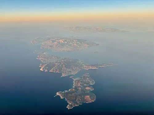 Cyclades Island, Nomós Kykládon93 km NW
-
Nisída Megali Plaka Island, Naxos and Lesser Cyclades55 km N
-
Nisída Plakí Island, Naxos and Lesser Cyclades55 km N
-
Nisída Kalógeros Island, Nomós Kykládon44 km NW
-
Nisída Vourgári Island, Nomós Kykládon56 km N
Sources & licences
Data last updated: · 2 independent sources