Giannouli
Local name: Γιάννουλη
Located in Larissa, Nomós Larísis Coordinates: 39°40′02″ N 22°23′45″ E
- Population
- 12,277
- 12.3K
- Elevation
- 75 m
- above sea level
- Local time
- UTC+02:00
- Europe/Athens · UTC+02:00
- Airports
- VOL Nea Anchialos National Airport60 km
- KZI Kozani National Airport Filippos83 km
About Giannouli
Giannouli is a town. Location: Larissa, Nomós Larísis. Population: 12,277. Elevation: 75 m.
Giannouli (Greek: Γιάννουλη) is a town and a former municipality in the Larissa regional unit, Thessaly, Greece. Population 12,277 (2021). The municipal unit has an area of 51.092 km2.
Source: Wikipedia · CC BY-SA 4.0
Photos of Giannouli
-
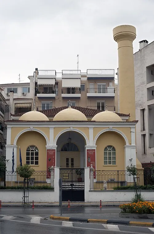
Yeni Mosque User:Ggia · CC BY-SA 3.0

Population of Giannouli over time
| 1991 | 3,261 | |
|---|---|---|
| 2001 | 6,127 | |
| 2011 | 7,847 | |
| 2021 | 8,160 |
Censuses and official estimates; source: Wikidata.
Climate of Giannouli
Best months for sightseeingBest months for sightseeing: April–May, September–October.
This month · November
Outside the best season
Day 15° · Night 6° · Rain 62 mm
- Hottest month
- July (day 33°)
- Coldest month
- January (night 1°)
- Wettest month
- November (62 mm)
- Driest month
- August (19 mm)
Bars: average monthly low and high temperature. Below: precipitation. Monthly averages for 1970–2000 at about 18 km resolution, adjusted for elevation. Highlighted months are mild and relatively dry. Source: WorldClim 2.1 (CC BY 4.0).
Show values as a table
| Month | Jan | Feb | Mar | Apr | May | Jun | Jul | Aug | Sep | Oct | Nov | Dec |
|---|---|---|---|---|---|---|---|---|---|---|---|---|
| Average high (°C) | 10° | 11° | 15° | 20° | 26° | 31° | 33° | 32° | 28° | 22° | 15° | 11° |
| Average low (°C) | 1° | 2° | 4° | 7° | 12° | 17° | 19° | 19° | 15° | 11° | 6° | 2° |
| Precipitation (mm) | 35 | 41 | 41 | 38 | 40 | 23 | 20 | 19 | 25 | 48 | 62 | 49 |
Other places to visit in this season: April May September October
How to get to Giannouli
The nearest airport is Nea Anchialos National Airport (VOL), 60 km to the southeast as the crow flies. For international flights: Thessaloniki Macedonia International Airport (SKG) (107 km). The nearest large city is Athens, 220 km to the southeast.
Airports
- Nea Anchialos National Airport (VOL) Nea Anchialos 60 kmsoutheast
- Kozani National Airport Filippos (KZI) Kozani 83 kmnorthwest
- Thessaloniki Macedonia International Airport (SKG) Thessaloniki 107 kmnortheast
Nearby large cities
- Athens Population: 664K 220 kmsoutheast
- Piraeus Population: 163.7K 220 kmsoutheast
- Plovdiv Population: 329.5K 340 kmnortheast
- Sofia Population: 1.2M 345 kmnorth
- Çanakkale Population: 143.6K 348 kmeast
Straight-line distances; road distances are longer. Airport data: OurAirports.
Day trips from Giannouli
Within 100 km: 14 historic and cultural sites, 2 natural sites, 20 lakes, rivers and coasts.
0–25 km1 place
- Yeni Mosque Attraction 4 kmSE
25–60 km9 places
- Stomio Beach Beach 37 kmNE
- Skotina Beach Beach 43 kmN
- Pantelehmonas Beach Beach 42 kmNE
- Platamonas Beach Beach 41 kmNE
60–100 km26 places
- Moní Genesíou Theotókou Damástas Attraction 99 kmS
- Moní Antinítsis Attraction 74 kmS
- Moni Spilias Attraction 88 kmSW
- Monastery of Agios Athanasios Sfinissis Attraction 97 kmN
Straight-line distances.
Sources & licences
Data last updated: · 2 independent sources