Nafpaktos
Local name: Ναύπακτος
Located in Nafpaktia, Aitoloakarnania Coordinates: 38°23′30″ N 21°49′39″ E
- Population
- 13,415
- 13.4K
- Elevation
- 3 m
- above sea level
- Local time
- UTC+02:00
- Europe/Athens · UTC+02:00
- Airports
- GPA Patras Araxos Agamemnon Airport44 km
- ZTH Zakynthos International Airport "Dionysios Solomos"109 km
About Nafpaktos
Nafpaktos is a town. Location: Nafpaktia, Aitoloakarnania. Population: 13,415. Elevation: 3 m.
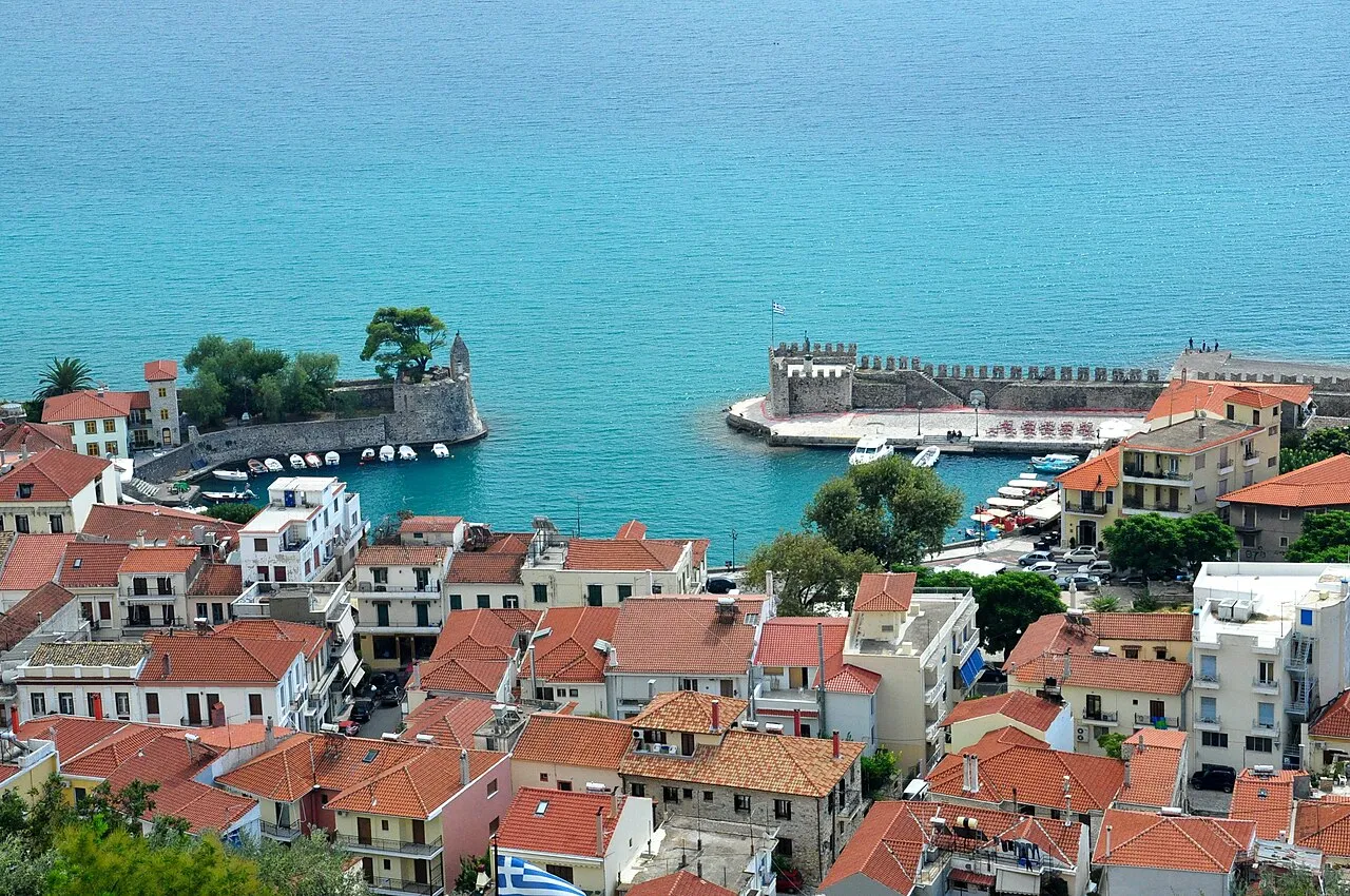
Nafpaktos (Greek: Ναύπακτος) or Naupactus, is a town and a former municipality in Nafpaktia, Aetolia-Acarnania, West Greece, situated on a bay on the north coast of the Gulf of Corinth, 3 km (2 mi) west of the mouth of the river Mornos. It is named for Naupaktos (Ναύπακτος, Latinized as Naupactus), an important Athenian naval station in the Peloponnesian War.
Source: Wikipedia · CC BY-SA 4.0
Photos of Nafpaktos
-

Sadopaul · CC BY-SA 4.0 -

Iolchos07 · CC BY-SA 4.0 -

Iolchos07 · CC BY-SA 4.0 -

The postcard was published by Nikolaos Kourtides · Public domain -

Johann Andreas Thelot · Public domain


Travel notes for Nafpaktos
From Wikivoyage
Nafpaktos is a picturesque coastal town in West Central Greece, in the region of Aetolia-Acarnania, overlooking the northern shore of the Gulf of Corinth. Built amphitheatrically beneath a vast Venetian castle and centred around one of the most charming small harbours in Greece, it blends medieval atmosphere with a relaxed seaside vibe. Despite its rich history—most famously linked to the Battle of Lepanto (1571)—it remains pleasantly low-key compared to more famous Greek destinations.
Understand+
Known in antiquity as Naupactus, the town has been inhabited since at least classical times and played a strategic role controlling access to the Gulf of Corinth. Its importance continued through Byzantine and Venetian periods, when the impressive castle and fortified harbour were constructed and expanded. Under Ottoman rule it became known as Lepanto, giving its name to the famous naval battle between the Holy League and Ottoman Empire.
Today, Nafpaktos is a laid-back destination popular with Greek visitors, especially in summer. It offers a mix of history, scenic walks, and nearby beaches without the crowds of larger resorts. The old town, clustered around the harbour, is full of cafés and tavernas, while pine-covered hills rise immediately behind.
Get in+
By car:
Nafpaktos lies just north of the Rio–Antirrio Bridge, about 3 hours from Athens, or 2.5 hours from Ioannina. The scenic coastal road along the Gulf of Corinth is particularly enjoyable.
By bus:
KTEL buses connect Nafpaktos with Athens, Patras, and other regional towns.
By plane:
The nearest airport is Araxos Airport (near Patras), though most international travellers arrive via Athens.
Source: Wikivoyage · CC BY-SA 4.0 · abridged
Population of Nafpaktos over time
| 1991 | 11,191 | |
|---|---|---|
| 2001 | 13,254 | |
| 2011 | 13,415 | |
| 2021 | 12,950 |
Censuses and official estimates; source: Wikidata.
Climate of Nafpaktos
Best months for sightseeingBest months for sightseeing: April–May, October.
This month · November
A wet month
Day 18° · Night 9° · Rain 129 mm
- Hottest month
- July (day 33°)
- Coldest month
- January (night 5°)
- Wettest month
- November (129 mm)
- Driest month
- July (15 mm)
Bars: average monthly low and high temperature. Below: precipitation. Monthly averages for 1970–2000 at about 18 km resolution, adjusted for elevation. Highlighted months are mild and relatively dry. Source: WorldClim 2.1 (CC BY 4.0).
Show values as a table
| Month | Jan | Feb | Mar | Apr | May | Jun | Jul | Aug | Sep | Oct | Nov | Dec |
|---|---|---|---|---|---|---|---|---|---|---|---|---|
| Average high (°C) | 13° | 14° | 16° | 20° | 25° | 30° | 33° | 33° | 29° | 24° | 18° | 15° |
| Average low (°C) | 5° | 5° | 7° | 10° | 14° | 17° | 19° | 19° | 17° | 13° | 9° | 6° |
| Precipitation (mm) | 94 | 96 | 77 | 60 | 36 | 18 | 15 | 16 | 33 | 85 | 129 | 119 |
How to get to Nafpaktos
The nearest airport is Patras Araxos Agamemnon Airport (GPA), 44 km to the southwest as the crow flies. For international flights: Zakynthos International Airport "Dionysios Solomos" (ZTH) (109 km). The nearest large city is Piraeus, 167 km to the east.
Airports
- Patras Araxos Agamemnon Airport (GPA) Patras 44 kmsouthwest
- Zakynthos International Airport "Dionysios Solomos" (ZTH) Zakynthos 109 kmsouthwest
- Aktion National Airport (PVK) Preveza 110 kmnorthwest
Nearby large cities
- Piraeus Population: 163.7K 167 kmeast
- Athens Population: 664K 173 kmeast
Straight-line distances; road distances are longer. Airport data: OurAirports.
Day trips from Nafpaktos
Within 100 km: 17 historic and cultural sites, 2 natural sites, 21 lakes, rivers and coasts.
0–25 km4 places
- Rígani Mountain 8 kmNW
- Panagia Panaxiotissa Attraction 18 kmW
- Pampeloponnisiako Stadium Landmark 20 kmS
- Rio–Antirrio Bridge Landmark 9 kmSW
25–60 km8 places
- Nisída Sáranta Island 34 kmW
- Lakopetra Beach Beach 38 kmSW
- Nisída Vasilikó Island 33 kmW
- Nisída Megálo Bourmpoúli Island 47 kmW
60–100 km28 places
- Ierá Moní Odigítrias Attraction 77 kmE
- Moní Genesíou Theotókou Damástas Attraction 71 kmNE
- Moni Tatárnas Attraction 67 kmNW
- Moní Antinítsis Attraction 84 kmNE
Straight-line distances.
Nearby attractions & nature
Everything nearby-
 Rio–Antirrio Bridge Landmark, Nafpaktia9.2 km SW
-
Rígani Mountain, Nafpaktia8.3 km NW
-
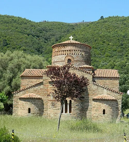 Panagia Panaxiotissa Attraction, Nafpaktia18 km W
-
 Pampeloponnisiako Stadium Landmark, Patras20 km S
Sources & licences
Data last updated: · 2 independent sources