Chlemoutsi
Located in Andravida-Kyllini, Ilia Prefecture Coordinates: 37°53′27″ N 21°08′28″ E
- Local time
- UTC+02:00
- Europe/Athens · UTC+02:00
- Elevation
- 214 m
- above sea level
- Airports
- ZTH Zakynthos International Airport "Dionysios Solomos"27 km
- GPA Patras Araxos Agamemnon Airport38 km
About Chlemoutsi
Chlemoutsi is a historic site. Location: Andravida-Kyllini, Ilia Prefecture.
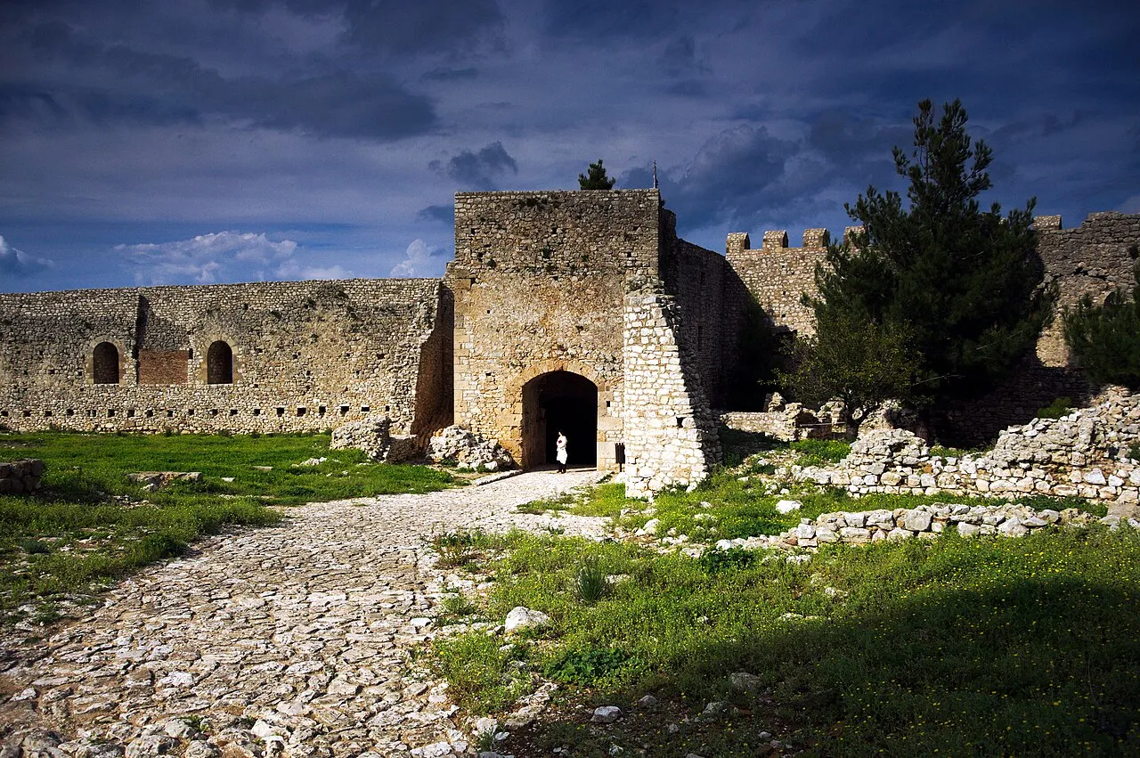
Chlemoutsi (Greek: Χλεμούτσι or Χλουμούτσι Chloumoútsi), also known as Clermont, is a medieval castle in the northwest of the Elis regional unit in the Peloponnese peninsula of southern Greece, in the Kastro-Kyllini municipality. It was built in the early 1220s by the Crusader rulers of the Principality of Achaea as their main stronghold and is perhaps the finest fortification of the early period of Frankish rule in Greece preserved in the country today.
Source: Wikipedia · CC BY-SA 4.0
At a glance
- Built
- 1220
- Architectural style
- Frankokratia
- Heritage designation
- archaeological site in Greece
Source: Wikidata
Photos of Chlemoutsi
-

G.H. Richard · Public domain -

dronepicr · CC BY 2.0 -

dronepicr · CC BY 2.0 -

Mark Landon · CC BY 4.0 -

Kritheus · CC BY-SA 4.0


Climate of Chlemoutsi
Best months for sightseeingBest months for sightseeing: May–June, September–October.
This month · November
A wet month
Day 17° · Night 9° · Rain 147 mm
- Hottest month
- August (day 29°)
- Coldest month
- January (night 5°)
- Wettest month
- December (155 mm)
- Driest month
- July (6 mm)
Bars: average monthly low and high temperature. Below: precipitation. Monthly averages for 1970–2000 at about 18 km resolution, adjusted for elevation. Highlighted months are mild and relatively dry. Source: WorldClim 2.1 (CC BY 4.0).
Show values as a table
| Month | Jan | Feb | Mar | Apr | May | Jun | Jul | Aug | Sep | Oct | Nov | Dec |
|---|---|---|---|---|---|---|---|---|---|---|---|---|
| Average high (°C) | 12° | 13° | 15° | 17° | 22° | 26° | 29° | 29° | 26° | 22° | 17° | 14° |
| Average low (°C) | 5° | 5° | 6° | 9° | 12° | 16° | 18° | 19° | 16° | 13° | 9° | 6° |
| Precipitation (mm) | 125 | 97 | 76 | 48 | 21 | 8 | 6 | 8 | 33 | 108 | 147 | 155 |
Other places to visit in this season: May June September October
How to get to Chlemoutsi
The nearest airport is Zakynthos International Airport "Dionysios Solomos" (ZTH), 27 km to the southwest as the crow flies. The nearest large city is Piraeus, 220 km to the east.
Airports
- Zakynthos International Airport "Dionysios Solomos" (ZTH) Zakynthos 27 kmsouthwest
- Patras Araxos Agamemnon Airport (GPA) Patras 38 kmnortheast
- Kefalonia International Airport "Anna Pollatou" (EFL) Kefallinia Island 62 kmnorthwest
Nearby large cities
- Piraeus Population: 163.7K 220 kmeast
- Athens Population: 664K 228 kmeast
Straight-line distances; road distances are longer. Airport data: OurAirports.
Day trips from Chlemoutsi
Within 100 km: 12 historic and cultural sites, 1 natural site, 23 lakes, rivers and coasts.
0–25 km1 place
- Byzantine Museum of Zakynthos Museum 24 kmSW
25–60 km17 places
- Moni Agiou Andrea Attraction 58 kmNW
- Monastery of the Virgin Mary of Atros Attraction 45 kmNW
- Nisída Sáranta Island 56 kmNE
- Nisídes Falarídes Island 49 kmN
60–100 km18 places
- Kefalonia Island 63 kmNW
- Moni Eamylianon Attraction 88 kmSE
- Monastery of Kipoureon Attraction 78 kmNW
- Kablafka Beach 74 kmN
Straight-line distances.
Nearest towns and villages
-
Karavaki Village, Andravida-Kyllini1.4 km N
-
Moni Vlachernon Village, Andravida-Kyllini3.2 km N
-
Káto Panagía Village, Andravida-Kyllini4.4 km N
-
Lygiá Village, Pineios3.6 km S
Sources & licences
Data last updated: · 2 independent sources