Matesi
Local name: Ματέσι
Located in Andritsaina-Krestena, Ilia Prefecture Coordinates: 37°31′48″ N 21°55′40″ E
- Population
- 109
- 109
- Elevation
- 480 m
- above sea level
- Local time
- UTC+02:00
- Europe/Athens · UTC+02:00
- Airports
- KLX Kalamata Airport52 km
- GPA Patras Araxos Agamemnon Airport82 km
About Matesi
Matesi is a village. Location: Andritsaina-Krestena, Ilia Prefecture. Population: 109. Elevation: 480 m.
Matesi (Greek: Μάτεσι) is a small mountain village in the municipal unit of Andritsaina, Elis, Greece.It is located on a hill above the left bank of the river Alfeios. It is 3 km northwest of Theisoa, 6 km east of Alifeira and 6 km northeast of Andritsaina. Nearby, some ancient tombs from the last centuries BC were found.
Source: Wikipedia · CC BY-SA 4.0
Population of Matesi over time
| 1951 | 398 | |
|---|---|---|
| 1991 | 134 | |
| 2001 | 77 | |
| 2011 | 109 | |
| 2021 | 56 |
Censuses and official estimates; source: Wikidata.
Climate of Matesi
Best months for sightseeingBest months for sightseeing: May–June, September–October.
This month · November
A wet month
Day 15° · Night 6° · Rain 130 mm
- Hottest month
- July (day 30°)
- Coldest month
- January (night 2°)
- Wettest month
- December (133 mm)
- Driest month
- July (12 mm)
Bars: average monthly low and high temperature. Below: precipitation. Monthly averages for 1970–2000 at about 18 km resolution, adjusted for elevation. Highlighted months are mild and relatively dry. Source: WorldClim 2.1 (CC BY 4.0).
Show values as a table
| Month | Jan | Feb | Mar | Apr | May | Jun | Jul | Aug | Sep | Oct | Nov | Dec |
|---|---|---|---|---|---|---|---|---|---|---|---|---|
| Average high (°C) | 11° | 11° | 13° | 17° | 22° | 27° | 30° | 30° | 26° | 21° | 15° | 12° |
| Average low (°C) | 2° | 3° | 4° | 7° | 10° | 14° | 16° | 16° | 14° | 10° | 6° | 4° |
| Precipitation (mm) | 108 | 96 | 74 | 59 | 30 | 13 | 12 | 15 | 28 | 84 | 130 | 133 |
Other places to visit in this season: May June September October
How to get to Matesi
The nearest airport is Kalamata Airport (KLX), 52 km to the south as the crow flies. For international flights: Zakynthos International Airport "Dionysios Solomos" (ZTH) (95 km). The nearest large city is Piraeus, 158 km to the east.
Airports
- Kalamata Airport (KLX) Kalamata 52 kmsouth
- Patras Araxos Agamemnon Airport (GPA) Patras 82 kmnorthwest
- Zakynthos International Airport "Dionysios Solomos" (ZTH) Zakynthos 95 kmwest
Nearby large cities
- Piraeus Population: 163.7K 158 kmeast
- Athens Population: 664K 166 kmeast
Straight-line distances; road distances are longer. Airport data: OurAirports.
Day trips from Matesi
Within 100 km: 24 historic and cultural sites, 2 natural sites, 20 lakes, rivers and coasts.
0–25 km2 places
- Moni Eamylianon Attraction 11 kmE
- Ancient Theater of Megalopolis Historic site 22 kmSE
25–60 km12 places
- Moni Voulkanou Attraction 40 kmS
- Moni Gardikiou Attraction 49 kmS
- Moní Velanidiás Attraction 54 kmS
- Moni Dimiovis Attraction 59 kmSE
60–100 km32 places
- Nisída Sáranta Island 99 kmNW
- Agios Georgios Attraction 70 kmS
- Kalamitsi beach Beach 77 kmS
- Kalogria beach Beach 81 kmS
Straight-line distances.
Nearby attractions & nature
Everything nearby-
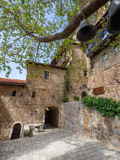 Moni Eamylianon Attraction, Gortynia11 km E
-
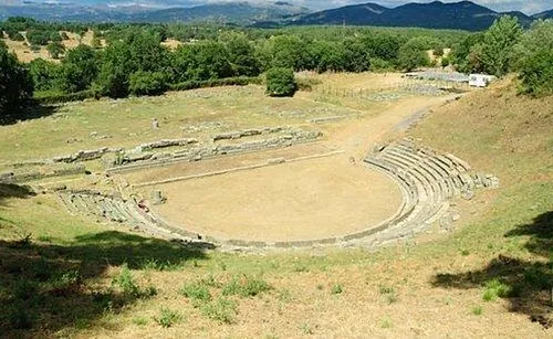 Ancient Theater of Megalopolis Historic site, Megalopoli22 km SE
Sources & licences
Data last updated: · 2 independent sources