Mezőkovácsháza Ghetto
Located in Bekes County, Hungary Coordinates: 46°24′00″ N 20°55′00″ E
- Local time
- UTC+01:00
- Europe/Budapest · UTC+01:00
- Elevation
- 97 m
- above sea level
- Airports
- ARW Arad International Airport37 km
- TSR Timișoara Traian Vuia International Airport73 km
About Mezőkovácsháza Ghetto
Mezőkovácsháza Ghetto is a historic site. Location: Bekes County, Hungary. The best months to visit are May–June, September. The nearest airport is Arad International Airport (37 km). Nearby sights include Magyarbánhegyes Ghetto and Tótkomlós Ghetto.
Climate of Mezőkovácsháza Ghetto
Best months for sightseeingBest months for sightseeing: May–June, September.
This month · November
A cold month
Day 8° · Night 1° · Rain 41 mm
- Hottest month
- August (day 28°)
- Coldest month
- January (night -4°)
- Wettest month
- June (70 mm)
- Driest month
- February (29 mm)
Bars: average monthly low and high temperature. Below: precipitation. Monthly averages for 1970–2000 at about 18 km resolution, adjusted for elevation. Highlighted months are mild and relatively dry. Source: WorldClim 2.1 (CC BY 4.0).
Show values as a table
| Month | Jan | Feb | Mar | Apr | May | Jun | Jul | Aug | Sep | Oct | Nov | Dec |
|---|---|---|---|---|---|---|---|---|---|---|---|---|
| Average high (°C) | 2° | 5° | 11° | 17° | 23° | 25° | 28° | 28° | 23° | 17° | 8° | 4° |
| Average low (°C) | -4° | -3° | 0° | 5° | 10° | 13° | 14° | 14° | 10° | 5° | 1° | -2° |
| Precipitation (mm) | 32 | 29 | 30 | 47 | 57 | 70 | 58 | 55 | 45 | 38 | 41 | 44 |
How to get to Mezőkovácsháza Ghetto
The nearest airport is Arad International Airport (ARW), 37 km to the southeast as the crow flies. For international flights: Timișoara Traian Vuia International Airport (TSR) (73 km). The nearest large city is Arad, 39 km to the southeast.
Airports
- Arad International Airport (ARW) Arad 37 kmsoutheast
- Timișoara Traian Vuia International Airport (TSR) Timişoara 73 kmsoutheast
- Oradea International Airport (OMR) Oradea 103 kmnortheast
Nearby large cities
- Arad Population: 169.1K 39 kmsoutheast
- Szeged Population: 160.8K 61 kmwest
- Timișoara Population: 250.8K 76 kmsouth
- Oradea Population: 183.1K 105 kmnortheast
- Kecskemét Population: 109.8K 109 kmnorthwest
Straight-line distances; road distances are longer. Airport data: OurAirports.
Day trips from Mezőkovácsháza Ghetto
Within 100 km: 26 historic and cultural sites, 7 natural sites, 5 lakes, rivers and coasts.
0–25 km2 places
- Magyarbánhegyes Ghetto Historic site 7 kmNE
- Tótkomlós Ghetto Historic site 14 kmW
25–60 km12 places
- Movila Mica Mountain 51 kmSW
- Vaszkó-halom Mountain 53 kmN
- Békés Ghetto Historic site 44 kmN
- Gyoma Ghetto Historic site 60 kmN
60–100 km24 places
- Zlatica River 88 kmSW
- Palićko Jezero Lake 97 kmW
- Ludoško Jezero Lake 91 kmW
- Kőrös-éri-főcsatorna River 80 kmSW
Straight-line distances.
Nearby attractions & nature
Everything nearby-
Magyarbánhegyes Ghetto Historic site, Bekes County6.8 km NE
-
Tótkomlós Ghetto Historic site, Bekes County14 km W
Nearest towns and villages
-
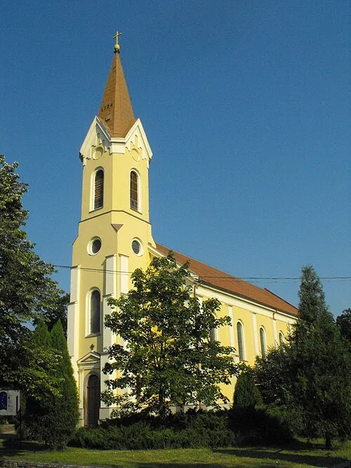 Mezőkovácsháza City, Bekes County<0.1 km N
-
Magyarbánhegyes Village, Bekes County6.8 km NE
-
Hatvanhétes major Neighbourhood, Bekes County4.5 km SE
-
Kaszaper Village, Bekes County9.8 km NW
Sources & licences
Data last updated: · 2 independent sources