Loughrea
Local name: Baile Locha Riach
Located in County Galway, Connacht Coordinates: 53°11′49″ N 8°34′01″ W
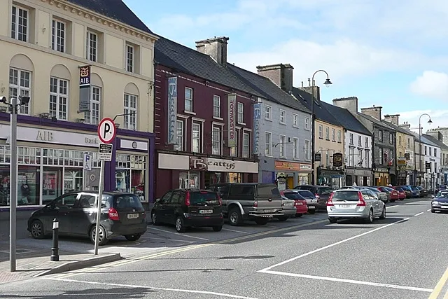
- Population
- 5,556
- 5.6K
- Elevation
- 84 m
- above sea level
- Local time
- UTC+00:00
- Europe/Dublin · UTC+00:00
- Airports
- SNN Shannon Airport60 km
- NOC Ireland West Airport Knock81 km
About Loughrea
Loughrea is a town. Location: County Galway, Connacht. Population: 5,556. Elevation: 84 m.
Loughrea ( lokh-RAY; Irish: Baile Locha Riach, meaning 'town of the grey/speckled lake'), is a town in County Galway, Ireland. It lies to the north of a range of wooded hills, the Slieve Aughty Mountains and Lough Rea, the lake from which it takes its name. The town's cathedral, St Brendan's, dominates the urban skyline. The town is in a townland and civil parish of the same name. The town increased in population in the late 20th and early 21st centuries.
Source: Wikipedia · CC BY-SA 4.0
At a glance
- Area
- 4.2 km²
Source: Wikidata
Photos of Loughrea
-

Jason Keane · CC BY-SA 2.0 -

Jason Keane · CC BY-SA 2.0 -

Sarah777 · CC BY-SA 2.0 -

Sarah777 · CC BY-SA 2.0


Climate of Loughrea
Best months for sightseeingBest months for sightseeing: June–August.
This month · November
A wet month
Day 10° · Night 4° · Rain 115 mm
- Hottest month
- July (day 19°)
- Coldest month
- January (night 2°)
- Wettest month
- November (115 mm)
- Driest month
- April (67 mm)
Bars: average monthly low and high temperature. Below: precipitation. Monthly averages for 1970–2000 at about 18 km resolution, adjusted for elevation. Highlighted months are mild and relatively dry. Source: WorldClim 2.1 (CC BY 4.0).
Show values as a table
| Month | Jan | Feb | Mar | Apr | May | Jun | Jul | Aug | Sep | Oct | Nov | Dec |
|---|---|---|---|---|---|---|---|---|---|---|---|---|
| Average high (°C) | 8° | 8° | 10° | 12° | 15° | 17° | 19° | 19° | 17° | 13° | 10° | 8° |
| Average low (°C) | 2° | 2° | 3° | 4° | 7° | 9° | 12° | 11° | 9° | 7° | 4° | 3° |
| Precipitation (mm) | 105 | 77 | 77 | 67 | 77 | 78 | 77 | 102 | 106 | 113 | 115 | 109 |
How to get to Loughrea
The nearest airport is Shannon Airport (SNN), 60 km to the southwest as the crow flies. The nearest large city is Limerick, 59 km to the south.
Airports
- Shannon Airport (SNN) Shannon 60 kmsouthwest
- Ireland West Airport Knock (NOC) Charlestown 81 kmnorth
- Kerry Airport (KIR) Farranfore 130 kmsouthwest
Nearby large cities
- Limerick Population: 102.3K 59 kmsouth
- Cork Population: 224K 145 kmsouth
- Dublin Population: 1M 155 kmeast
- Belfast Population: 348K 233 kmnortheast
- Swansea Population: 300.4K 360 kmsoutheast
Straight-line distances; road distances are longer. Airport data: OurAirports.
Day trips from Loughrea
Within 100 km: 228 historic and cultural sites, 627 natural sites, 1,104 lakes, rivers and coasts.
0–25 km61 places
- Lough Rea Lake 1 kmSW
- Lough Graney Lake 25 kmS
- Lough Cutra Lake 23 kmSW
- Coole Lough Lake 22 kmSW
25–60 km571 places
- Bush Island Island 60 kmS
- Saint Thomas Island Island 57 kmS
- Mutton Island Island 33 kmW
- Long Island Island 48 kmNE
60–100 km1,327 places
- Gorumna Island Island 75 kmW
- Inisheer Island 66 kmW
- Inishlyre Island 100 kmNW
- White Strand Beach 80 kmSW
Straight-line distances.
Nearby attractions & nature
Everything nearby-
Lough Rea Lake, County Galway1.4 km SW
-
Knockauncoura Mountain, County Galway2.5 km W
-
Brick Lough Lake, County Galway3.1 km SE
-
Knockatee Mountain, County Galway4.2 km SW
-
Riverview Castle Historic site, County Galway7.5 km NW
-
Taragh Castle Historic site, County Galway12 km N
-
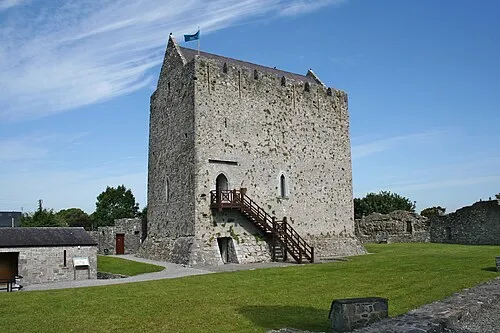 Athenry Castle Historic site, County Galway16 km NW
-
Deerpark Wood Natural site, County Galway8.3 km SE
Other cities and towns in County Galway
-
Ballinasloe Town, County Galway27 km NE
-
Galway City, County Galway33 km W
-
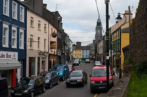 Tuam Town, County Galway40 km NW
Sources & licences
Data last updated: · 2 independent sources