- Population
- 85,910
- 85.9K
- Elevation
- 10 m
- above sea level
- Local time
- UTC+00:00
- Europe/Dublin · UTC+00:00
- Airports
- SNN Shannon Airport64 km
- NOC Ireland West Airport Knock73 km
About Galway
Galway is a city. Location: County Galway, Connacht. Population: 85,910. Elevation: 10 m. The best months to visit are June–September. The nearest airport is Shannon Airport (64 km). Nearby sights include Galway Cathedral and River Corrib.
Climate of Galway
Best months for sightseeingBest months for sightseeing: June–September.
This month · November
A wet month
Day 11° · Night 5° · Rain 123 mm
- Hottest month
- July (day 19°)
- Coldest month
- January (night 3°)
- Wettest month
- November (123 mm)
- Driest month
- April (64 mm)
Bars: average monthly low and high temperature. Below: precipitation. Monthly averages for 1970–2000 at about 18 km resolution, adjusted for elevation. Highlighted months are mild and relatively dry. Source: WorldClim 2.1 (CC BY 4.0).
Show values as a table
| Month | Jan | Feb | Mar | Apr | May | Jun | Jul | Aug | Sep | Oct | Nov | Dec |
|---|---|---|---|---|---|---|---|---|---|---|---|---|
| Average high (°C) | 9° | 9° | 10° | 12° | 15° | 17° | 19° | 19° | 17° | 14° | 11° | 9° |
| Average low (°C) | 3° | 3° | 4° | 5° | 8° | 10° | 13° | 12° | 10° | 8° | 5° | 4° |
| Precipitation (mm) | 115 | 83 | 82 | 64 | 73 | 72 | 72 | 95 | 104 | 120 | 123 | 118 |
Other places to visit in this season: June July August September
How to get to Galway
The nearest airport is Shannon Airport (SNN), 64 km to the south as the crow flies. The nearest large city is Limerick, 73 km to the southeast.
Airports
- Shannon Airport (SNN) Shannon 64 kmsouth
- Ireland West Airport Knock (NOC) Charlestown 73 kmnorth
- Kerry Airport (KIR) Farranfore 126 kmsouth
Nearby large cities
- Limerick Population: 102.3K 73 kmsoutheast
- Cork Population: 224K 158 kmsouth
- Dublin Population: 1M 187 kmeast
- Belfast Population: 348K 253 kmnortheast
- Swansea Population: 300.4K 393 kmsoutheast
Straight-line distances; road distances are longer. Airport data: OurAirports.
Day trips from Galway
Within 100 km: 215 historic and cultural sites, 617 natural sites, 1,275 lakes, rivers and coasts.
0–25 km147 places
- Mutton Island Island 2 kmS
- Deer Island Island 10 kmS
- Hare Island Island 3 kmSE
- Eddy Island Island 10 kmSE
25–60 km604 places
- Gorumna Island Island 42 kmW
- Inisheer Island 40 kmSW
- Saint Macdaras Island Island 58 kmW
- Mweenish Island Island 53 kmW
60–100 km1,356 places
- Inishlyre Island 72 kmNW
- White Strand Beach 65 kmSW
- White Strand Beach 70 kmW
- Bush Island Island 69 kmS
Straight-line distances.
Galway and similar cities
Side by side with cities of similar size in the same country: population, elevation and climate.
| Measure | Galway | Tallaght | Limerick | Waterford |
|---|---|---|---|---|
| Population | 85.9K | 81K | 102.3K | 60.1K |
| Elevation | 10 m | 103 m | 7 m | 10 m |
| Summer day (hottest month) | 19° | 19° | 20° | 20° |
| Winter night (coldest month) | 3° | 2° | 3° | 3° |
| Annual rainfall | 1,121 mm | 1,022 mm | 1,085 mm | 955 mm |
| Best months | Jun–Sep | Jun–Sep | Jun–Sep | Jun–Sep |
| Distance | — | 179 km | 73 km | 173 km |
Climate values are 1970–2000 monthly averages; straight-line distance.
Nearby attractions & nature
Everything nearby-
Galway Cathedral Attraction, County Galway0.5 km NW
-
River Corrib River, County Galway0.6 km S
-
Lynch's Castle Historic site, Galway City0.1 km NW
-
Collegiate Church of St Nicholas Attraction, Galway City0.2 km W
-
The Nora Barnacle Museum Museum, Galway City0.2 km W
-
 Galway City Museum Museum, Galway City0.4 km SW
-
Spanish Arch Historic site, Galway City0.4 km SW
-
Bridge Mills Landmark, Galway City0.4 km W
Other cities and towns in County Galway
-
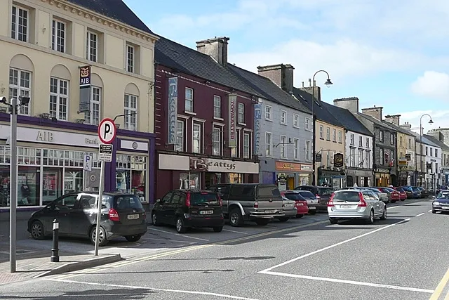 Loughrea Town, County Galway33 km E
-
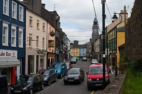 Tuam Town, County Galway30 km NE
-
Ballinasloe Town, County Galway56 km E
Sources & licences
Data last updated: