- Elevation
- 14 m
- above sea level
- Local time
- UTC+00:00
- Europe/Dublin · UTC+00:00
- Airports
- NOC Ireland West Airport Knock40 km
- SNN Shannon Airport139 km
About Rinnagragh
Rinnagragh is a natural site. Location: County Mayo, Connacht. The best months to visit are June–August. The nearest airport is Ireland West Airport Knock (40 km). Nearby sights include Coarse Island and Islandmore.
Climate of Rinnagragh
Best months for sightseeingBest months for sightseeing: June–August.
This month · November
A wet month
Day 11° · Night 5° · Rain 148 mm
- Hottest month
- August (day 18°)
- Coldest month
- February (night 3°)
- Wettest month
- November (148 mm)
- Driest month
- April (73 mm)
Bars: average monthly low and high temperature. Below: precipitation. Monthly averages for 1970–2000 at about 18 km resolution, adjusted for elevation. Highlighted months are mild and relatively dry. Source: WorldClim 2.1 (CC BY 4.0).
Show values as a table
| Month | Jan | Feb | Mar | Apr | May | Jun | Jul | Aug | Sep | Oct | Nov | Dec |
|---|---|---|---|---|---|---|---|---|---|---|---|---|
| Average high (°C) | 8° | 9° | 10° | 12° | 15° | 17° | 18° | 18° | 16° | 13° | 11° | 9° |
| Average low (°C) | 3° | 3° | 4° | 5° | 7° | 10° | 11° | 11° | 10° | 8° | 5° | 4° |
| Precipitation (mm) | 142 | 93 | 108 | 73 | 80 | 74 | 75 | 98 | 116 | 140 | 148 | 143 |
How to get to Rinnagragh
The nearest airport is Ireland West Airport Knock (NOC), 40 km to the east as the crow flies. The nearest large city is Limerick, 149 km to the south.
Airports
- Ireland West Airport Knock (NOC) Charlestown 40 kmeast
- Shannon Airport (SNN) Shannon 139 kmsouth
- Donegal Airport (CFN) Donegal 144 kmnortheast
Nearby large cities
- Limerick Population: 102.3K 149 kmsouth
- Dublin Population: 1M 220 kmeast
- Cork Population: 224K 233 kmsouth
- Belfast Population: 348K 240 kmeast
- Glasgow Population: 626.4K 396 kmnortheast
Straight-line distances; road distances are longer. Airport data: OurAirports.
Nearest towns and villages
-
Tree Island Village, County Mayo0.7 km NW
-
Muckanagh Village, County Mayo1.4 km S
-
Ballyteige Village, County Mayo1.6 km N
-
Glenisland Village, County Mayo2.2 km SE
-
Kilhale Village, County Mayo2.8 km E
-
Cloondaff Village, County Mayo3.1 km NW
Nearby attractions & nature
Everything nearby-
Coarse Island Island, County Mayo0.8 km NW
-
Islandmore Island, County Mayo1 km N
-
Low Island Island, County Mayo0.6 km NW
-
Beltra Lough Lake, County Mayo0.9 km NE
-
Muckanagh Hill Mountain, County Mayo1.5 km S
-
Bush Island Island, County Mayo1.2 km N
-
Birreen Mountain, County Mayo2.1 km E
-
Glen Hest Natural site, County Mayo2.4 km N
More nature in Ireland
-
Croaghmoyle Mountain, County Mayo3.5 km E
-
Knockrappalaghaun Mountain, County Mayo4.5 km E
-
Birreencorragh Mountain, County Mayo8.8 km NW
-
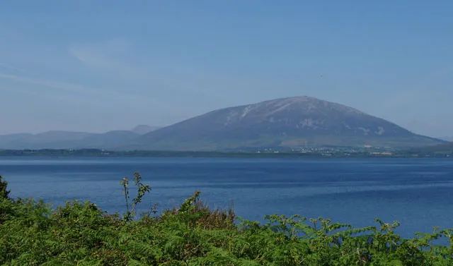 Nephin Mountain, County Mayo12 km N
-
Buckoogh Mountain, County Mayo8.4 km NW
-
Knockaffertagh Mountain, County Mayo7.9 km N
Sources & licences
Data last updated: · 2 independent sources