
- Elevation
- 24 m
- above sea level
- Local time
- UTC+00:00
- Europe/Dublin · UTC+00:00
- Airports
- NOC Ireland West Airport Knock40 km
- CFN Donegal Airport101 km
About Kilglass
Kilglass is a village. Location: County Sligo, Connacht. Elevation: 24 m.
Kilglass or Kilglas (Irish: Cill Ghlas, meaning 'green church') is a rural townland in County Sligo, Ireland, in the hinterland of Enniscrone. Kilglass is in a civil parish of the same name. The area is the location of an Anglican church, built in 1829 with funding provided by the Board of First Fruits, and renovated in 1996. The parish is in the Church of Ireland Diocese of Tuam, Killala and Achonry. The nearby MacFerbis Centre serves as a community centre and it is used for social and cultural functions.
Source: Wikipedia · CC BY-SA 4.0
Photos of Kilglass
-
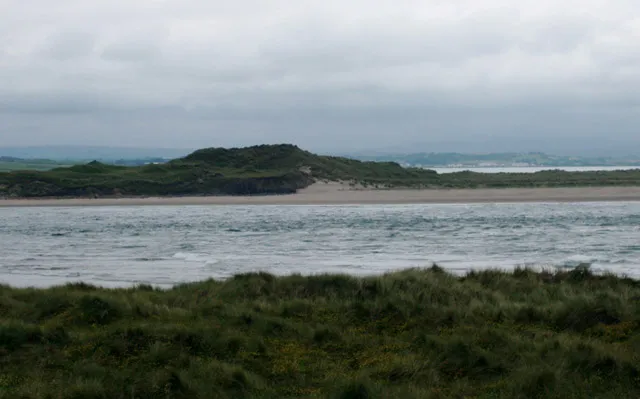
Bartragh Island Liz McCabe · CC BY-SA 2.0

Climate of Kilglass
Best months for sightseeingBest months for sightseeing: June–September.
This month · November
A wet month
Day 10° · Night 5° · Rain 121 mm
- Hottest month
- August (day 18°)
- Coldest month
- February (night 2°)
- Wettest month
- November (121 mm)
- Driest month
- April (58 mm)
Bars: average monthly low and high temperature. Below: precipitation. Monthly averages for 1970–2000 at about 18 km resolution, adjusted for elevation. Highlighted months are mild and relatively dry. Source: WorldClim 2.1 (CC BY 4.0).
Show values as a table
| Month | Jan | Feb | Mar | Apr | May | Jun | Jul | Aug | Sep | Oct | Nov | Dec |
|---|---|---|---|---|---|---|---|---|---|---|---|---|
| Average high (°C) | 8° | 8° | 10° | 12° | 14° | 16° | 18° | 18° | 16° | 13° | 10° | 9° |
| Average low (°C) | 3° | 2° | 3° | 4° | 7° | 9° | 11° | 11° | 9° | 7° | 5° | 4° |
| Precipitation (mm) | 108 | 70 | 84 | 58 | 71 | 68 | 64 | 81 | 98 | 114 | 121 | 119 |
Other places to visit in this season: June July August September
How to get to Kilglass
The nearest airport is Ireland West Airport Knock (NOC), 40 km to the southeast as the crow flies. The nearest large city is Limerick, 178 km to the south.
Airports
- Ireland West Airport Knock (NOC) Charlestown 40 kmsoutheast
- Donegal Airport (CFN) Donegal 101 kmnortheast
- City of Derry Airport (LDY) Derry, Derry and Strabane 152 kmnortheast
Nearby large cities
- Limerick Population: 102.3K 178 kmsouth
- Belfast Population: 348K 207 kmeast
- Dublin Population: 1M 211 kmsoutheast
- Cork Population: 224K 263 kmsouth
- Glasgow Population: 626.4K 356 kmnortheast
Straight-line distances; road distances are longer. Airport data: OurAirports.
Day trips from Kilglass
Within 100 km: 170 historic and cultural sites, 641 natural sites, 1,279 lakes, rivers and coasts.
0–25 km130 places
- Dunmoran Strand Beach 21 kmE
- Annagh Island Island 23 kmSW
- Castle Island Island 25 kmSW
- Roe Island Island 24 kmSW
25–60 km863 places
- Strandhill Beach Beach 29 kmE
- Rathlin O’Birne Island Island 50 kmN
- Pig Island Island 44 kmW
- Kid Island Island 54 kmW
60–100 km1,097 places
- Inishlyre Island 61 kmSW
- Dooniver Strand Beach 63 kmSW
- Inishteige Island 72 kmE
- Station Island Island 87 kmNE
Straight-line distances.
Nearby attractions & nature
Everything nearby-
Culleens River River, County Sligo2.4 km E
-
Leaffony River River, County Sligo3.1 km N
-
Devlin River River, County Sligo5.9 km SW
-
Bartragh Island Island, County Mayo7.6 km W
-
Bellawaddy River River, County Sligo4.3 km SW
-
Killala Bay Natural site, Ireland5.2 km W
Other cities and towns in County Sligo
-
 Easky Village, County Sligo8.3 km NE
-
Quignalahy Village, County Sligo3.4 km NE
-
Cabraghkeel Village, County Sligo3.4 km NE
-
Cloonycarney Village, County Sligo3.6 km E
-
Ballynamona Village, County Sligo3.8 km SE
-
Cuffs Town Village, County Sligo3.9 km E
Sources & licences
Data last updated: · 2 independent sources