- Elevation
- 4 m
- above sea level
- Local time
- UTC+00:00
- Europe/Dublin · UTC+00:00
- Airports
- ORK Cork International Airport106 km
- SNN Shannon Airport133 km
About Ferrybank
Ferrybank is a village. Location: County Kilkenny, Leinster. Elevation: 4 m.
Ferrybank (Irish: Port an Chalaidh) is a suburb of Waterford City in Ireland. Parts of Ferrybank, or "the village" as it is referred to locally, is under the political jurisdiction of Waterford City and County Council and thus an area of administration for Waterford City, on the northern bank of the River Suir, extending into County Waterford. However, other parts of Ferrybank extend into County Kilkenny and are administered by Kilkenny County Council.
Source: Wikipedia · CC BY-SA 4.0
Climate of Ferrybank
Best months for sightseeingBest months for sightseeing: June–September.
This month · November
A cold month
Day 11° · Night 5° · Rain 96 mm
- Hottest month
- July (day 20°)
- Coldest month
- January (night 3°)
- Wettest month
- January (109 mm)
- Driest month
- July (54 mm)
Bars: average monthly low and high temperature. Below: precipitation. Monthly averages for 1970–2000 at about 18 km resolution, adjusted for elevation. Highlighted months are mild and relatively dry. Source: WorldClim 2.1 (CC BY 4.0).
Show values as a table
| Month | Jan | Feb | Mar | Apr | May | Jun | Jul | Aug | Sep | Oct | Nov | Dec |
|---|---|---|---|---|---|---|---|---|---|---|---|---|
| Average high (°C) | 8° | 9° | 11° | 13° | 16° | 18° | 20° | 20° | 18° | 14° | 11° | 9° |
| Average low (°C) | 3° | 3° | 4° | 5° | 8° | 10° | 12° | 12° | 10° | 8° | 5° | 4° |
| Precipitation (mm) | 109 | 86 | 73 | 58 | 64 | 56 | 54 | 75 | 77 | 100 | 96 | 107 |
Other places to visit in this season: June July August September
How to get to Ferrybank
The nearest airport is Cork International Airport (ORK), 106 km to the southwest as the crow flies. The nearest large city is Cork, 102 km to the southwest.
Airports
- Cork International Airport (ORK) Cork 106 kmsouthwest
- Shannon Airport (SNN) Shannon 133 kmwest
- Dublin Airport (DUB) Dublin 142 kmnortheast
Nearby large cities
- Cork Population: 224K 102 kmsouthwest
- Limerick Population: 102.3K 112 kmnorthwest
- Dublin Population: 1M 132 kmnortheast
- Swansea Population: 300.4K 229 kmeast
- Belfast Population: 348K 271 kmnorth
Straight-line distances; road distances are longer. Airport data: OurAirports.
Day trips from Ferrybank
Within 100 km: 207 historic and cultural sites, 616 natural sites, 296 lakes, rivers and coasts.
0–25 km111 places
- Sheep Island Island 17 kmSW
- Ballin Lough Lake 19 kmSW
- Knockaderry Reservoir Lake 13 kmSW
- Ballyscanlan Lough Lake 12 kmSW
25–60 km303 places
- Curracloe Beach Beach 53 kmE
- Saltee Islands Island 38 kmSE
- Lady’s Island Island 51 kmE
- Keeragh Islands Island 27 kmE
60–100 km705 places
- Rocky Island Island 95 kmSW
- Ringaskiddy Island Island 96 kmSW
- Little Island Island 96 kmSW
- Haulbowline Island Island 94 kmSW
Straight-line distances.
Nearby attractions & nature
Everything nearby-
Johns River River, Ireland0.6 km NE
-
William Vincent Wallace Plaza Historic site, Waterford0.4 km S
-
Reginald’s Tower Landmark, Waterford0.5 km S
-
Black Water River, County Kilkenny2.2 km NW
-
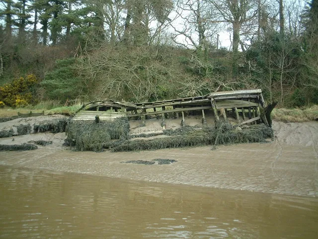 Little Island Island, Munster4.5 km SE
-
May Park Natural site, Waterford3.2 km SE
Sources & licences
Data last updated: · 2 independent sources