Kilkenny
Local name: Cill Chainnigh
Located in County Kilkenny, Leinster Coordinates: 52°39′15″ N 7°15′08″ W
- Population
- 21,589
- 21.6K
- Elevation
- 48 m
- above sea level
- Local time
- UTC+00:00
- Europe/Dublin · UTC+00:00
- Airports
- DUB Dublin Airport109 km
- SNN Shannon Airport113 km
About Kilkenny
Kilkenny is a city. Location: County Kilkenny, Leinster. Population: 21,589. Elevation: 48 m.
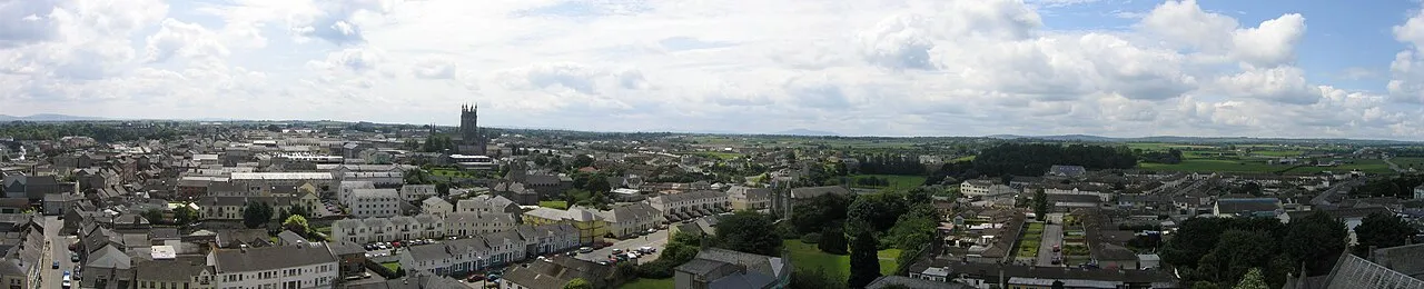
Kilkenny (Irish: Cill Chainnigh [ˌciːl̠ʲ ˈxan̠ʲəj], meaning 'church of Cainnech') is a city in County Kilkenny, Ireland. It is located in the South-East Region and in the province of Leinster. It is built on both banks of the River Nore. The 2022 census gave the population of Kilkenny as 27,184, the thirteenth-largest urban centre in Ireland.
Source: Wikipedia · CC BY-SA 4.0
Photos of Kilkenny
-

William Murphy · CC BY-SA 2.0 -

Holger Uwe Schmitt · CC BY-SA 4.0 -

Manuel Velazquez · CC BY 3.0 -

A.-K. D · CC0 -

A.-K. D · CC BY-SA 4.0


Travel notes for Kilkenny
From Wikivoyage
Kilkenny is the county town of County Kilkenny in southeast Ireland, with a population of 27,000 in 2022. At its core is the medieval city founded by the Normans, and in the 1640s it was effectively the capital of Ireland. It's a lively small city with a rich cultural heritage and lots of visitor facilities, mostly on the west bank of the River Nore.
Understand+
Kilkenny in Irish is Cill Chainnigh, the church of Cainnech or Canice (515-600 AD), and the first settlement grew up in the 6th century around what is now St Canice Cathedral. It was seized by the Normans in 1170, led by Richard de Clare or "Strongbow"; he built the fortress which became the castle. The ford across the River Nore was replaced by a bridge and medieval Kilkenny grew up as three districts each protected by their own walls: High Town around the castle, Irish Town around the cathedral, and St John's on the east bank of the river.
The English Tudors strengthened their grip on Ireland by "plantations", colonies of loyal English and Scots (mostly Protestant) to keep the natives in check. Irish resentment flared into rebellion in 1641. Rebellion was crushed in Dublin and Ulster but gained strength elsewhere, and led to the de facto state of Confederate Ireland. This controlled two-thirds of the country, and Kilkenny was its capital. It had a governing assembly, minted coins and levied taxes; it was continuously at war but backed with money and weapons by friendly Catholic nations, especially by the Pope. Nominally however it was not independent, but Royalist in support of the deposed King Charles I. In 1650 Oliver Cromwell, the commander of the English New Model Army, arrived outside the city walls of Kilkenny to discuss the finer constitutional points of this stance. And when he'd done discussing, the walls and city were rubble and Ireland wasn't a confederacy any more.
Get in+
By plane:
Dublin (DUB IATA) is a good choice for its wide range of flights, competitive fares, and good onward public transport.
Cork (ORK IATA) is another possibility but has fewer flights.
By train:
Trains from Dublin Heuston take 90 min to Kilkenny via Newbridge, Kildare, Athy, Carlow and Bagenalstown, and continue south to Thomastown and Waterford (another 35 min). There are eight M-Sa and five on Sunday. See Irish Rail for timetables and tickets.
1 Kilkenny MacDonagh Station is central, enter from the south off Dublin Rd. Don't go into MacDonagh Junction Shopping Centre, there's no passageway to the station from that side. It's named for Thomas MacDonagh (1878-1916), one of the executed leaders of the Easter Rising. The station is wheelchair friendly and has a left luggage facility.
By bus:
Dublin Coach 600 runs daily every two hours from Dublin Burgh Quay (not Busáras) and Red Cow P&R to Kilkenny (1 hr 45 min) and continues to Waterford, Dungarvan and Cork.
JJ Kavanagh Bus 717 runs daily every two hours from Dublin airport and city centre, and continues to Clonmel.
Bus Éireann 73 crosses the Midlands from Athlone via Tullamore, Portlaoise and Carlow to Kilkenny, and continues to Thomastown and Waterford. There are two F & Sa and one on Sunday.
Bus 374 runs once on Thursday from New Ross via Thomastown to Kilkenny. Otherwise you have to backtrack via Waterford.
BK Bus 881 runs twice M-Sa from Graignamanagh, taking an hour via Borris, Goresbridge and Gowran. Bus 882 runs twice M-F from Inistioge.
The rival bus companies use different stopping points in Kilkenny, but they're all close to the railway station.
By road:
From Dublin take N7 / M7 west then M9, leave at Junction 8 for N10 into town. Reckon an hour.
From Carlow or Waterford it's a straight run on M9.
From Cork take M8, and at Cahir follow N24 through Clonmel then N76 for Kilkenny.
Source: Wikivoyage · CC BY-SA 4.0 · abridged
Places bordering Kilkenny
- Ballyragget
Climate of Kilkenny
Best months for sightseeingBest months for sightseeing: June–September.
This month · November
A cold month
Day 11° · Night 4° · Rain 89 mm
- Hottest month
- July (day 20°)
- Coldest month
- January (night 2°)
- Wettest month
- January (96 mm)
- Driest month
- April (56 mm)
Bars: average monthly low and high temperature. Below: precipitation. Monthly averages for 1970–2000 at about 18 km resolution, adjusted for elevation. Highlighted months are mild and relatively dry. Source: WorldClim 2.1 (CC BY 4.0).
Show values as a table
| Month | Jan | Feb | Mar | Apr | May | Jun | Jul | Aug | Sep | Oct | Nov | Dec |
|---|---|---|---|---|---|---|---|---|---|---|---|---|
| Average high (°C) | 8° | 9° | 10° | 13° | 16° | 18° | 20° | 20° | 17° | 14° | 11° | 9° |
| Average low (°C) | 2° | 2° | 3° | 4° | 7° | 10° | 12° | 11° | 9° | 7° | 4° | 3° |
| Precipitation (mm) | 96 | 77 | 68 | 56 | 62 | 56 | 56 | 78 | 76 | 94 | 89 | 96 |
Other places to visit in this season: June July August September
How to get to Kilkenny
The nearest airport is Dublin Airport (DUB), 109 km to the northeast as the crow flies. The nearest large city is Limerick, 93 km to the west.
Airports
- Dublin Airport (DUB) Dublin 109 kmnortheast
- Shannon Airport (SNN) Shannon 113 kmwest
- Cork International Airport (ORK) Cork 124 kmsouthwest
Nearby large cities
- Limerick Population: 102.3K 93 kmwest
- Dublin Population: 1M 101 kmnortheast
- Cork Population: 224K 118 kmsouthwest
- Belfast Population: 348K 233 kmnorth
- Swansea Population: 300.4K 254 kmsoutheast
Straight-line distances; road distances are longer. Airport data: OurAirports.
Day trips from Kilkenny
Within 100 km: 272 historic and cultural sites, 795 natural sites, 473 lakes, rivers and coasts.
0–25 km68 places
- Mount Alto Mountain 24 kmSE
- Saddle Hill Mountain 20 kmSE
- Freagh Hill Mountain 18 kmSE
- Freestone Hill Mountain 8 kmE
25–60 km493 places
- Sheep Island Island 59 kmS
- Kings Island Island 53 kmSE
- Coumshingaun Lough Lake 49 kmS
- Lough Coumfea Lake 52 kmSW
60–100 km979 places
- Wicklow Mountains Mountain 78 kmNE
- Curracloe Beach Beach 67 kmSE
- Saltee Islands Island 74 kmSE
- Saint Thomas Island Island 93 kmW
Straight-line distances.
Nearby attractions & nature
Everything nearby-
St. Canice's Cathedral & Round Tower Attraction, County Kilkenny0.4 km NW
-
Kikenny Castle Historic site, County Kilkenny0.4 km SE
-
Black Castle Historic site, County Kilkenny6.7 km NW
-
Clara Castle Historic site, County Kilkenny7.1 km E
-
Freestone Hill Mountain, County Kilkenny8.3 km E
-
Ballykeefe Wood Natural site, County Kilkenny11 km SW
-
Dinin River River, County Kilkenny7 km NW
-
Drumshane Hill Mountain, County Kilkenny16 km W
Sources & licences
Data last updated: · 2 independent sources