- Elevation
- 313 m
- above sea level
- Local time
- UTC+00:00
- Europe/Dublin · UTC+00:00
- Airports
- SNN Shannon Airport101 km
- DUB Dublin Airport106 km
About Knockmannon Hill
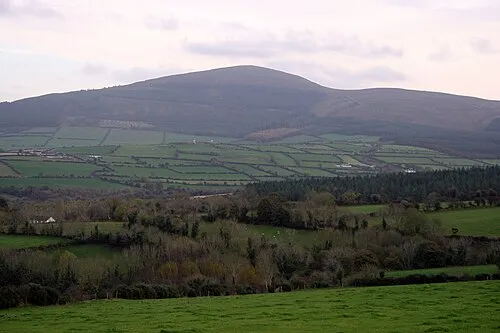
Knockmannon Hill is a mountain. Location: County Kilkenny, Leinster. Elevation: 313 m. The best months to visit are June–August. The nearest airport is Shannon Airport (101 km). Nearby sights include Ballyring and Tinnaslatty House.
Climate of Knockmannon Hill
Best months for sightseeingBest months for sightseeing: June–August.
This month · November
A wet month
Day 9° · Night 2° · Rain 115 mm
- Hottest month
- July (day 18°)
- Coldest month
- January (night 1°)
- Wettest month
- January (120 mm)
- Driest month
- April (69 mm)
Bars: average monthly low and high temperature. Below: precipitation. Monthly averages for 1970–2000 at about 18 km resolution, adjusted for elevation. Highlighted months are mild and relatively dry. Source: WorldClim 2.1 (CC BY 4.0).
Show values as a table
| Month | Jan | Feb | Mar | Apr | May | Jun | Jul | Aug | Sep | Oct | Nov | Dec |
|---|---|---|---|---|---|---|---|---|---|---|---|---|
| Average high (°C) | 7° | 7° | 9° | 11° | 14° | 17° | 18° | 18° | 16° | 12° | 9° | 7° |
| Average low (°C) | 1° | 1° | 2° | 2° | 5° | 8° | 10° | 9° | 7° | 5° | 2° | 1° |
| Precipitation (mm) | 120 | 98 | 92 | 69 | 73 | 72 | 73 | 99 | 95 | 118 | 115 | 120 |
How to get to Knockmannon Hill
The nearest airport is Shannon Airport (SNN), 101 km to the west as the crow flies. The nearest large city is Limerick, 81 km to the west.
Airports
- Shannon Airport (SNN) Shannon 101 kmwest
- Dublin Airport (DUB) Dublin 106 kmnortheast
- Cork International Airport (ORK) Cork 128 kmsouthwest
Nearby large cities
- Limerick Population: 102.3K 81 kmwest
- Dublin Population: 1M 100 kmnortheast
- Cork Population: 224K 122 kmsouthwest
- Belfast Population: 348K 225 kmnortheast
- Swansea Population: 300.4K 272 kmsoutheast
Straight-line distances; road distances are longer. Airport data: OurAirports.
Nearest towns and villages
-
Knockmannon Cross Roads Village, County Kilkenny1.6 km E
-
Ballykealy Village, County Laois2.3 km NE
-
Bunlacken Village, County Laois2.4 km NW
-
Foyle Bridge Village, County Kilkenny3.2 km S
-
Gattabaun Village, County Kilkenny3.3 km SW
-
Ballyragget Village, County Kilkenny7.3 km E
Nearby attractions & nature
Everything nearby-
Ballyring Mountain, County Kilkenny2.2 km SE
-
Tinnaslatty House Historic site, County Kilkenny1.9 km NE
-
Caponellan Hill Mountain, County Laois4.7 km NE
-
Clomantagh Hill Mountain, County Kilkenny7.2 km SW
-
Ouveg River River, Ireland6.8 km NE
-
Monabrogue Mountain, County Kilkenny9.2 km S
-
Drumshane Hill Mountain, County Kilkenny11 km S
-
Ballynalacken Hill Mountain, County Kilkenny11 km NE
More nature in Ireland
-
Boggan Mountain, County Kilkenny15 km S
-
Knockdrinnia Mountain, County Kilkenny12 km W
-
Ballykeefe Wood Natural site, County Kilkenny20 km S
-
Freestone Hill Mountain, County Kilkenny26 km SE
-
 Brandon Hill Mountain, County Kilkenny44 km SE
-
Carricknagappul Mountain, County Kilkenny37 km S
Sources & licences
Data last updated: