Baltray
Local name: Baile Trá
Located in County Louth, Leinster Coordinates: 53°44′26″ N 6°16′03″ W
- Population
- 150
- 150
- Elevation
- 10 m
- above sea level
- Local time
- UTC+00:00
- Europe/Dublin · UTC+00:00
About Baltray
Baltray is a village. Location: County Louth, Leinster. Population: 150. Elevation: 10 m.
Baltray (historically Ballytra, from Irish: Baile Trá, meaning 'town of the beach') is a village and townland in County Louth, Ireland. It sits on the northern shore of the River Boyne estuary.
Read more on Wikipedia Text: Wikipedia contributors · CC BY-SA 4.0 · shortened
In comparison
- No. 24 of 24 places in County Louth by population
- Nearest larger town: Beaulieu House, 2 km W
- 10 sights and natural places within 10 km River Boyne, Castlecoo Hill
Nearby attractions & nature
Everything nearby-
River Boyne River, County Meath2.5 km SE
-
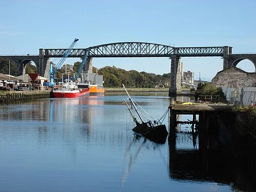 Boyne Viaduct Landmark, County Louth5.3 km SW
-
Castlecoo Hill Mountain, County Louth5.2 km N
-
 Hunky Dorys Park Landmark, County Louth6.2 km W
-
Benhead Natural site, County Meath9.9 km S
-
Clogher Head Natural site, County Louth7.3 km NE
Sources & licences
Data last updated: · 2 independent sources