- Elevation
- 28 m
- above sea level
- Local time
- UTC+00:00
- Europe/Dublin · UTC+00:00
- Airports
- DUB Dublin Airport35 km
- BHD George Best Belfast City Airport101 km
About Townrath Bridge
Townrath Bridge is a village. Location: County Louth, Leinster. Elevation: 28 m. The best months to visit are June–September. The nearest airport is Dublin Airport (35 km). Nearby sights include Boyne Viaduct and Hunky Dorys Park.
Climate of Townrath Bridge
Best months for sightseeingBest months for sightseeing: June–September.
This month · November
A cold month
Day 10° · Night 4° · Rain 94 mm
- Hottest month
- July (day 20°)
- Coldest month
- January (night 2°)
- Wettest month
- January (99 mm)
- Driest month
- April (58 mm)
Bars: average monthly low and high temperature. Below: precipitation. Monthly averages for 1970–2000 at about 18 km resolution, adjusted for elevation. Highlighted months are mild and relatively dry. Source: WorldClim 2.1 (CC BY 4.0).
Show values as a table
| Month | Jan | Feb | Mar | Apr | May | Jun | Jul | Aug | Sep | Oct | Nov | Dec |
|---|---|---|---|---|---|---|---|---|---|---|---|---|
| Average high (°C) | 7° | 8° | 10° | 12° | 15° | 18° | 20° | 19° | 17° | 14° | 10° | 8° |
| Average low (°C) | 2° | 2° | 3° | 4° | 6° | 9° | 11° | 11° | 9° | 7° | 4° | 3° |
| Precipitation (mm) | 99 | 74 | 74 | 58 | 61 | 65 | 63 | 81 | 77 | 92 | 94 | 97 |
Other places to visit in this season: June July August September
How to get to Townrath Bridge
The nearest airport is Dublin Airport (DUB), 35 km to the south as the crow flies. The nearest large city is Dublin, 46 km to the south.
Airports
- Dublin Airport (DUB) Dublin 35 kmsouth
- George Best Belfast City Airport (BHD) Belfast 101 kmnorth
- Belfast International Airport (BFS) Belfast 102 kmnorth
Nearby large cities
- Dublin Population: 1M 46 kmsouth
- Belfast Population: 348K 98 kmnorth
- Limerick Population: 102.3K 195 kmsouthwest
- Blackpool Population: 145K 215 kmeast
- Birkenhead Population: 325.3K 222 kmeast
Straight-line distances; road distances are longer. Airport data: OurAirports.
Nearby attractions & nature
Everything nearby-
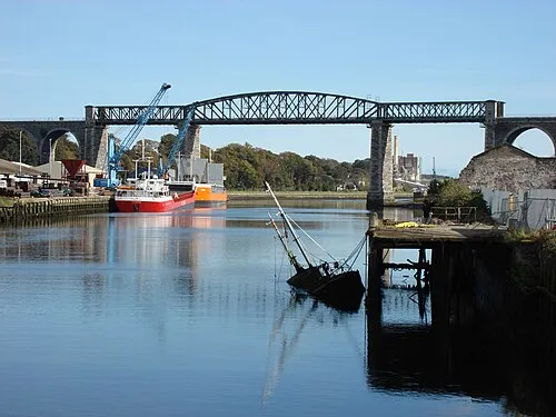 Boyne Viaduct Landmark, County Louth3.4 km SW
-
 Hunky Dorys Park Landmark, County Louth3.6 km SW
-
Fieldstown Hill Mountain, County Louth4.8 km NW
-
Castlecoo Hill Mountain, County Louth5.8 km NE
-
River Boyne River, County Meath5.3 km SE
-
Mattock River River, Ireland7.9 km W
Sources & licences
Data last updated: