- Local time
- UTC+00:00
- Europe/Dublin · UTC+00:00
- Airports
- ORK Cork International Airport112 km
- SNN Shannon Airport150 km
About Doornoge Bay
Doornoge Bay is a natural site. Location: County Wexford, Leinster. The best months to visit are June–September. The nearest airport is Cork International Airport (112 km). Nearby sights include Hook Point and Hook Lighthouse.
Climate of Doornoge Bay
Best months for sightseeingBest months for sightseeing: June–September.
This month · November
A wet month
Day 11° · Night 6° · Rain 101 mm
- Hottest month
- August (day 19°)
- Coldest month
- February (night 4°)
- Wettest month
- January (114 mm)
- Driest month
- July (55 mm)
Bars: average monthly low and high temperature. Below: precipitation. Monthly averages for 1970–2000 at about 18 km resolution, adjusted for elevation. Highlighted months are mild and relatively dry. Source: WorldClim 2.1 (CC BY 4.0).
Show values as a table
| Month | Jan | Feb | Mar | Apr | May | Jun | Jul | Aug | Sep | Oct | Nov | Dec |
|---|---|---|---|---|---|---|---|---|---|---|---|---|
| Average high (°C) | 9° | 9° | 10° | 12° | 15° | 17° | 19° | 19° | 17° | 14° | 11° | 9° |
| Average low (°C) | 4° | 4° | 4° | 6° | 8° | 10° | 12° | 12° | 11° | 9° | 6° | 4° |
| Precipitation (mm) | 114 | 91 | 75 | 57 | 65 | 57 | 55 | 78 | 81 | 104 | 101 | 111 |
Other places to visit in this season: June July August September
How to get to Doornoge Bay
The nearest airport is Cork International Airport (ORK), 112 km to the west as the crow flies. The nearest large city is Cork, 109 km to the west.
Airports
- Cork International Airport (ORK) Cork 112 kmwest
- Shannon Airport (SNN) Shannon 150 kmnorthwest
- Dublin Airport (DUB) Dublin 152 kmnorth
Nearby large cities
- Cork Population: 224K 109 kmwest
- Limerick Population: 102.3K 130 kmnorthwest
- Dublin Population: 1M 142 kmnorth
- Swansea Population: 300.4K 213 kmeast
- Cardiff Population: 372.1K 269 kmeast
Straight-line distances; road distances are longer. Airport data: OurAirports.
Day trips from Doornoge Bay
Within 100 km: 180 historic and cultural sites, 456 natural sites, 229 lakes, rivers and coasts.
0–25 km74 places
- Saltee Islands Island 23 kmE
- Keeragh Islands Island 16 kmNE
- Sheep Island Island 19 kmW
- Cull Island Island 22 kmNE
25–60 km225 places
- Curracloe Beach Beach 49 kmNE
- Lady’s Island Island 39 kmE
- Gull Island Island 35 kmW
- Sigginstown Islands Island 34 kmE
60–100 km566 places
- The Smalls Island 98 kmSE
- Rocky Island Island 100 kmW
- Haulbowline Island Island 99 kmW
- Great Island Island 97 kmW
Straight-line distances.
Nearest towns and villages
-
Churchtown Village, County Wexford0.9 km NE
-
Slade Village, County Wexford1.9 km E
-
Dunmore East Village, Waterford5.4 km NW
-
Harrylock Village, County Wexford5 km NE
-
 Fethard Village, County Wexford9.6 km NE
-
Graigue Little Village, County Wexford6 km NE
Nearby attractions & nature
Everything nearby-
Hook Point Natural site, County Wexford0.4 km S
-
Hook Lighthouse Landmark, County Wexford0.3 km S
-
Slade Bay Natural site, County Wexford1.9 km NE
-
Oldtown Bay Natural site, Leinster2.4 km NE
-
Lumsdin’s Bay Natural site, County Wexford3.8 km NE
-
Patrick’s Bay Natural site, County Wexford3.3 km NE
-
Woarwoy Bay Natural site, County Wexford4.4 km NE
-
Bullochpark Bay Natural site, County Wexford4.4 km NE
More nature in Ireland
-
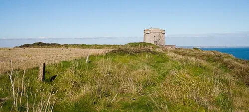 Baginbun Head Natural site, County Wexford8.7 km NE
-
Stonewall Bay Natural site, County Wexford6.1 km N
-
Sandeel Bay Natural site, County Wexford5.4 km NE
-
Booley Bay Natural site, County Wexford8.2 km N
-
Templetown Bay Natural site, County Wexford5.7 km N
-
Broomhill Bay Natural site, County Wexford8 km N
Sources & licences
Data last updated: