Rosslare Harbour
Local name: Calafort Ros Láir
Located in County Wexford, Leinster Coordinates: 52°14′59″ N 6°20′17″ W
- Elevation
- 0 m
- above sea level
- Local time
- UTC+00:00
- Europe/Dublin · UTC+00:00
- Airports
- DUB Dublin Airport131 km
- ORK Cork International Airport155 km
About Rosslare Harbour
Rosslare Harbour is a neighbourhood. Location: County Wexford, Leinster.
The village of Rosslare Harbour (Irish: Calafort Ros Láir), also known as Ballygeary, grew up to serve the needs of the harbour of the same name (now called Rosslare Europort), first developed in 1906 by the Great Western Railway and the Great Southern and Western Railway to accommodate steamferry traffic between Great Britain and Ireland. This port also serves France and Spain, traffic is mainly roll-on roll-off (RoRo). Rosslare Harbour railway station opened on 30 August 1906.
Source: Wikipedia · CC BY-SA 4.0
Climate of Rosslare Harbour
Best months for sightseeingBest months for sightseeing: June–September.
This month · November
A cold month
Day 11° · Night 6° · Rain 94 mm
- Hottest month
- August (day 19°)
- Coldest month
- February (night 4°)
- Wettest month
- January (105 mm)
- Driest month
- July (52 mm)
Bars: average monthly low and high temperature. Below: precipitation. Monthly averages for 1970–2000 at about 18 km resolution, adjusted for elevation. Highlighted months are mild and relatively dry. Source: WorldClim 2.1 (CC BY 4.0).
Show values as a table
| Month | Jan | Feb | Mar | Apr | May | Jun | Jul | Aug | Sep | Oct | Nov | Dec |
|---|---|---|---|---|---|---|---|---|---|---|---|---|
| Average high (°C) | 9° | 9° | 10° | 12° | 14° | 17° | 19° | 19° | 17° | 14° | 11° | 9° |
| Average low (°C) | 4° | 4° | 5° | 6° | 8° | 11° | 13° | 13° | 11° | 9° | 6° | 5° |
| Precipitation (mm) | 105 | 81 | 72 | 54 | 58 | 53 | 52 | 76 | 80 | 98 | 94 | 103 |
Other places to visit in this season: June July August September
How to get to Rosslare Harbour
The nearest airport is Dublin Airport (DUB), 131 km to the north as the crow flies. The nearest large city is Dublin, 121 km to the north.
Airports
- Dublin Airport (DUB) Dublin 131 kmnorth
- Cork International Airport (ORK) Cork 155 kmwest
- Shannon Airport (SNN) Shannon 183 kmwest
Nearby large cities
- Dublin Population: 1M 121 kmnorth
- Cork Population: 224K 151 kmwest
- Limerick Population: 102.3K 162 kmwest
- Swansea Population: 300.4K 179 kmeast
- Cardiff Population: 372.1K 234 kmeast
Straight-line distances; road distances are longer. Airport data: OurAirports.
Day trips from Rosslare Harbour
Within 100 km: 169 historic and cultural sites, 459 natural sites, 212 lakes, rivers and coasts.
0–25 km31 places
- Curracloe Beach Beach 16 kmN
- Saltee Islands Island 22 kmSW
- Lady’s Island Island 5 kmSW
- Cull Island Island 21 kmW
25–60 km211 places
- Keeragh Islands Island 28 kmW
- Kings Island Island 25 kmNW
- Ballyscanlan Lough Lake 60 kmW
- Belle Lake Lake 47 kmW
60–100 km598 places
- Wicklow Mountains Mountain 93 kmN
- St Justinian Natural site 82 kmSE
- Porth Clais Natural site 84 kmSE
- Port Selau Natural site 82 kmSE
Straight-line distances.
Nearby attractions & nature
Everything nearby-
Rosslare Pier Lighthouse Landmark, County Wexford0.8 km N
-
Rosslare Bay Natural site, County Wexford4 km N
-
Inish Island, County Wexford7.9 km SW
-
Lady’s Island Island, County Wexford4.8 km SW
-
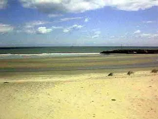 Carnsore Point Natural site, County Wexford8.9 km S
-
New Bay Natural site, Leinster6.7 km NW
Sources & licences
Data last updated: · 2 independent sources