- Elevation
- 330 m
- above sea level
- Local time
- UTC+00:00
- Europe/Dublin · UTC+00:00
- Airports
- KIR Kerry Airport8 km
- ORK Cork International Airport72 km
About Cnoc an Tseagail Mor
Cnoc an Tseagail Mor is a mountain. Location: County Kerry, Munster. Elevation: 330 m. The best months to visit are July–August. The nearest airport is Kerry Airport (8 km). Nearby sights include Currow Hill and Lough Dooling.
Climate of Cnoc an Tseagail Mor
Best months for sightseeingBest months for sightseeing: July–August.
This month · November
A wet month
Day 9° · Night 4° · Rain 161 mm
- Hottest month
- July (day 17°)
- Coldest month
- January (night 2°)
- Wettest month
- December (177 mm)
- Driest month
- July (71 mm)
Bars: average monthly low and high temperature. Below: precipitation. Monthly averages for 1970–2000 at about 18 km resolution, adjusted for elevation. Highlighted months are mild and relatively dry. Source: WorldClim 2.1 (CC BY 4.0).
Show values as a table
| Month | Jan | Feb | Mar | Apr | May | Jun | Jul | Aug | Sep | Oct | Nov | Dec |
|---|---|---|---|---|---|---|---|---|---|---|---|---|
| Average high (°C) | 7° | 7° | 9° | 10° | 13° | 15° | 17° | 17° | 15° | 12° | 9° | 8° |
| Average low (°C) | 2° | 2° | 3° | 3° | 6° | 8° | 10° | 10° | 9° | 6° | 4° | 3° |
| Precipitation (mm) | 172 | 125 | 125 | 77 | 87 | 77 | 71 | 92 | 112 | 146 | 161 | 177 |
How to get to Cnoc an Tseagail Mor
The nearest airport is Kerry Airport (KIR), 8 km to the northwest as the crow flies. For international flights: Cork International Airport (ORK) (72 km). The nearest large city is Cork, 71 km to the east.
Airports
- Kerry Airport (KIR) Farranfore 8 kmnorthwest
- Cork International Airport (ORK) Cork 72 kmsoutheast
- Shannon Airport (SNN) Shannon 73 kmnortheast
Nearby large cities
- Cork Population: 224K 71 kmeast
- Limerick Population: 102.3K 82 kmnortheast
- Dublin Population: 1M 254 kmnortheast
- Belfast Population: 348K 361 kmnortheast
- Swansea Population: 300.4K 382 kmeast
Straight-line distances; road distances are longer. Airport data: OurAirports.
Day trips from Cnoc an Tseagail Mor
Within 100 km: 159 historic and cultural sites, 981 natural sites, 813 lakes, rivers and coasts.
0–25 km242 places
- Brown Island Island 12 kmSW
- Ross Island Island 12 kmSW
- Lamb Island Island 11 kmSW
- Innisfallen Island 12 kmSW
25–60 km854 places
- Banna Strand Beach 36 kmNW
- Inch beach Beach 37 kmW
- Rossbeigh Strand Beach 37 kmW
- Whiddy Island Island 49 kmS
60–100 km857 places
- Valentia Island Island 69 kmW
- White Strand Beach 74 kmSW
- White Strand Beach 70 kmN
- Derrynane Beach Beach 63 kmSW
Straight-line distances.
Nearest towns and villages
-
Kilcummin Farmhill Village, County Kerry3.6 km SW
-
Knocknaharan Village, County Kerry2.7 km N
-
Kilsarkan Village, County Kerry2.7 km N
-
Inchicorrigane Village, County Kerry3.1 km E
-
Coollick Village, County Kerry3.3 km W
-
Haremount Village, County Kerry3.7 km NE
Nearby attractions & nature
Everything nearby-
Currow Hill Mountain, County Kerry5.4 km NW
-
Lough Dooling Lake, County Kerry4.2 km SE
-
Lockagh Lake Lake, County Kerry4.4 km S
-
Kilbrean Lake Lake, County Kerry4.9 km S
-
Slievebrickan Mountain, County Kerry7.5 km NE
-
Ballahacommane Mountain, County Kerry7.9 km S
-
Dogue River River, County Kerry4.2 km N
-
Dooneen Bridge Landmark, County Kerry4.7 km W
More nature in Ireland
-
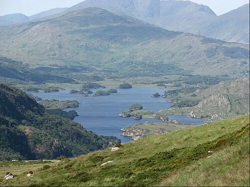 Torc Mountain Mountain, County Kerry15 km S
-
Staginount Mountain, County Kerry11 km SE
-
Knockfeha Mountain, County Kerry13 km NE
-
Baraveha Mountain, County Kerry14 km NE
-
Killeen Mountain Mountain, County Kerry15 km SE
-
Crinny Mountain Mountain, County Kerry15 km N
Sources & licences
Data last updated: