- Local time
- UTC+00:00
- Europe/Dublin · UTC+00:00
- Elevation
- 4 m
- above sea level
- Airports
- KIR Kerry Airport7 km
- SNN Shannon Airport75 km
About Maine Bridge
Maine Bridge is a landmark. Location: County Kerry, Munster. The best months to visit are June–August. The nearest airport is Kerry Airport (7 km). Nearby sights include Molahiffe Castle and Mountnicholas.
Climate of Maine Bridge
Best months for sightseeingBest months for sightseeing: June–August.
This month · November
A wet month
Day 11° · Night 6° · Rain 189 mm
- Hottest month
- July (day 19°)
- Coldest month
- January (night 4°)
- Wettest month
- December (193 mm)
- Driest month
- June (90 mm)
Bars: average monthly low and high temperature. Below: precipitation. Monthly averages for 1970–2000 at about 18 km resolution, adjusted for elevation. Highlighted months are mild and relatively dry. Source: WorldClim 2.1 (CC BY 4.0).
Show values as a table
| Month | Jan | Feb | Mar | Apr | May | Jun | Jul | Aug | Sep | Oct | Nov | Dec |
|---|---|---|---|---|---|---|---|---|---|---|---|---|
| Average high (°C) | 9° | 10° | 11° | 13° | 15° | 17° | 19° | 19° | 17° | 14° | 11° | 10° |
| Average low (°C) | 4° | 4° | 5° | 6° | 8° | 11° | 13° | 12° | 11° | 9° | 6° | 5° |
| Precipitation (mm) | 188 | 129 | 135 | 96 | 106 | 90 | 91 | 113 | 134 | 167 | 189 | 193 |
How to get to Maine Bridge
The nearest airport is Kerry Airport (KIR), 7 km to the east as the crow flies. For international flights: Shannon Airport (SNN) (75 km). The nearest large city is Cork, 85 km to the east.
Airports
- Kerry Airport (KIR) Farranfore 7 kmeast
- Shannon Airport (SNN) Shannon 75 kmnortheast
- Cork International Airport (ORK) Cork 86 kmsoutheast
Nearby large cities
- Cork Population: 224K 85 kmeast
- Limerick Population: 102.3K 87 kmnortheast
- Dublin Population: 1M 261 kmnortheast
- Belfast Population: 348K 364 kmnortheast
- Swansea Population: 300.4K 396 kmeast
Straight-line distances; road distances are longer. Airport data: OurAirports.
Day trips from Maine Bridge
Within 100 km: 150 historic and cultural sites, 912 natural sites, 785 lakes, rivers and coasts.
0–25 km230 places
- Banna Strand Beach 23 kmNW
- Inch beach Beach 25 kmW
- Great Samphire Island Island 19 kmNW
- Annagh Island Island 12 kmNW
25–60 km872 places
- Valentia Island Island 60 kmSW
- Rossbeigh Strand Beach 28 kmSW
- Derrynane Beach Beach 59 kmSW
- Whiddy Island Island 55 kmS
60–100 km745 places
- Inisheer Island 97 kmN
- White Strand Beach 72 kmSW
- White Strand Beach 64 kmN
- Bush Island Island 79 kmNE
Straight-line distances.
Nearby attractions & nature
Everything nearby-
Molahiffe Castle Historic site, County Kerry2 km E
-
Mountnicholas Mountain, County Kerry4.2 km N
-
Tralia River River, County Kerry2.2 km SW
-
Knockawaddra Mountain, County Kerry5.2 km NW
-
Killaclohane Wood Natural site, County Kerry5.7 km SW
-
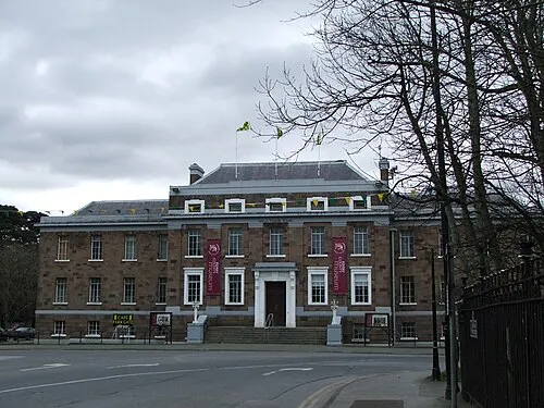 Kerry County Museum Museum, County Kerry11 km NW
-
Gweestin Bridge Landmark, County Kerry7.3 km SE
-
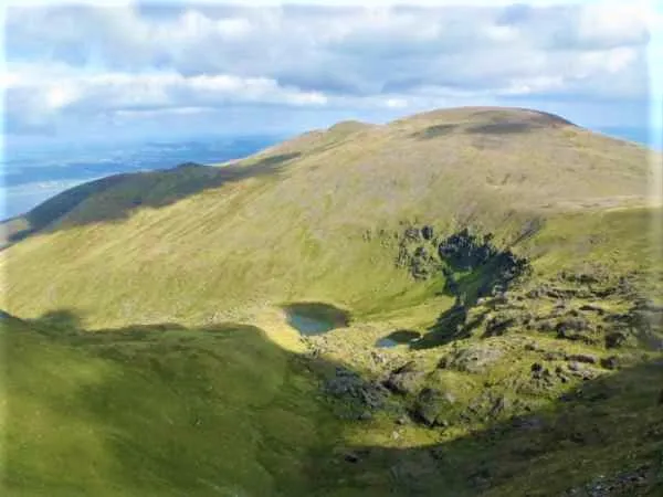 Slieve Mish Mountains Mountain, County Kerry10 km W
Nearest towns and villages
-
Fieries Village, County Kerry2.3 km SE
-
Kilnanare Village, County Kerry2.2 km S
-
Fieries Cross Roads Village, County Kerry2.3 km SE
-
Molahiffe Village, County Kerry2.6 km E
More sights in County Kerry
-
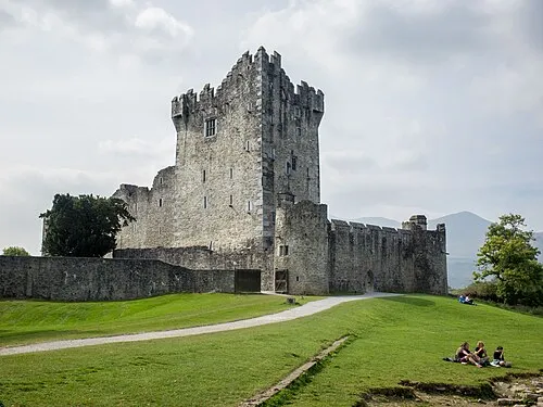 Ross Castle Historic site, County Kerry17 km S
-
Rathass Church Historic site, County Kerry10 km NW
-
Dooneen Bridge Landmark, County Kerry11 km SE
-
St. John's Parish Attraction, County Kerry11 km NW
-
Ballybeggan Castle Historic site, County Kerry11 km N
-
Tralee Courthouse Attraction, County Kerry11 km NW
Sources & licences
Data last updated: