- Elevation
- 92 m
- above sea level
- Local time
- UTC+00:00
- Europe/Dublin · UTC+00:00
- Airports
- SNN Shannon Airport54 km
- ORK Cork International Airport113 km
About Gibbet Hill
Gibbet Hill is a mountain. Location: County Tipperary, Munster. Elevation: 92 m. The best months to visit are June–September. The nearest airport is Shannon Airport (54 km). Nearby sights include Knockcraheen Hill and Ballintotty River.
Climate of Gibbet Hill
Best months for sightseeingBest months for sightseeing: June–September.
This month · November
A wet month
Day 10° · Night 4° · Rain 103 mm
- Hottest month
- July (day 19°)
- Coldest month
- January (night 2°)
- Wettest month
- December (106 mm)
- Driest month
- April (61 mm)
Bars: average monthly low and high temperature. Below: precipitation. Monthly averages for 1970–2000 at about 18 km resolution, adjusted for elevation. Highlighted months are mild and relatively dry. Source: WorldClim 2.1 (CC BY 4.0).
Show values as a table
| Month | Jan | Feb | Mar | Apr | May | Jun | Jul | Aug | Sep | Oct | Nov | Dec |
|---|---|---|---|---|---|---|---|---|---|---|---|---|
| Average high (°C) | 8° | 8° | 10° | 12° | 15° | 18° | 19° | 19° | 17° | 13° | 10° | 8° |
| Average low (°C) | 2° | 2° | 3° | 4° | 6° | 9° | 11° | 11° | 9° | 7° | 4° | 3° |
| Precipitation (mm) | 100 | 76 | 77 | 61 | 63 | 68 | 64 | 91 | 81 | 103 | 103 | 106 |
Other places to visit in this season: June July August September
How to get to Gibbet Hill
The nearest airport is Shannon Airport (SNN), 54 km to the west as the crow flies. The nearest large city is Limerick, 37 km to the southwest.
Airports
- Shannon Airport (SNN) Shannon 54 kmwest
- Cork International Airport (ORK) Cork 113 kmsouth
- Kerry Airport (KIR) Farranfore 118 kmsouthwest
Nearby large cities
- Limerick Population: 102.3K 37 kmsouthwest
- Cork Population: 224K 106 kmsouth
- Dublin Population: 1M 139 kmnortheast
- Belfast Population: 348K 245 kmnortheast
- Swansea Population: 300.4K 318 kmsoutheast
Straight-line distances; road distances are longer. Airport data: OurAirports.
Day trips from Gibbet Hill
Within 100 km: 204 historic and cultural sites, 676 natural sites, 702 lakes, rivers and coasts.
0–25 km150 places
- Illaunmore Island 17 kmNW
- Holy Island Island 22 kmNW
- Caher Island Island 22 kmW
- Scilly Island Island 18 kmW
25–60 km510 places
- Bush Island Island 47 kmW
- Saint Thomas Island Island 35 kmSW
- Deenish Island Island 56 kmW
- Coney Island Island 59 kmW
60–100 km922 places
- Inisheer Island 95 kmW
- White Strand Beach 91 kmW
- Scattery Island Island 95 kmW
- Mutton Island Island 76 kmNW
Straight-line distances.
Nearest towns and villages
-
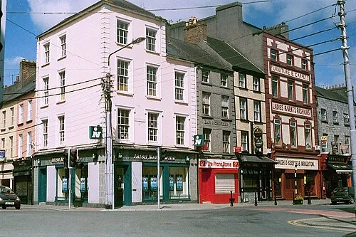 Nenagh City, County Tipperary4.3 km NW
-
Ballynaclogh Village, County Tipperary0.8 km S
-
Nenagh Bridge Town, County Tipperary6 km NW
-
Lissatunny Village, County Tipperary1.9 km NW
-
Kilkeary Cross Roads Village, County Tipperary2.2 km E
-
Kilriffen Village, County Tipperary2.8 km SW
Nearby attractions & nature
Everything nearby-
Knockcraheen Hill Mountain, County Tipperary6 km SE
-
Ballintotty River River, County Tipperary3.2 km N
-
Cnoc Duiginn Mountain, County Tipperary6.4 km SE
-
Ballincurra Hill Mountain, County Tipperary6.7 km SE
-
Nenagh Friary Historic site, County Tipperary4.2 km NW
-
Cooneen Hill Mountain, County Tipperary7.9 km S
-
Nenagh Heritage Centre Museum, County Tipperary4.6 km NW
-
Bolingbrook Mountain, County Tipperary8.2 km S
Sources & licences
Data last updated: