Pellescritta
Located in Montereale, Province of L'Aquila Coordinates: 42°30′30″ N 13°12′19″ E

- Population
- 21
- 21
- Elevation
- 887 m
- above sea level
- Local time
- UTC+01:00
- Europe/Rome · UTC+01:00
- Airports
- PSR Abruzzo Airport81 km
- PEG Perugia San Francesco d'Assisi – Umbria International Airport86 km
About Pellescritta
Pellescritta is a village. Location: Montereale, Province of L'Aquila. Population: 21. Elevation: 887 m.
Pellescritta is a frazione of Montereale, in the Province of L'Aquila in the Abruzzo region of Italy. The local church is dedicated to St. Nicholas, whose annual festival includes a procession. Due to its topography, the village is at risk from damage caused by an earthquake. The village is remote and is not directly accessible by public transportation; one must take a bus from L'Aquila, through Marana di Montereale, and then drive or hike.
Source: Wikipedia · CC BY-SA 4.0
Climate of Pellescritta
Best months for sightseeingBest months for sightseeing: June–September.
This month · November
A cold month
Day 10° · Night 3° · Rain 81 mm
- Hottest month
- July (day 24°)
- Coldest month
- February (night -1°)
- Wettest month
- October (99 mm)
- Driest month
- January (41 mm)
Bars: average monthly low and high temperature. Below: precipitation. Monthly averages for 1970–2000 at about 18 km resolution, adjusted for elevation. Highlighted months are mild and relatively dry. Source: WorldClim 2.1 (CC BY 4.0).
Show values as a table
| Month | Jan | Feb | Mar | Apr | May | Jun | Jul | Aug | Sep | Oct | Nov | Dec |
|---|---|---|---|---|---|---|---|---|---|---|---|---|
| Average high (°C) | 6° | 6° | 9° | 12° | 17° | 21° | 24° | 24° | 20° | 15° | 10° | 7° |
| Average low (°C) | -1° | -1° | 1° | 4° | 9° | 12° | 15° | 15° | 12° | 8° | 3° | 1° |
| Precipitation (mm) | 41 | 51 | 50 | 66 | 81 | 82 | 73 | 71 | 93 | 99 | 81 | 57 |
Other places to visit in this season: June July August September
How to get to Pellescritta
The nearest airport is Abruzzo Airport (PSR), 81 km to the east as the crow flies. The nearest large city is Split, 286 km to the northeast.
Airports
- Abruzzo Airport (PSR) Pescara 81 kmeast
- Perugia San Francesco d'Assisi – Umbria International Airport (PEG) Perugia (PG) 86 kmnorthwest
- Ciampino–G. B. Pastine International Airport (CIA) Rome 94 kmsouthwest
Nearby large cities
- Split Population: 149.8K 286 kmnortheast
- Rijeka Population: 108K 329 kmnorth
- Mostar Population: 104.5K 387 kmeast
Straight-line distances; road distances are longer. Airport data: OurAirports.
Day trips from Pellescritta
Within 100 km: 211 historic and cultural sites, 276 natural sites, 29 lakes, rivers and coasts.
0–25 km67 places
- Monte Trascinelli Mountain 21 kmS
- Monte Tilia Mountain 23 kmW
- Monte Terminillo Mountain 18 kmW
- Monte San Franco Mountain 16 kmSE
25–60 km178 places
- Valle Cerrese Natural site 46 kmSW
- Monte Guaidone Mountain 30 kmN
- Monte Zoccane Mountain 33 kmSW
- Monte Veticoso Mountain 41 kmE
60–100 km271 places
- Appennino Umbro Mountain 89 kmNW
- Ripari di Giobbe Beach 99 kmE
- Giulianova Beach Beach 68 kmNE
- Spiaggia Marina Palmense Beach 87 kmNE
Straight-line distances.
Nearby attractions & nature
Everything nearby-
Valle di Costa Rosata Natural site, Abruzzo6.5 km SW
-
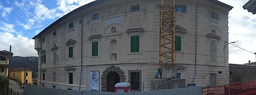 Palazzo Ricci Historic site, Capitignano8.1 km E
-
Monte Lato Mountain, Cagnano Amiterno8.4 km S
-
Valle della Mela Natural site, Abruzzo7.9 km SW
-
Valle dei Cafassi Natural site, Abruzzo9.6 km E
-
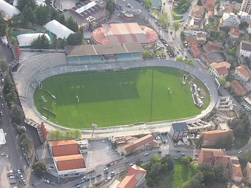 Stadio Tommaso Fattori Landmark, L'Aquila24 km SE
Sources & licences
Data last updated: · 2 independent sources