Spiaggia di Cala Casotto
Located in Otranto, Province of Lecce Coordinates: 40°07′44″ N 18°30′25″ E
- Elevation
- 8 m
- above sea level
- Local time
- UTC+01:00
- Europe/Rome · UTC+01:00
- Airports
- BDS Brindisi Airport76 km
- CFU Corfu Ioannis Kapodistrias International Airport134 km
About Spiaggia di Cala Casotto
Spiaggia di Cala Casotto is a beach. Location: Otranto, Province of Lecce. The best months to visit are May–June, October. The nearest airport is Brindisi Airport (76 km). Nearby sights include Spiaggia di Porto Grande and Cape Otranto.
Photos of Spiaggia di Cala Casotto
-
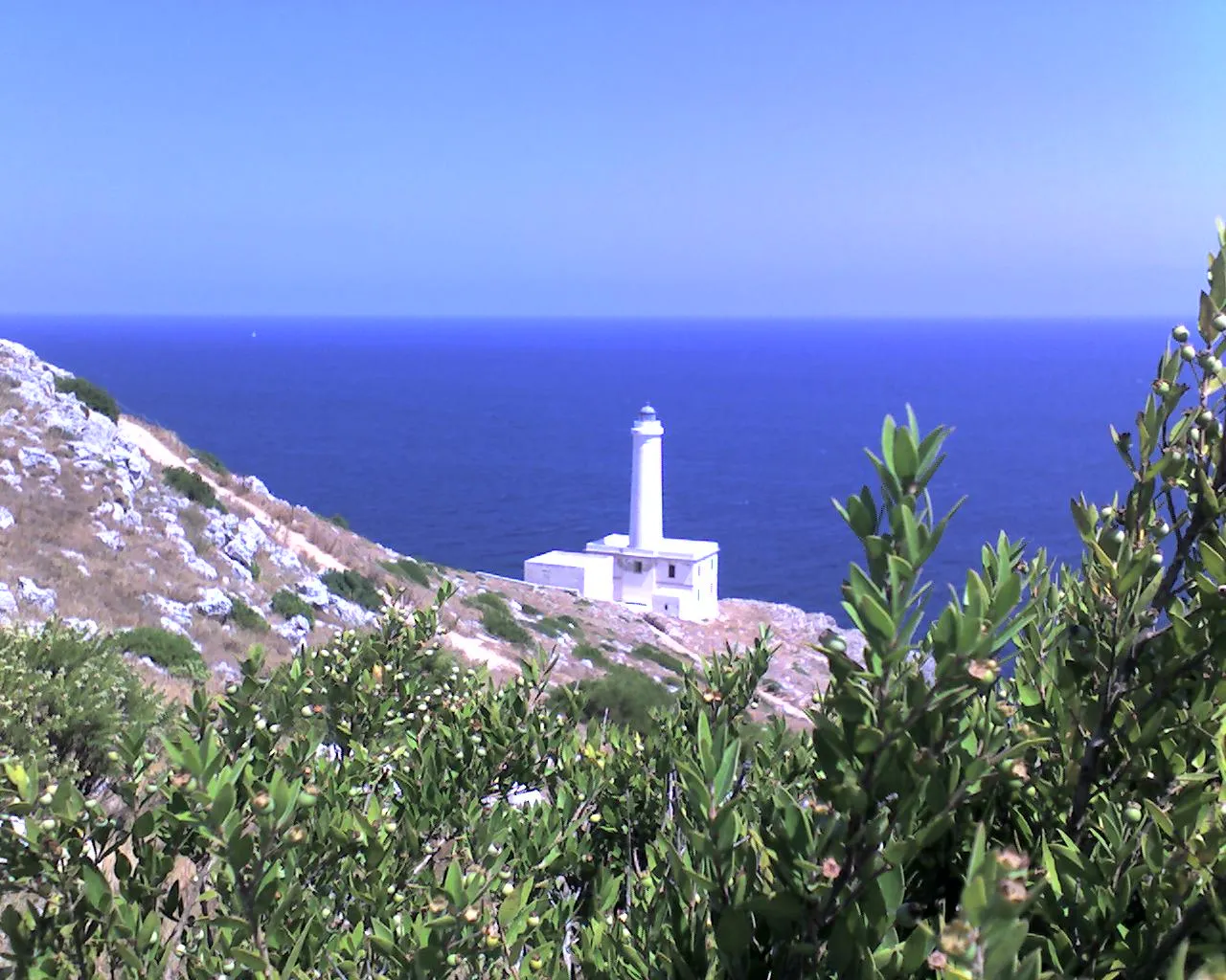
Cape Otranto Esposito Luciano - original uploader was Gabbiano64 at it.wikipedia · Public domain -
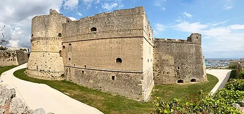
Castello di Otranto Bernard Gagnon · CC0


Climate of Spiaggia di Cala Casotto
Best months for sightseeingBest months for sightseeing: May–June, October.
This month · November
A wet month
Day 17° · Night 11° · Rain 113 mm
- Hottest month
- July (day 30°)
- Coldest month
- January (night 7°)
- Wettest month
- November (113 mm)
- Driest month
- July (9 mm)
Bars: average monthly low and high temperature. Below: precipitation. Monthly averages for 1970–2000 at about 18 km resolution, adjusted for elevation. Highlighted months are mild and relatively dry. Source: WorldClim 2.1 (CC BY 4.0).
Show values as a table
| Month | Jan | Feb | Mar | Apr | May | Jun | Jul | Aug | Sep | Oct | Nov | Dec |
|---|---|---|---|---|---|---|---|---|---|---|---|---|
| Average high (°C) | 13° | 13° | 15° | 18° | 22° | 27° | 30° | 30° | 26° | 22° | 17° | 15° |
| Average low (°C) | 7° | 7° | 8° | 11° | 15° | 18° | 21° | 21° | 18° | 15° | 11° | 8° |
| Precipitation (mm) | 96 | 60 | 65 | 37 | 22 | 16 | 9 | 25 | 60 | 91 | 113 | 75 |
How to get to Spiaggia di Cala Casotto
The nearest airport is Brindisi Airport (BDS), 76 km to the northwest as the crow flies. The nearest large city is Durrës, 155 km to the northeast.
Airports
- Brindisi Airport (BDS) Brindisi 76 kmnorthwest
- Corfu Ioannis Kapodistrias International Airport (CFU) Kerkyra (Corfu) 134 kmsoutheast
- Crotone Sant'Anna Pythagoras Airport (CRV) Isola di Capo Rizzuto (KR) 176 kmsouthwest
Nearby large cities
- Durrës Population: 195.9K 155 kmnortheast
- Tirana Population: 418.5K 173 kmnortheast
- Podgorica Population: 236.9K 265 kmnorth
- Prizren Population: 171.5K 298 kmnortheast
- Skopje Population: 474.9K 322 kmnortheast
Straight-line distances; road distances are longer. Airport data: OurAirports.
Day trips from Spiaggia di Cala Casotto
Within 100 km: 10 historic and cultural sites, 13 natural sites, 45 lakes, rivers and coasts.
0–25 km14 places
- Spiaggia di Porto Grande Beach 1 kmNE
- Castello di Otranto Historic site 2 kmNW
- Spiaggia di Porto Miggiano Beach 12 kmSW
- Spiaggia della Punticeddha Beach 14 kmN
25–60 km30 places
- Blue Bay Beach Beach 43 kmW
- Spiaggia la Puritate Beach 46 kmW
- Punta della suina Beach 44 kmW
- Lido Mancarella Beach 33 kmNW
60–100 km24 places
- Lagoon of Narta Lake 90 kmNE
- Aóös Potamós River 90 kmNE
- Llogara National Park Natural site 92 kmE
- Ishulli i Zvërnecit Island 87 kmNE
Straight-line distances.
Nearest towns and villages
-
Otranto Village, Otranto2.7 km NW
-
Zona Artigianale Village, Otranto2.2 km W
-
Selva del Turchese Village, Uggiano la Chiesa2.8 km W
-
 Casamassella Village, Uggiano la Chiesa5 km W
-
Uggiano la Chiesa Municipality, Province of Lecce5.8 km SW
-
Uggiano la Chiesa Village, Uggiano la Chiesa5.9 km SW
Nearby attractions & nature
Everything nearby-
Spiaggia di Porto Grande Beach, Otranto0.3 km NE
-
Cape Otranto Natural site, Otranto2.7 km SE
-
Castello di Otranto Historic site, Otranto2.1 km NW
-
Spiaggia Alimini Beach, Otranto9 km NW
-
Alimini Beach, Otranto9.5 km NW
-
Frassanito Beach, Otranto12 km N
-
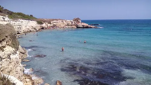 Spiaggia della Punticeddha Beach, Otranto14 km N
-
San Giorgio Beach, Otranto13 km N
Sources & licences
Data last updated: · 2 independent sources