- Population
- 12,346
- 12.3K
- Elevation
- 88 m
- above sea level
- Local time
- UTC+01:00
- Europe/Rome · UTC+01:00
- Places inside
- 6
- listed under Ugento
- Airports
- BDS Brindisi Airport83 km
- CRV Crotone Sant'Anna Pythagoras Airport139 km
About Ugento
Ugento is a municipality. Location: Province of Lecce, Apulia. Population: 12,346. Elevation: 88 m. The best months to visit are May–June, September–October. The nearest airport is Brindisi Airport (83 km). Nearby sights include Spiaggia Torre San Giovanni and Spiaggia Torre Mozza.
Climate of Ugento
Best months for sightseeingBest months for sightseeing: May–June, September–October.
This month · November
Outside the best season
Day 17° · Night 11° · Rain 84 mm
- Hottest month
- July (day 29°)
- Coldest month
- January (night 6°)
- Wettest month
- November (84 mm)
- Driest month
- July (11 mm)
Bars: average monthly low and high temperature. Below: precipitation. Monthly averages for 1970–2000 at about 18 km resolution, adjusted for elevation. Highlighted months are mild and relatively dry. Source: WorldClim 2.1 (CC BY 4.0).
Show values as a table
| Month | Jan | Feb | Mar | Apr | May | Jun | Jul | Aug | Sep | Oct | Nov | Dec |
|---|---|---|---|---|---|---|---|---|---|---|---|---|
| Average high (°C) | 12° | 13° | 15° | 17° | 22° | 26° | 29° | 29° | 26° | 21° | 17° | 14° |
| Average low (°C) | 6° | 6° | 8° | 10° | 14° | 18° | 21° | 21° | 18° | 15° | 11° | 8° |
| Precipitation (mm) | 65 | 52 | 53 | 31 | 21 | 12 | 11 | 24 | 40 | 82 | 84 | 71 |
Other places to visit in this season: May June September October
How to get to Ugento
The nearest airport is Brindisi Airport (BDS), 83 km to the north as the crow flies.
Airports
- Brindisi Airport (BDS) Brindisi 83 kmnorth
- Crotone Sant'Anna Pythagoras Airport (CRV) Isola di Capo Rizzuto (KR) 139 kmsouthwest
- Corfu Ioannis Kapodistrias International Airport (CFU) Kerkyra (Corfu) 155 kmeast
Straight-line distances; road distances are longer. Airport data: OurAirports.
Day trips from Ugento
Within 100 km: 11 historic and cultural sites, 8 natural sites, 44 lakes, rivers and coasts.
0–25 km14 places
- Spiaggia Torre San Giovanni Beach 6 kmSW
- Castello dei Trane Historic site 16 kmE
- Cape Leuca Natural site 23 kmSE
- Torre dell'Alto Lido Landmark 25 kmNW
25–60 km33 places
- Spiaggia di Porto Grande Beach 38 kmNE
- Castello di Otranto Historic site 37 kmNE
- Serre di Martignano Mountain 37 kmN
- Torre dell'Orso Landmark 45 kmNE
60–100 km16 places
- Spiaggia a Taranto Beach 77 kmNW
- Capo San Vito Natural site 97 kmNW
- Stadio Erasmo Iacovone Landmark 96 kmNW
- Lido Bruno Beach 96 kmNW
Straight-line distances.
Places in Ugento
6 places- 1 Ugento 8.9K
- 2 Gemini 1.7K
- 3 Torre San Giovanni 1.3K
- 4 Lido Marini 23
- 5 Torre Mozza 17
- 6 Fontanelle 14
Bar: population relative to the most populous place in this list.
Nearby attractions & nature
Everything nearby-
Spiaggia Torre San Giovanni Beach, Italy5.6 km SW
-
Spiaggia Torre Mozza Beach, Italy7.5 km S
-
Spiaggia Lido Marini Beach, Italy8.7 km S
-
Spiaggia Torre Pali Beach, Salve11 km SE
-
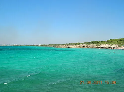 Punta della suina Beach, Gallipoli15 km NW
-
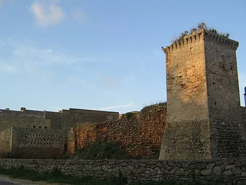 Castello dei Trane Historic site, Tricase16 km E
-
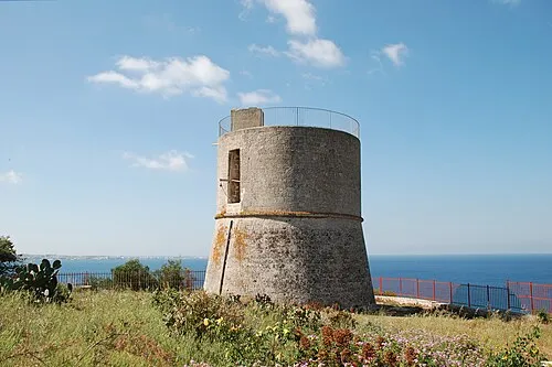 Torre dell'Alto Lido Landmark, Galatone25 km NW
-
Samsara Beach Beach, Gallipoli16 km NW
Sources & licences
Data last updated: