- Population
- 17
- 17
- Elevation
- 764 m
- above sea level
- Local time
- UTC+01:00
- Europe/Rome · UTC+01:00
- Airports
- SUF Lamezia Terme Sant'Eufemia International Airport114 km
- QSR Salerno Costa d'Amalfi Airport124 km
About Serra
Serra is a village. Location: Rotonda, Province of Potenza. Population: 17. Elevation: 764 m. The best months to visit are June–September. The nearest airport is Lamezia Terme Sant'Eufemia International Airport (114 km). Nearby sights include Serra Dolcedorme and Serra delle Ciavole.
Climate of Serra
Best months for sightseeingBest months for sightseeing: June–September.
This month · November
A wet month
Day 12° · Night 7° · Rain 121 mm
- Hottest month
- July (day 25°)
- Coldest month
- February (night 3°)
- Wettest month
- December (126 mm)
- Driest month
- July (21 mm)
Bars: average monthly low and high temperature. Below: precipitation. Monthly averages for 1970–2000 at about 18 km resolution, adjusted for elevation. Highlighted months are mild and relatively dry. Source: WorldClim 2.1 (CC BY 4.0).
Show values as a table
| Month | Jan | Feb | Mar | Apr | May | Jun | Jul | Aug | Sep | Oct | Nov | Dec |
|---|---|---|---|---|---|---|---|---|---|---|---|---|
| Average high (°C) | 7° | 7° | 10° | 13° | 18° | 22° | 25° | 25° | 21° | 17° | 12° | 8° |
| Average low (°C) | 3° | 3° | 4° | 7° | 11° | 15° | 17° | 17° | 15° | 11° | 7° | 4° |
| Precipitation (mm) | 97 | 95 | 81 | 76 | 53 | 35 | 21 | 38 | 58 | 102 | 121 | 126 |
Other places to visit in this season: June July August September
How to get to Serra
The nearest airport is Lamezia Terme Sant'Eufemia International Airport (SUF), 114 km to the south as the crow flies. The nearest large city is Split, 399 km to the north.
Airports
- Lamezia Terme Sant'Eufemia International Airport (SUF) Lamezia Terme (CZ) 114 kmsouth
- Salerno Costa d'Amalfi Airport (QSR) Salerno 124 kmnorthwest
- Crotone Sant'Anna Pythagoras Airport (CRV) Isola di Capo Rizzuto (KR) 136 kmsoutheast
Nearby large cities
- Split Population: 149.8K 399 kmnorth
Straight-line distances; road distances are longer. Airport data: OurAirports.
Day trips from Serra
Within 100 km: 18 historic and cultural sites, 37 natural sites, 19 lakes, rivers and coasts.
0–25 km3 places
- Spiaggia Dell'Arcomagno Beach 24 kmW
- Serra Dolcedorme Mountain 14 kmE
- Serra delle Ciavole Mountain 14 kmE
25–60 km24 places
- Monte del Papa Mountain 30 kmNW
- SoundRise Beach Beach 55 kmNE
- Marina di Schiavonea Beach 51 kmSE
- Spiaggia Villaggio Thurium Beach 48 kmSE
60–100 km47 places
- Spiaggia Castellaneta Marina Beach 96 kmNE
- Spiaggia Gallarate Beach 62 kmSE
- Spiaggia Gammicella Beach 63 kmSE
- Spiaggia Fossa-Solfara Mare Beach 66 kmSE
Straight-line distances.
Nearby attractions & nature
Everything nearby-
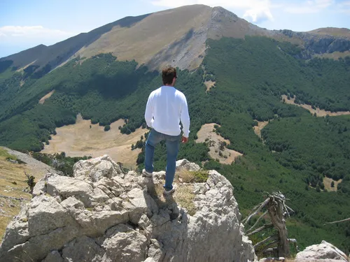 Serra Dolcedorme Mountain, Cerchiara di Calabria14 km E
-
Serra delle Ciavole Mountain, Terranova di Pollino14 km E
-
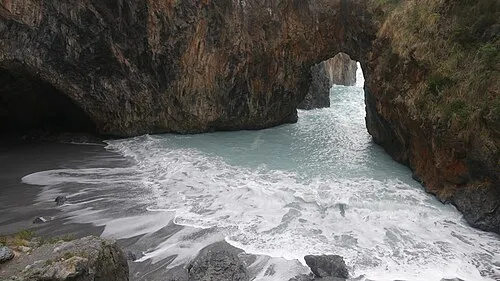 Spiaggia Dell'Arcomagno Beach, San Nicola Arcella24 km W
Sources & licences
Data last updated: