- Population
- 15,688
- 15.7K
- Elevation
- 62 m
- above sea level
- Local time
- UTC+01:00
- Europe/Rome · UTC+01:00
- Places inside
- 33
- listed under Paola
- Airports
- SUF Lamezia Terme Sant'Eufemia International Airport53 km
- CRV Crotone Sant'Anna Pythagoras Airport99 km
About Paola
Paola is a municipality. Location: Province of Cosenza, Calabria. Population: 15,688. Elevation: 62 m. The best months to visit are May–June, September–October. The nearest airport is Lamezia Terme Sant'Eufemia International Airport (53 km). Nearby sights include Stadio San Vito and Stadio Marco Lorenzon.
Climate of Paola
Best months for sightseeingBest months for sightseeing: May–June, September–October.
This month · November
A wet month
Day 18° · Night 12° · Rain 127 mm
- Hottest month
- August (day 29°)
- Coldest month
- January (night 8°)
- Wettest month
- December (133 mm)
- Driest month
- July (18 mm)
Bars: average monthly low and high temperature. Below: precipitation. Monthly averages for 1970–2000 at about 18 km resolution, adjusted for elevation. Highlighted months are mild and relatively dry. Source: WorldClim 2.1 (CC BY 4.0).
Show values as a table
| Month | Jan | Feb | Mar | Apr | May | Jun | Jul | Aug | Sep | Oct | Nov | Dec |
|---|---|---|---|---|---|---|---|---|---|---|---|---|
| Average high (°C) | 13° | 13° | 15° | 18° | 22° | 26° | 29° | 29° | 26° | 22° | 18° | 14° |
| Average low (°C) | 8° | 8° | 9° | 12° | 16° | 19° | 22° | 22° | 20° | 16° | 12° | 9° |
| Precipitation (mm) | 111 | 102 | 93 | 77 | 54 | 28 | 18 | 32 | 62 | 126 | 127 | 133 |
Other places to visit in this season: May June September October
How to get to Paola
The nearest airport is Lamezia Terme Sant'Eufemia International Airport (SUF), 53 km to the south as the crow flies. The nearest large city is Durrës, 363 km to the northeast.
Airports
- Lamezia Terme Sant'Eufemia International Airport (SUF) Lamezia Terme (CZ) 53 kmsouth
- Crotone Sant'Anna Pythagoras Airport (CRV) Isola di Capo Rizzuto (KR) 99 kmsoutheast
- Reggio Calabria Airport (REG) Reggio Calabria 147 kmsouth
Nearby large cities
- Durrës Population: 195.9K 363 kmnortheast
- Tirana Population: 418.5K 388 kmnortheast
Straight-line distances; road distances are longer. Airport data: OurAirports.
Day trips from Paola
Within 100 km: 9 historic and cultural sites, 16 natural sites, 45 lakes, rivers and coasts.
0–25 km2 places
- Stadio San Vito Landmark 17 kmE
- Stadio Marco Lorenzon Landmark 17 kmE
25–60 km23 places
- Marina di Schiavonea Beach 54 kmNE
- Spiaggia Villaggio Thurium Beach 56 kmNE
- Spiaggia Salicetti Beach 55 kmNE
- Spiaggia Fabrizio Beach 55 kmNE
60–100 km45 places
- Monte del Papa Mountain 88 kmN
- SoundRise Beach Beach 99 kmNE
- Spiaggia San Ferdinando Beach 98 kmS
- Le Dune Blu Beach 96 kmS
Straight-line distances.
Places in Paola
33 places- 1 Paola 12.6K
- 2 Sotterra 288
- 3 Tenimento-Manca di Gatto 267
- 4 San Miceli 231
- 5 Licciardo 166
- 6 Sant'Angelo 111
- 7 Deuda 94
- 8 Fosse 86
- 9 Madonna del Carmelo 83
- 10 Petrulla 83
- 11 Petrulla II 82
- 12 Cutura 65
- 13 Santomarco 65
- 14 Petraro 56
- 15 San Giuliano 53
- 16 Parata 51
- 17 Casalinelle 48
- 18 Palumbo 48
- 19 San Salvatore 46
- 20 Torrevecchia 46
- 21 Acqua dei Rossi 36
- 22 Cumma 33
- 23 Castagnelle 30
- 24 Triola 30
- 25 Madonna del Rito 29
- 26 Laponte 28
- 27 Pantani 28
- 28 Giustiniano 26
- 29 Scirocco 26
- 30 Mulattiera 23
- 31 Campolongo 19
- 32 San Michele 16
- 33 Camigliano 15
Bar: population relative to the most populous place in this list.
Nearby attractions & nature
Everything nearby-
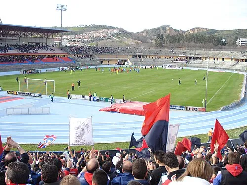 Stadio San Vito Landmark, Cosenza17 km E
-
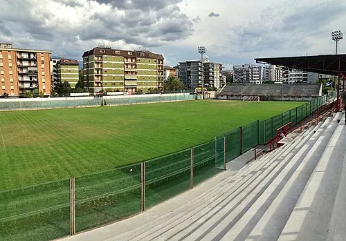 Stadio Marco Lorenzon Landmark, Rende17 km E
Sources & licences
Data last updated: