- Population
- 76
- 76
- Elevation
- 699 m
- above sea level
- Local time
- UTC+01:00
- Europe/Rome · UTC+01:00
- Airports
- QSR Salerno Costa d'Amalfi Airport33 km
- NAP Naples International Airport61 km
About Canali
Canali is a village. Location: Montemarano, Province of Avellino. Population: 76. Elevation: 699 m. The best months to visit are June–September. The nearest airport is Salerno Costa d'Amalfi Airport (33 km). Nearby sights include Monti Picentini and Raione.
Climate of Canali
Best months for sightseeingBest months for sightseeing: June–September.
This month · November
A cold month
Day 11° · Night 5° · Rain 98 mm
- Hottest month
- August (day 25°)
- Coldest month
- January (night 1°)
- Wettest month
- November (98 mm)
- Driest month
- July (28 mm)
Bars: average monthly low and high temperature. Below: precipitation. Monthly averages for 1970–2000 at about 18 km resolution, adjusted for elevation. Highlighted months are mild and relatively dry. Source: WorldClim 2.1 (CC BY 4.0).
Show values as a table
| Month | Jan | Feb | Mar | Apr | May | Jun | Jul | Aug | Sep | Oct | Nov | Dec |
|---|---|---|---|---|---|---|---|---|---|---|---|---|
| Average high (°C) | 7° | 7° | 10° | 13° | 18° | 22° | 25° | 25° | 22° | 17° | 11° | 8° |
| Average low (°C) | 1° | 1° | 3° | 5° | 9° | 13° | 16° | 16° | 13° | 9° | 5° | 2° |
| Precipitation (mm) | 77 | 71 | 61 | 64 | 49 | 29 | 28 | 33 | 59 | 78 | 98 | 87 |
Other places to visit in this season: June July August September
How to get to Canali
The nearest airport is Salerno Costa d'Amalfi Airport (QSR), 33 km to the south as the crow flies. For international flights: Naples International Airport (NAP) (61 km). The nearest large city is Split, 312 km to the north.
Airports
- Salerno Costa d'Amalfi Airport (QSR) Salerno 33 kmsouth
- Naples International Airport (NAP) Napoli 61 kmwest
- Foggia Gino Lisa Airport (FOG) Foggia (FG) 73 kmnortheast
Nearby large cities
- Split Population: 149.8K 312 kmnorth
- Mostar Population: 104.5K 355 kmnortheast
- Durrës Population: 195.9K 375 kmeast
- Podgorica Population: 236.9K 392 kmnortheast
Straight-line distances; road distances are longer. Airport data: OurAirports.
Day trips from Canali
Within 100 km: 30 historic and cultural sites, 133 natural sites, 30 lakes, rivers and coasts.
0–25 km11 places
- Monti Picentini Mountain 18 kmS
- Monte Faito Mountain 16 kmSW
- Raione Mountain 15 kmS
- Cervialto Mountain 17 kmSE
25–60 km65 places
- Colle Umberto Mountain 52 kmW
- Spiaggia Lido Linora Beach 57 kmS
- Spiaggia Lido Raggio Verde Beach 54 kmS
- Spiaggia Lido Marilena Beach 56 kmS
60–100 km117 places
- Vallone Grande Natural site 97 kmN
- Valle Covatta Natural site 87 kmN
- S.L.O Rodolfo beach Beach 90 kmW
- Lido di Liccola Beach 82 kmW
Straight-line distances.
Nearby attractions & nature
Everything nearby-
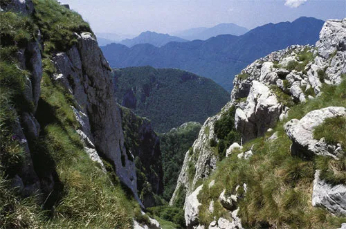 Monti Picentini Mountain, Giffoni Valle Piana18 km S
-
Raione Mountain, Giffoni Valle Piana15 km S
-
Cervialto Mountain, Bagnoli Irpino17 km SE
-
Monte Raia della Licina Mountain, Acerno17 km S
-
Monte Telegrafo Mountain, Giffoni Valle Piana19 km S
-
Monte Circhio Mountain, Montecorvino Rovella20 km S
Sources & licences
Data last updated: · 2 independent sources