Budrio
Located in Province of Bologna, Emilia-Romagna Coordinates: 44°32′13″ N 11°32′01″ E
- Population
- 18,460
- 18.5K
- Elevation
- 26 m
- above sea level
- Local time
- UTC+01:00
- Europe/Rome · UTC+01:00
- Places inside
- 29
- listed under Budrio
- Airports
- BLQ Bologna Guglielmo Marconi Airport19 km
- FRL Forlì-Luigi Ridolfi International Airport57 km
About Budrio
Budrio is a municipality. Location: Province of Bologna, Emilia-Romagna. Population: 18,460. Elevation: 26 m. The best months to visit are May, September. The nearest airport is Bologna Guglielmo Marconi Airport (19 km). Nearby sights include Valle del Savena and Palazzo Tozzoni.
Climate of Budrio
Best months for sightseeingBest months for sightseeing: May, September.
This month · November
A cold month
Day 11° · Night 4° · Rain 71 mm
- Hottest month
- July (day 30°)
- Coldest month
- January (night -1°)
- Wettest month
- October (71 mm)
- Driest month
- February (38 mm)
Bars: average monthly low and high temperature. Below: precipitation. Monthly averages for 1970–2000 at about 18 km resolution, adjusted for elevation. Highlighted months are mild and relatively dry. Source: WorldClim 2.1 (CC BY 4.0).
Show values as a table
| Month | Jan | Feb | Mar | Apr | May | Jun | Jul | Aug | Sep | Oct | Nov | Dec |
|---|---|---|---|---|---|---|---|---|---|---|---|---|
| Average high (°C) | 6° | 9° | 14° | 18° | 23° | 27° | 30° | 30° | 26° | 19° | 11° | 6° |
| Average low (°C) | -1° | 1° | 4° | 8° | 12° | 16° | 18° | 18° | 15° | 10° | 4° | 1° |
| Precipitation (mm) | 41 | 38 | 55 | 55 | 54 | 53 | 42 | 55 | 64 | 71 | 71 | 51 |
How to get to Budrio
The nearest airport is Bologna Guglielmo Marconi Airport (BLQ), 19 km to the west as the crow flies. The nearest large city is Rijeka, 246 km to the east.
Airports
- Bologna Guglielmo Marconi Airport (BLQ) Bologna 19 kmwest
- Forlì-Luigi Ridolfi International Airport (FRL) Forlì (FC) 57 kmsoutheast
- Florence Airport, Peretola (FLR) Firenze (FI) 85 kmsouth
Nearby large cities
- Rijeka Population: 108K 246 kmeast
- Ljubljana Population: 272.2K 287 kmnortheast
- Innsbruck Population: 132.5K 303 kmnorth
- Klagenfurt Population: 100.3K 317 kmnortheast
- Nice Population: 342.7K 354 kmwest
Straight-line distances; road distances are longer. Airport data: OurAirports.
Day trips from Budrio
Within 100 km: 53 historic and cultural sites, 194 natural sites, 19 lakes, rivers and coasts.
0–25 km3 places
- Valle del Savena Natural site 10 kmSW
- Pieve di San Giorgio Attraction 24 kmE
- Palazzo Tozzoni Museum 25 kmSE
25–60 km20 places
- Lido di Pomposa Beach 60 kmE
- Monte Vigese Mountain 51 kmSW
- Monte Santa Croce Mountain 41 kmS
- Monte Gazzaro Mountain 54 kmS
60–100 km243 places
- Poggio di Iavello Mountain 73 kmSW
- Vela Beach 61 kmE
- Big Mama Beach Beach 60 kmE
- Spiaggia Pinarella Beach 74 kmSE
Straight-line distances.
Places in Budrio
29 places- 1 Budrio 8.9K
- 2 Mezzolara 1.6K
- 3 Vedrana 658
- 4 Prunaro 476
- 5 Dugliolo 414
- 6 Cento 409
- 7 Bagnarola 315
- 8 Maddalena di Cazzano 291
- 9 Riccardina 216
- 10 Il Casino 187
- 11 Vigorso 154
- 12 Canaletti 85
- 13 Armarolo 64
- 14 La Valletta 56
- 15 Centonara 55
- 16 Fondo Visita 51
- 17 Il Palazzino 46
- 18 Il Santissimo 40
- 19 L'Olmo 36
- 20 Club 35
- 21 Case Lipparini 29
- 22 Fondo Borghetto 27
- 23 Case San Vincenzo 25
- 24 I Casoni 22
- 25 Prato 17
- 26 San Zenone 17
- 27 La Motta 16
- 28 San Leo 15
- 29 Palazzo Bellone 13
Bar: population relative to the most populous place in this list.
Nearby attractions & nature
Everything nearby-
Valle del Savena Natural site, Emilia-Romagna10 km SW
-
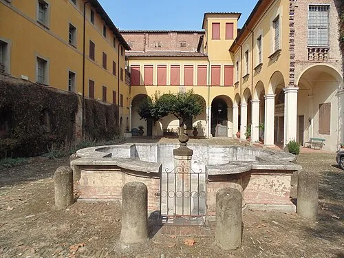 Palazzo Tozzoni Museum, Imola25 km SE
-
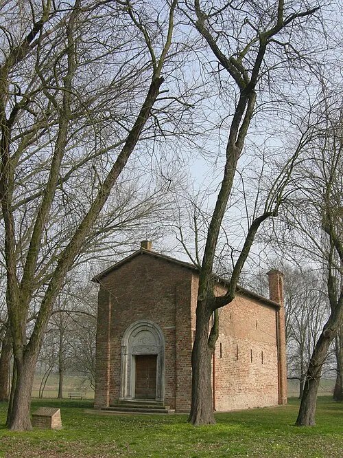 Pieve di San Giorgio Attraction, Argenta24 km E
Sources & licences
Data last updated: