- Population
- 17
- 17
- Elevation
- 26 m
- above sea level
- Local time
- UTC+01:00
- Europe/Rome · UTC+01:00
- Airports
- BLQ Bologna Guglielmo Marconi Airport20 km
- FRL Forlì-Luigi Ridolfi International Airport55 km
About Prato
Prato is a village. Location: Budrio, Province of Bologna. Population: 17. Elevation: 26 m. The best months to visit are May, September. The nearest airport is Bologna Guglielmo Marconi Airport (20 km). Nearby sights include Valle del Savena and Palazzo Tozzoni.
Climate of Prato
Best months for sightseeingBest months for sightseeing: May, September.
This month · November
A cold month
Day 11° · Night 4° · Rain 71 mm
- Hottest month
- July (day 30°)
- Coldest month
- January (night -1°)
- Wettest month
- October (71 mm)
- Driest month
- February (38 mm)
Bars: average monthly low and high temperature. Below: precipitation. Monthly averages for 1970–2000 at about 18 km resolution, adjusted for elevation. Highlighted months are mild and relatively dry. Source: WorldClim 2.1 (CC BY 4.0).
Show values as a table
| Month | Jan | Feb | Mar | Apr | May | Jun | Jul | Aug | Sep | Oct | Nov | Dec |
|---|---|---|---|---|---|---|---|---|---|---|---|---|
| Average high (°C) | 6° | 9° | 14° | 18° | 23° | 27° | 30° | 30° | 26° | 19° | 11° | 6° |
| Average low (°C) | -1° | 1° | 4° | 8° | 12° | 16° | 18° | 18° | 15° | 10° | 4° | 1° |
| Precipitation (mm) | 41 | 38 | 55 | 55 | 54 | 53 | 42 | 55 | 64 | 71 | 71 | 51 |
How to get to Prato
The nearest airport is Bologna Guglielmo Marconi Airport (BLQ), 20 km to the west as the crow flies. The nearest large city is Rijeka, 247 km to the northeast.
Airports
- Bologna Guglielmo Marconi Airport (BLQ) Bologna 20 kmwest
- Forlì-Luigi Ridolfi International Airport (FRL) Forlì (FC) 55 kmsoutheast
- Florence Airport, Peretola (FLR) Firenze (FI) 82 kmsouth
Nearby large cities
- Rijeka Population: 108K 247 kmnortheast
- Ljubljana Population: 272.2K 289 kmnortheast
- Innsbruck Population: 132.5K 306 kmnorth
- Klagenfurt Population: 100.3K 319 kmnortheast
- Nice Population: 342.7K 353 kmwest
Straight-line distances; road distances are longer. Airport data: OurAirports.
Day trips from Prato
Within 100 km: 54 historic and cultural sites, 198 natural sites, 19 lakes, rivers and coasts.
0–25 km2 places
- Valle del Savena Natural site 9 kmW
- Palazzo Tozzoni Museum 23 kmSE
25–60 km21 places
- Big Mama Beach Beach 60 kmE
- Monte Vigese Mountain 49 kmSW
- Monte Santa Croce Mountain 38 kmS
- Monte Gazzaro Mountain 51 kmS
60–100 km248 places
- Lido di Pomposa Beach 61 kmNE
- Poggio di Iavello Mountain 70 kmSW
- Vela Beach 61 kmE
- Spiaggia Pinarella Beach 73 kmSE
Straight-line distances.
Nearby attractions & nature
Everything nearby-
Valle del Savena Natural site, Emilia-Romagna8.6 km W
-
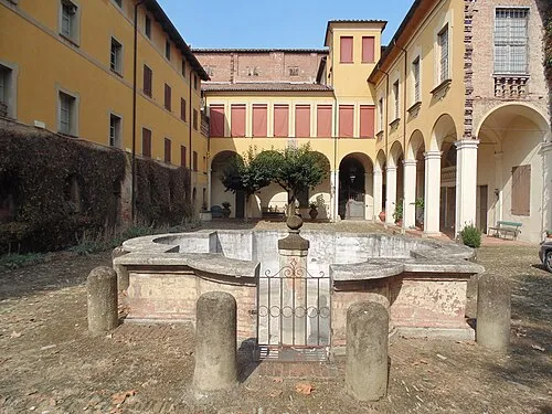 Palazzo Tozzoni Museum, Imola23 km SE
Sources & licences
Data last updated: · 2 independent sources