Montefiorino
Located in Province of Modena, Emilia-Romagna Coordinates: 44°21′10″ N 10°37′32″ E
- Population
- 2,122
- 2.1K
- Elevation
- 700 m
- above sea level
- Local time
- UTC+01:00
- Europe/Rome · UTC+01:00
- Places inside
- 28
- listed under Montefiorino
- Airports
- BLQ Bologna Guglielmo Marconi Airport57 km
- PMF Parma Airport59 km
About Montefiorino
Montefiorino is a municipality. Location: Province of Modena, Emilia-Romagna. Population: 2,122. Elevation: 700 m. The best months to visit are June–September. The nearest airport is Bologna Guglielmo Marconi Airport (57 km). Nearby sights include Monte Santa Giulia and Monte San Martino.
Climate of Montefiorino
Best months for sightseeingBest months for sightseeing: June–September.
This month · November
A wet month
Day 9° · Night 1° · Rain 109 mm
- Hottest month
- July (day 26°)
- Coldest month
- January (night -3°)
- Wettest month
- November (109 mm)
- Driest month
- July (51 mm)
Bars: average monthly low and high temperature. Below: precipitation. Monthly averages for 1970–2000 at about 18 km resolution, adjusted for elevation. Highlighted months are mild and relatively dry. Source: WorldClim 2.1 (CC BY 4.0).
Show values as a table
| Month | Jan | Feb | Mar | Apr | May | Jun | Jul | Aug | Sep | Oct | Nov | Dec |
|---|---|---|---|---|---|---|---|---|---|---|---|---|
| Average high (°C) | 5° | 6° | 10° | 13° | 18° | 23° | 26° | 26° | 21° | 15° | 9° | 6° |
| Average low (°C) | -3° | -3° | 0° | 3° | 7° | 11° | 13° | 13° | 10° | 6° | 1° | -2° |
| Precipitation (mm) | 66 | 60 | 78 | 101 | 71 | 76 | 51 | 81 | 92 | 104 | 109 | 79 |
Other places to visit in this season: June July August September
How to get to Montefiorino
The nearest airport is Bologna Guglielmo Marconi Airport (BLQ), 57 km to the east as the crow flies. The nearest large city is Nice, 279 km to the west.
Airports
- Bologna Guglielmo Marconi Airport (BLQ) Bologna 57 kmeast
- Parma Airport (PMF) Parma (PR) 59 kmnorthwest
- Florence Airport, Peretola (FLR) Firenze (FI) 76 kmsoutheast
Nearby large cities
- Nice Population: 342.7K 279 kmwest
- Rijeka Population: 108K 321 kmeast
- Innsbruck Population: 132.5K 329 kmnorth
- Zurich Population: 415.4K 372 kmnorthwest
- Bern Population: 121.6K 380 kmnorthwest
Straight-line distances; road distances are longer. Airport data: OurAirports.
Day trips from Montefiorino
Within 100 km: 61 historic and cultural sites, 184 natural sites, 23 lakes, rivers and coasts.
0–25 km31 places
- Monte Santa Giulia Mountain 5 kmNE
- Monte Lama Mountain 10 kmS
- Monte Giovo Mountain 25 kmS
- Monte Cusna Mountain 20 kmW
25–60 km100 places
- Poggio di Iavello Mountain 57 kmSE
- Correggio Beach Beach 46 kmN
- Spiaggia Forte dei Marmi Beach 57 kmSW
- Spiaggia Marina di Pietrasanta Beach 58 kmSW
60–100 km137 places
- Spiaggia per Cani Beach 97 kmS
- Spiaggia del Felciaio Beach 96 kmS
- Spiaggia libera per cani Beach 90 kmS
- La Lecciona Beach 65 kmSW
Straight-line distances.
Places in Montefiorino
28 places- 1 Montefiorino 403
- 2 Farneta 213
- 3 La Verna 185
- 4 Vitriola 179
- 5 Gusciola 108
- 6 Ca' della Polda 47
- 7 Serradimigni 42
- 8 Corzago 40
- 9 Albero 38
- 10 Ca' de' Bongi 26
- 11 Il Borgo 26
- 12 Macognano 26
- 13 Monte Stefano 26
- 14 Prada 26
- 15 Ca' Tonelli 23
- 16 Pianezzo 22
- 17 Giunzione 21
- 18 Chiosca 20
- 19 Tavernago 18
- 20 Caselle 17
- 21 Castagneta 17
- 22 Lago 17
- 23 Ca' de' Bocci 16
- 24 Ca' di Bellucci 15
- 25 Grovaieda 10
- 26 Ca' del Monte 9
- 27 Casa Maestri 8
- 28 Cerratello 8
Bar: population relative to the most populous place in this list.
Nearby attractions & nature
Everything nearby-
Monte Santa Giulia Mountain, Palagano5.2 km NE
-
Monte San Martino Mountain, Polinago5.7 km NE
-
Monte Cantiere Mountain, Tuscany8.9 km S
-
Monte Lama Mountain, Lama Mocogno10 km S
-
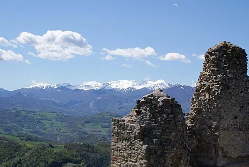 Monte Cusna Mountain, Villa Minozzo20 km W
-
Monte S. Andrea Mountain, Tuscany13 km S
-
Il Monte Mountain, Tuscany14 km SE
-
Monte Cavrile Mountain, Tuscany14 km SE
Sources & licences
Data last updated: