San Pellegrinetto
Located in Prignano sulla Secchia, Province of Modena Coordinates: 44°25′45″ N 10°44′39″ E

- Population
- 27
- 27
- Elevation
- 706 m
- above sea level
- Local time
- UTC+01:00
- Europe/Rome · UTC+01:00
- Airports
- BLQ Bologna Guglielmo Marconi Airport45 km
- PMF Parma Airport57 km
About San Pellegrinetto
San Pellegrinetto is a village. Location: Prignano sulla Secchia, Province of Modena. Population: 27. Elevation: 706 m.
San Pellegrinetto was an Italian comune in the Alps of Garfagnana, a historic region of Tuscany, province of Lucca. It was dependent for many years on the comune of Trassilico, time during which it adopted the name Alpe di Trassilico until the creation of its parish. When Trassilico was incorporated as a fraction of Gallicano, so was San Pellegrinetto. It was eventually incorporated into the comune of Fabbriche di Vergemoli.
Source: Wikipedia · CC BY-SA 4.0
Photos of San Pellegrinetto
-

O Correto · CC BY-SA 4.0 -

O Correto · CC BY-SA 4.0 -

O Correto · CC BY-SA 4.0


Climate of San Pellegrinetto
Best months for sightseeingBest months for sightseeing: June–September.
This month · November
A cold month
Day 10° · Night 1° · Rain 90 mm
- Hottest month
- July (day 26°)
- Coldest month
- January (night -3°)
- Wettest month
- April (91 mm)
- Driest month
- February (50 mm)
Bars: average monthly low and high temperature. Below: precipitation. Monthly averages for 1970–2000 at about 18 km resolution, adjusted for elevation. Highlighted months are mild and relatively dry. Source: WorldClim 2.1 (CC BY 4.0).
Show values as a table
| Month | Jan | Feb | Mar | Apr | May | Jun | Jul | Aug | Sep | Oct | Nov | Dec |
|---|---|---|---|---|---|---|---|---|---|---|---|---|
| Average high (°C) | 5° | 6° | 10° | 13° | 19° | 23° | 26° | 26° | 22° | 16° | 10° | 6° |
| Average low (°C) | -3° | -3° | 0° | 3° | 8° | 11° | 13° | 13° | 10° | 6° | 1° | -2° |
| Precipitation (mm) | 53 | 50 | 70 | 91 | 69 | 73 | 53 | 78 | 86 | 91 | 90 | 64 |
Other places to visit in this season: June July August September
How to get to San Pellegrinetto
The nearest airport is Bologna Guglielmo Marconi Airport (BLQ), 45 km to the east as the crow flies. The nearest large city is Nice, 290 km to the west.
Airports
- Bologna Guglielmo Marconi Airport (BLQ) Bologna 45 kmeast
- Parma Airport (PMF) Parma (PR) 57 kmnorthwest
- Florence Airport, Peretola (FLR) Firenze (FI) 78 kmsoutheast
Nearby large cities
- Nice Population: 342.7K 290 kmwest
- Rijeka Population: 108K 309 kmeast
- Innsbruck Population: 132.5K 319 kmnorth
- Ljubljana Population: 272.2K 346 kmnortheast
- Zurich Population: 415.4K 368 kmnorthwest
Straight-line distances; road distances are longer. Airport data: OurAirports.
Day trips from San Pellegrinetto
Within 100 km: 61 historic and cultural sites, 156 natural sites, 16 lakes, rivers and coasts.
0–25 km13 places
- Monte Santa Giulia Mountain 8 kmSW
- Monte Lama Mountain 20 kmSW
- Il Monte Mountain 18 kmS
- Monte Fiorino Mountain 19 kmS
25–60 km98 places
- Poggio di Iavello Mountain 58 kmSE
- Correggio Beach Beach 36 kmN
- Monte Vigese Mountain 38 kmSE
- Alpe di Succiso Mountain 45 kmW
60–100 km122 places
- La Lecciona Beach 77 kmSW
- Spiaggia della Marinella di San Terenzo Beach 78 kmSW
- La Spiaggia di Levanto Beach 95 kmW
- Spiaggia Forte dei Marmi Beach 70 kmSW
Straight-line distances.
Nearby attractions & nature
Everything nearby-
Monte San Martino Mountain, Polinago7.6 km SW
-
Monte Santa Giulia Mountain, Palagano7.8 km SW
-
Poggio Castro Mountain, Pavullo nel Frignano12 km SE
-
Monte S. Croce Mountain, Tuscany14 km SE
-
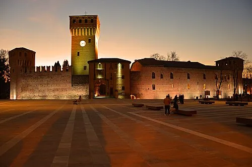 Castello di Formigine Historic site, Formigine18 km NE
-
Monte Lama Mountain, Lama Mocogno20 km SW
Sources & licences
Data last updated: · 2 independent sources