- Population
- 21,249
- 21.2K
- Elevation
- 411 m
- above sea level
- Local time
- UTC+01:00
- Europe/Rome · UTC+01:00
- Places inside
- 29
- listed under Anagni
- Airports
- CIA Ciampino–G. B. Pastine International Airport47 km
- FCO Rome–Fiumicino Leonardo da Vinci International Airport75 km
About Anagni
Anagni is a municipality. Location: Province of Frosinone, Lazio. Population: 21,249. Elevation: 411 m. The best months to visit are May–July, September. The nearest airport is Ciampino–G. B. Pastine International Airport (47 km). Nearby sights include Monte Alto and Stadio Matusa.
Climate of Anagni
Best months for sightseeingBest months for sightseeing: May–July, September.
This month · November
A wet month
Day 14° · Night 5° · Rain 145 mm
- Hottest month
- August (day 29°)
- Coldest month
- January (night 1°)
- Wettest month
- November (145 mm)
- Driest month
- July (40 mm)
Bars: average monthly low and high temperature. Below: precipitation. Monthly averages for 1970–2000 at about 18 km resolution, adjusted for elevation. Highlighted months are mild and relatively dry. Source: WorldClim 2.1 (CC BY 4.0).
Show values as a table
| Month | Jan | Feb | Mar | Apr | May | Jun | Jul | Aug | Sep | Oct | Nov | Dec |
|---|---|---|---|---|---|---|---|---|---|---|---|---|
| Average high (°C) | 10° | 11° | 13° | 16° | 21° | 25° | 29° | 29° | 25° | 19° | 14° | 10° |
| Average low (°C) | 1° | 1° | 4° | 6° | 10° | 14° | 16° | 17° | 13° | 10° | 5° | 2° |
| Precipitation (mm) | 88 | 86 | 73 | 87 | 65 | 46 | 40 | 52 | 90 | 124 | 145 | 116 |
Other places to visit in this season: May June July September
How to get to Anagni
The nearest airport is Ciampino–G. B. Pastine International Airport (CIA), 47 km to the west as the crow flies. The nearest large city is Split, 333 km to the northeast.
Airports
- Ciampino–G. B. Pastine International Airport (CIA) Rome 47 kmwest
- Rome–Fiumicino Leonardo da Vinci International Airport (FCO) Rome 75 kmwest
- Abruzzo Airport (PSR) Pescara 114 kmnortheast
Nearby large cities
- Split Population: 149.8K 333 kmnortheast
Straight-line distances; road distances are longer. Airport data: OurAirports.
Day trips from Anagni
Within 100 km: 170 historic and cultural sites, 256 natural sites, 47 lakes, rivers and coasts.
0–25 km17 places
- Monte Viglio Mountain 24 kmNE
- Monte Serima Mountain 22 kmNW
- Monte Sentinella Mountain 20 kmS
- Monte Sant'Angelo Mountain 22 kmW
25–60 km178 places
- Sombrero Beach 52 kmS
- La Bussola Beach 57 kmS
- Lido di Latino Beach 44 kmSW
- Spiaggia Saporetti Beach 56 kmS
60–100 km278 places
- Valle Cerrese Natural site 77 kmNW
- Spiaggia delle Bambole Beach 62 kmSE
- Spiaggia Dell'Agave Beach 67 kmSE
- Ultima spiaggia Beach 68 kmSE
Straight-line distances.
Places in Anagni
29 places- 1 Anagni 9.2K
- 2 Tufano 689
- 3 Madonna delle Grazie Iacp 653
- 4 Osteria della Fontana 520
- 5 San Filippo 399
- 6 San Bartolomeo 381
- 7 Vignola-Monti 344
- 8 Torre del Papa-Tufo Ranzani 327
- 9 Fucigno 289
- 10 Monte Pistillo 280
- 11 Pascione-Quattro Strade 278
- 12 Sant'Anna 229
- 13 Casale Giminiani 228
- 14 Pantanello 129
- 15 Formelli 124
- 16 Zona Industriale Paduni-Selciatella 124
- 17 Mola del Lago 120
- 18 Capocroce 109
- 19 Le Fosse 93
- 20 Collacciano 83
- 21 Casale Menenti 79
- 22 Capannaccio 53
- 23 Nocicchia 48
- 24 Ara la Stella 41
- 25 Casale Buccitto 38
- 26 Ranuccio 35
- 27 Cavone 34
- 28 Zona Industriale Ponte delle Tavole 22
- 29 Campo Sportivo 17
Bar: population relative to the most populous place in this list.
Nearby attractions & nature
Everything nearby-
Monte Alto Mountain, Morolo12 km S
-
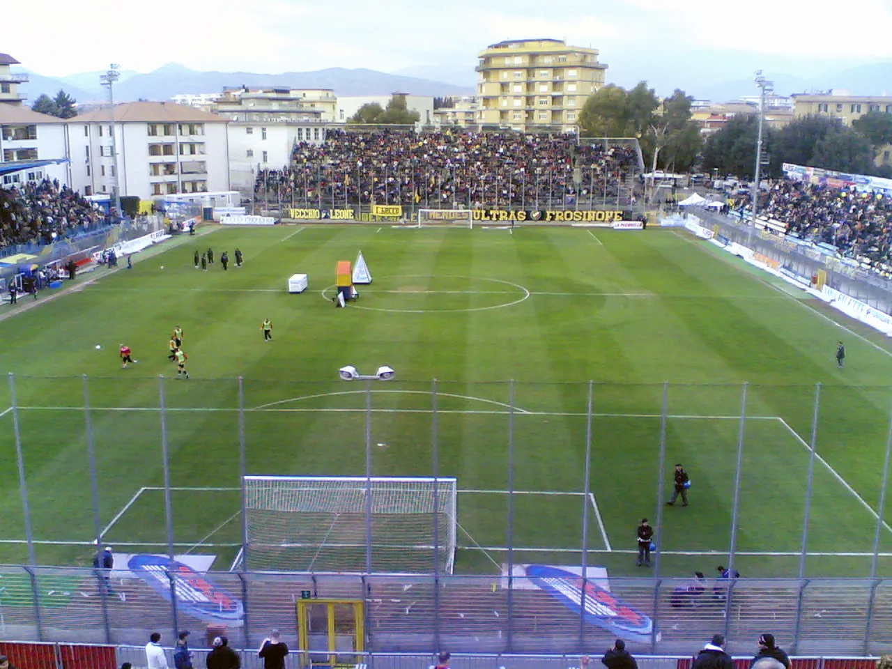 Stadio Matusa Landmark, Frosinone20 km SE
-
Monte Manno Mountain, Rocca Massima19 km W
-
Monte Rinzaturo Mountain, Cori20 km SW
-
Monte Pratiglio Mountain, Cori20 km SW
-
Monte Garofalo Mountain, Cori21 km SW
-
Monte Sant'Angelo Mountain, Rocca Massima22 km W
-
Monte Serima Mountain, San Vito Romano22 km NW
Sources & licences
Data last updated: