Castrocielo
Located in Province of Frosinone, Lazio Coordinates: 41°31′42″ N 13°41′37″ E
- Population
- 3,979
- 4K
- Elevation
- 188 m
- above sea level
- Local time
- UTC+01:00
- Europe/Rome · UTC+01:00
- Places inside
- 22
- listed under Castrocielo
- Airports
- NAP Naples International Airport87 km
- CIA Ciampino–G. B. Pastine International Airport96 km
About Castrocielo
Castrocielo is a municipality. Location: Province of Frosinone, Lazio. Population: 3,979. Elevation: 188 m. The best months to visit are May–June, September–October. The nearest airport is Naples International Airport (87 km). Nearby sights include Monte Occhio and Pizzo di Murro Marro.
Climate of Castrocielo
Best months for sightseeingBest months for sightseeing: May–June, September–October.
This month · November
A wet month
Day 15° · Night 8° · Rain 122 mm
- Hottest month
- August (day 29°)
- Coldest month
- January (night 3°)
- Wettest month
- November (122 mm)
- Driest month
- July (43 mm)
Bars: average monthly low and high temperature. Below: precipitation. Monthly averages for 1970–2000 at about 18 km resolution, adjusted for elevation. Highlighted months are mild and relatively dry. Source: WorldClim 2.1 (CC BY 4.0).
Show values as a table
| Month | Jan | Feb | Mar | Apr | May | Jun | Jul | Aug | Sep | Oct | Nov | Dec |
|---|---|---|---|---|---|---|---|---|---|---|---|---|
| Average high (°C) | 11° | 11° | 14° | 17° | 22° | 26° | 29° | 29° | 25° | 20° | 15° | 12° |
| Average low (°C) | 3° | 4° | 6° | 8° | 13° | 16° | 19° | 19° | 16° | 12° | 8° | 5° |
| Precipitation (mm) | 75 | 73 | 66 | 79 | 61 | 48 | 43 | 54 | 82 | 107 | 122 | 94 |
Other places to visit in this season: May June September October
How to get to Castrocielo
The nearest airport is Naples International Airport (NAP), 87 km to the southeast as the crow flies. The nearest large city is Split, 315 km to the northeast.
Airports
- Naples International Airport (NAP) Napoli 87 kmsoutheast
- Ciampino–G. B. Pastine International Airport (CIA) Rome 96 kmwest
- Abruzzo Airport (PSR) Pescara 108 kmnorth
Nearby large cities
- Split Population: 149.8K 315 kmnortheast
- Mostar Population: 104.5K 394 kmnortheast
Straight-line distances; road distances are longer. Airport data: OurAirports.
Day trips from Castrocielo
Within 100 km: 142 historic and cultural sites, 230 natural sites, 45 lakes, rivers and coasts.
0–25 km33 places
- Monte Vomero Mountain 25 kmS
- Cimarone del Villaneto Mountain 6 kmN
- Monte Trocchio Mountain 17 kmSE
- Monte Santa Maria Mountain 16 kmNE
25–60 km114 places
- Sombrero Beach 46 kmSW
- La Bussola Beach 59 kmSW
- Spiaggia delle Bambole Beach 37 kmSW
- Spiaggia Dell'Agave Beach 37 kmS
60–100 km270 places
- Colle Umberto Mountain 98 kmSE
- Vallone Grande Natural site 95 kmE
- Valle Covatta Natural site 78 kmE
- S.L.O Rodolfo beach Beach 63 kmS
Straight-line distances.
Places in Castrocielo
22 places- 1 Castrocielo 871
- 2 Stazione d'Aquino 293
- 3 Capodacqua 159
- 4 Cavallara 109
- 5 Delli Colli 62
- 6 De Angelis 59
- 7 Via Latina 54
- 8 Autostrada del Sole 48
- 9 Giovenale 45
- 10 Guadicciolo 44
- 11 Campo Cavaliere 32
- 12 Case Diana 24
- 13 Ruscio 22
- 14 Carcione-Caprio 19
- 15 Parco dei Principi 19
- 16 Fontana Coperta 17
- 17 Ex Recoaro 16
- 18 Il Circolo 16
- 19 Di Ruzza 13
- 20 Materiale 12
- 21 Casilina Est/Ovest 6
- 22 Ex Ocis 1
Bar: population relative to the most populous place in this list.
Nearby attractions & nature
Everything nearby-
Monte Occhio Mountain, Colle San Magno4.3 km N
-
Pizzo di Murro Marro Mountain, Colle San Magno6.1 km N
-
Cimarone del Villaneto Mountain, Colle San Magno6.4 km N
-
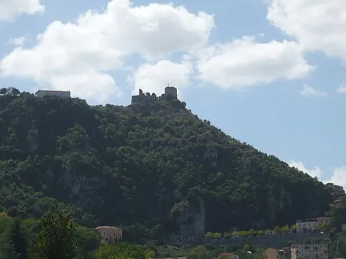 Roccaguglielma Historic site, Esperia16 km S
-
Monte d'Oro Mountain, Esperia14 km S
-
Cassino Valley Natural site, Cassino13 km SE
-
Monte Cifalco Mountain, Sant'Elia Fiumerapido14 km E
-
Monte Paolino Mountain, Sant'Apollinare15 km SE
Sources & licences
Data last updated: