Rocca d'Arce
Located in Province of Frosinone, Lazio Coordinates: 41°35′14″ N 13°35′06″ E
- Population
- 948
- 948
- Elevation
- 479 m
- above sea level
- Local time
- UTC+01:00
- Europe/Rome · UTC+01:00
- Places inside
- 9
- listed under Rocca d'Arce
- Airports
- CIA Ciampino–G. B. Pastine International Airport86 km
- NAP Naples International Airport98 km
About Rocca d'Arce
Rocca d'Arce is a municipality. Location: Province of Frosinone, Lazio. Population: 948. Elevation: 479 m. The best months to visit are May–July, September. The nearest airport is Ciampino–G. B. Pastine International Airport (86 km). Nearby sights include Castello di Monte San Giovanni Campano and Monte Occhio.
Climate of Rocca d'Arce
Best months for sightseeingBest months for sightseeing: May–July, September.
This month · November
A wet month
Day 13° · Night 4° · Rain 148 mm
- Hottest month
- August (day 28°)
- Coldest month
- January (night 0°)
- Wettest month
- November (148 mm)
- Driest month
- July (39 mm)
Bars: average monthly low and high temperature. Below: precipitation. Monthly averages for 1970–2000 at about 18 km resolution, adjusted for elevation. Highlighted months are mild and relatively dry. Source: WorldClim 2.1 (CC BY 4.0).
Show values as a table
| Month | Jan | Feb | Mar | Apr | May | Jun | Jul | Aug | Sep | Oct | Nov | Dec |
|---|---|---|---|---|---|---|---|---|---|---|---|---|
| Average high (°C) | 9° | 10° | 12° | 15° | 20° | 24° | 28° | 28° | 24° | 19° | 13° | 10° |
| Average low (°C) | 0° | 1° | 3° | 5° | 10° | 13° | 16° | 16° | 13° | 9° | 4° | 1° |
| Precipitation (mm) | 91 | 86 | 75 | 88 | 60 | 43 | 39 | 55 | 89 | 123 | 148 | 119 |
Other places to visit in this season: May June July September
How to get to Rocca d'Arce
The nearest airport is Ciampino–G. B. Pastine International Airport (CIA), 86 km to the west as the crow flies. The nearest large city is Split, 317 km to the northeast.
Airports
- Ciampino–G. B. Pastine International Airport (CIA) Rome 86 kmwest
- Naples International Airport (NAP) Napoli 98 kmsoutheast
- Abruzzo Airport (PSR) Pescara 106 kmnortheast
Nearby large cities
- Split Population: 149.8K 317 kmnortheast
Straight-line distances; road distances are longer. Airport data: OurAirports.
Day trips from Rocca d'Arce
Within 100 km: 202 historic and cultural sites, 239 natural sites, 50 lakes, rivers and coasts.
0–25 km16 places
- Cimarone del Villaneto Mountain 11 kmE
- Monte Santa Maria Mountain 23 kmE
- Monte Pastenese Mountain 18 kmS
- Monte d'Oro Mountain 22 kmS
25–60 km152 places
- Sombrero Beach 44 kmSW
- La Bussola Beach 56 kmSW
- Spiaggia delle Bambole Beach 40 kmS
- Spiaggia Dell'Agave Beach 42 kmS
60–100 km323 places
- Valle Covatta Natural site 86 kmE
- S.L.O Rodolfo beach Beach 73 kmSE
- Lido di Liccola Beach 87 kmSE
- Marina di Varcaturo Beach 85 kmSE
Straight-line distances.
Places in Rocca d'Arce
9 places- 1 Madonna di Paris 230
- 2 Rocca d'Arce 157
- 3 Fraioli 78
- 4 Cafanta 67
- 5 Fontana del Basso 28
- 6 Marconi 23
- 7 Murata 23
- 8 Sant'Antonio 17
- 9 Fraioli Casilina 15
Bar: population relative to the most populous place in this list.
Nearby attractions & nature
Everything nearby-
 Castello di Monte San Giovanni Campano Historic site, Monte San Giovanni Campano8.3 km NW
-
Monte Occhio Mountain, Colle San Magno8.5 km E
-
Pizzo di Murro Marro Mountain, Colle San Magno9.6 km E
-
Cimarone del Villaneto Mountain, Colle San Magno11 km E
-
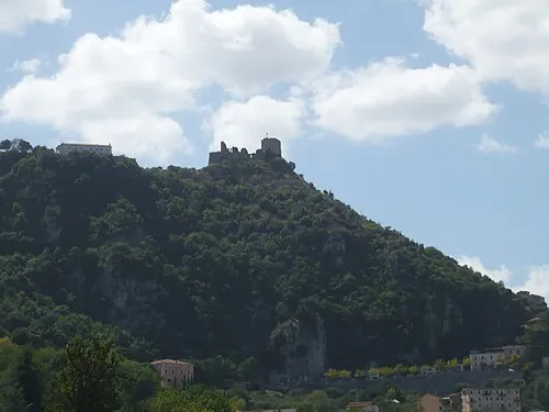 Roccaguglielma Historic site, Esperia24 km S
-
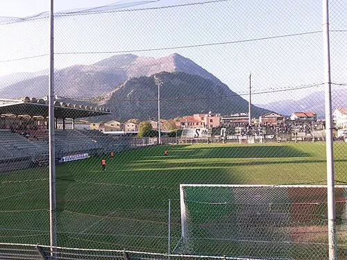 Stadio Claudio Tomei Landmark, Sora15 km N
-
Chiesa di Sant'Antonino Martire Attraction, Pofi14 km W
-
Monte d'Oro Mountain, Esperia22 km S
Sources & licences
Data last updated: