Longone Sabino
Located in Province of Rieti, Lazio Coordinates: 42°16′23″ N 12°58′03″ E
- Population
- 554
- 554
- Elevation
- 783 m
- above sea level
- Local time
- UTC+01:00
- Europe/Rome · UTC+01:00
- Places inside
- 5
- listed under Longone Sabino
- Airports
- CIA Ciampino–G. B. Pastine International Airport61 km
- FCO Rome–Fiumicino Leonardo da Vinci International Airport79 km
About Longone Sabino
Longone Sabino is a municipality. Location: Province of Rieti, Lazio. Population: 554. Elevation: 783 m. The best months to visit are June–September. The nearest airport is Ciampino–G. B. Pastine International Airport (61 km). Nearby sights include Monte Navegna and Colle Lepre.
Climate of Longone Sabino
Best months for sightseeingBest months for sightseeing: June–September.
This month · November
A cold month
Day 11° · Night 4° · Rain 76 mm
- Hottest month
- August (day 26°)
- Coldest month
- January (night 0°)
- Wettest month
- October (88 mm)
- Driest month
- January (41 mm)
Bars: average monthly low and high temperature. Below: precipitation. Monthly averages for 1970–2000 at about 18 km resolution, adjusted for elevation. Highlighted months are mild and relatively dry. Source: WorldClim 2.1 (CC BY 4.0).
Show values as a table
| Month | Jan | Feb | Mar | Apr | May | Jun | Jul | Aug | Sep | Oct | Nov | Dec |
|---|---|---|---|---|---|---|---|---|---|---|---|---|
| Average high (°C) | 7° | 8° | 10° | 13° | 18° | 22° | 26° | 26° | 21° | 16° | 11° | 8° |
| Average low (°C) | 0° | 0° | 2° | 4° | 9° | 12° | 15° | 15° | 12° | 8° | 4° | 1° |
| Precipitation (mm) | 41 | 47 | 42 | 57 | 61 | 57 | 49 | 52 | 75 | 88 | 76 | 56 |
Other places to visit in this season: June July August September
How to get to Longone Sabino
The nearest airport is Ciampino–G. B. Pastine International Airport (CIA), 61 km to the southwest as the crow flies. The nearest large city is Split, 315 km to the northeast.
Airports
- Ciampino–G. B. Pastine International Airport (CIA) Rome 61 kmsouthwest
- Rome–Fiumicino Leonardo da Vinci International Airport (FCO) Rome 79 kmsouthwest
- Perugia San Francesco d'Assisi – Umbria International Airport (PEG) Perugia (PG) 99 kmnorth
Nearby large cities
- Split Population: 149.8K 315 kmnortheast
- Rijeka Population: 108K 359 kmnorth
Straight-line distances; road distances are longer. Airport data: OurAirports.
Day trips from Longone Sabino
Within 100 km: 188 historic and cultural sites, 276 natural sites, 32 lakes, rivers and coasts.
0–25 km35 places
- Valle Cerrese Natural site 25 kmW
- Monte Zoccane Mountain 12 kmNW
- Monte Trascinelli Mountain 14 kmNE
- Monte Terminillo Mountain 22 kmN
25–60 km225 places
- Tiber Island Island 59 kmSW
- Monte Piscina Mountain 43 kmSW
- Monte Viglio Mountain 55 kmSE
- Monte Vagliamenti Mountain 52 kmNW
60–100 km236 places
- Giulianova Beach Beach 99 kmNE
- Lido di Latino Beach 96 kmS
- Campo di Mare Beach 84 kmSW
- Spiaggia Roseto degli Abruzzi Beach 97 kmNE
Straight-line distances.
Places in Longone Sabino
5 placesBar: population relative to the most populous place in this list.
Mountains & nature1
- Monte Aquilone · Mountain
Nearby attractions & nature
Everything nearby-
Monte Navegna Mountain, Varco Sabino6.8 km SE
-
Colle Lepre Mountain, Colle di Tora10 km S
-
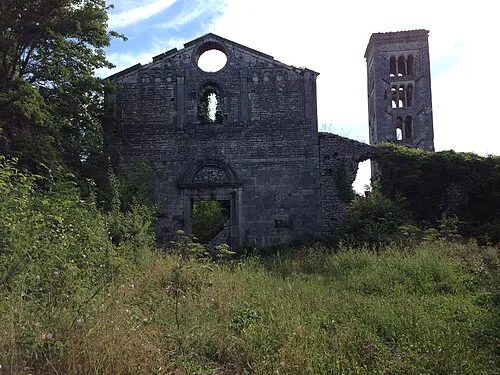 Santa Maria del Piano Attraction, Orvinio15 km S
-
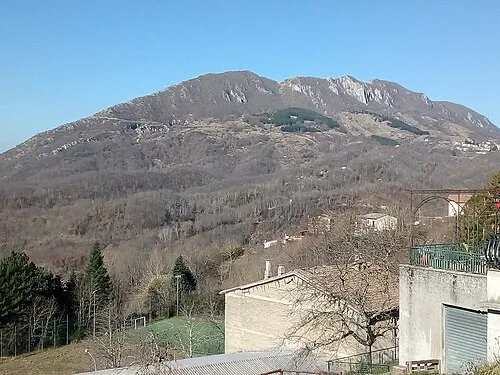 Monte Cervia Mountain, Paganico Sabino13 km S
-
Monte Pendente Mountain, Poggio Moiano11 km SW
-
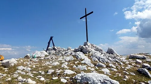 Monte Nuria Mountain, Petrella Salto13 km NE
-
Monte Nurietta Mountain, Petrella Salto12 km NE
-
Valle Fracida Natural site, Lazio12 km SE
Sources & licences
Data last updated: