Marzolanella
Located in Palombara Sabina, Province of Rome Coordinates: 42°05′44″ N 12°38′32″ E
- Population
- 347
- 347
- Elevation
- 56 m
- above sea level
- Local time
- UTC+01:00
- Europe/Rome · UTC+01:00
- Airports
- CIA Ciampino–G. B. Pastine International Airport33 km
- FCO Rome–Fiumicino Leonardo da Vinci International Airport46 km
About Marzolanella
Marzolanella is a village. Location: Palombara Sabina, Province of Rome. Population: 347. Elevation: 56 m. The best months to visit are May, October. The nearest airport is Ciampino–G. B. Pastine International Airport (33 km). Nearby sights include Lucus Feroniae and Valle del Tevere.
Photos of Marzolanella
-
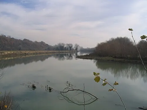
Valle del Tevere Patatebollenti · CC BY-SA 3.0 -
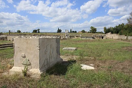
Lucus Feroniae Rossignol Benoît · CC BY-SA 4.0


Climate of Marzolanella
Best months for sightseeingBest months for sightseeing: May, October.
This month · November
Outside the best season
Day 16° · Night 7° · Rain 83 mm
- Hottest month
- August (day 32°)
- Coldest month
- January (night 3°)
- Wettest month
- November (83 mm)
- Driest month
- July (17 mm)
Bars: average monthly low and high temperature. Below: precipitation. Monthly averages for 1970–2000 at about 18 km resolution, adjusted for elevation. Highlighted months are mild and relatively dry. Source: WorldClim 2.1 (CC BY 4.0).
Show values as a table
| Month | Jan | Feb | Mar | Apr | May | Jun | Jul | Aug | Sep | Oct | Nov | Dec |
|---|---|---|---|---|---|---|---|---|---|---|---|---|
| Average high (°C) | 12° | 13° | 16° | 18° | 23° | 28° | 31° | 32° | 27° | 22° | 16° | 13° |
| Average low (°C) | 3° | 4° | 6° | 8° | 12° | 16° | 18° | 19° | 15° | 12° | 7° | 4° |
| Precipitation (mm) | 60 | 55 | 49 | 50 | 39 | 31 | 17 | 32 | 57 | 76 | 83 | 68 |
How to get to Marzolanella
The nearest airport is Ciampino–G. B. Pastine International Airport (CIA), 33 km to the south as the crow flies. The nearest large city is Split, 348 km to the northeast.
Airports
- Ciampino–G. B. Pastine International Airport (CIA) Rome 33 kmsouth
- Rome–Fiumicino Leonardo da Vinci International Airport (FCO) Rome 46 kmsouthwest
- Perugia San Francesco d'Assisi – Umbria International Airport (PEG) Perugia (PG) 112 kmnorth
Nearby large cities
- Split Population: 149.8K 348 kmnortheast
- Rijeka Population: 108K 387 kmnorth
Straight-line distances; road distances are longer. Airport data: OurAirports.
Day trips from Marzolanella
Within 100 km: 137 historic and cultural sites, 229 natural sites, 30 lakes, rivers and coasts.
0–25 km23 places
- Monte Piscina Mountain 9 kmSW
- Monte Soratte Mountain 21 kmNW
- Monte Sant'Angelo in Arcese Mountain 23 kmSE
- Monte Pendente Mountain 23 kmNE
25–60 km171 places
- Valle Cerrese Natural site 28 kmN
- Campo di Mare Beach 52 kmW
- Spiaggia di Rio Torto Beach 56 kmS
- Spiaggia Torvaianica Beach 54 kmS
60–100 km202 places
- Boca Do Mar Beach 75 kmW
- Lido di Latino Beach 79 kmS
- Spiaggia Saporetti Beach 100 kmS
- Spiaggia Lilanda Beach 96 kmS
Straight-line distances.
Nearby attractions & nature
Everything nearby-
Lucus Feroniae Historic site, Capena5.3 km NW
-
Valle del Tevere Natural site, Lazio6.4 km NW
-
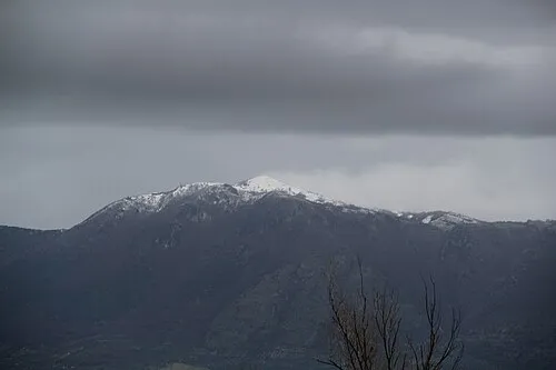 Monte Gennaro Mountain, Palombara Sabina13 km E
-
Monte di Massa Mountain, Municipio Roma III8.5 km SW
-
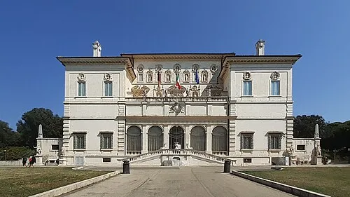 Galleria Borghese Museum, Municipio Roma II24 km SW
-
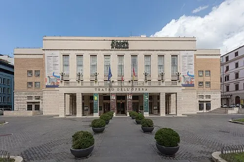 Opera House Attraction, Municipio Roma I25 km SW
Sources & licences
Data last updated: · 2 independent sources