- Population
- 818
- 818
- Elevation
- 430 m
- above sea level
- Local time
- UTC+01:00
- Europe/Rome · UTC+01:00
- Places inside
- 5
- listed under Pontinvrea
- Airports
- GOA Genoa Cristoforo Colombo Airport32 km
- CUF Cuneo International Airport66 km
About Pontinvrea
Pontinvrea is a municipality. Location: Province of Savona, Liguria. Population: 818. Elevation: 430 m. The best months to visit are June–September. The nearest airport is Genoa Cristoforo Colombo Airport (32 km). Nearby sights include Priamar Fortress and Spiaggia di Albisola Marina.
Climate of Pontinvrea
Best months for sightseeingBest months for sightseeing: June–September.
This month · November
A cold month
Day 12° · Night 6° · Rain 94 mm
- Hottest month
- August (day 26°)
- Coldest month
- January (night 2°)
- Wettest month
- October (139 mm)
- Driest month
- July (27 mm)
Bars: average monthly low and high temperature. Below: precipitation. Monthly averages for 1970–2000 at about 18 km resolution, adjusted for elevation. Highlighted months are mild and relatively dry. Source: WorldClim 2.1 (CC BY 4.0).
Show values as a table
| Month | Jan | Feb | Mar | Apr | May | Jun | Jul | Aug | Sep | Oct | Nov | Dec |
|---|---|---|---|---|---|---|---|---|---|---|---|---|
| Average high (°C) | 8° | 9° | 12° | 15° | 19° | 23° | 26° | 26° | 22° | 17° | 12° | 9° |
| Average low (°C) | 2° | 3° | 5° | 8° | 12° | 15° | 18° | 18° | 15° | 11° | 6° | 3° |
| Precipitation (mm) | 81 | 61 | 77 | 87 | 78 | 50 | 27 | 59 | 84 | 139 | 94 | 74 |
Other places to visit in this season: June July August September
How to get to Pontinvrea
The nearest airport is Genoa Cristoforo Colombo Airport (GOA), 32 km to the east as the crow flies. The nearest large city is Nice, 125 km to the southwest.
Airports
- Genoa Cristoforo Colombo Airport (GOA) Genova (GE) 32 kmeast
- Cuneo International Airport (CUF) Levaldigi (CN) 66 kmwest
- Turin Airport (TRN) Caselle Torinese (TO) 105 kmnorthwest
Nearby large cities
- Nice Population: 342.7K 125 kmsouthwest
- Grenoble Population: 158.6K 230 kmwest
- Toulon Population: 168.7K 249 kmsouthwest
- Aix-en-Provence Population: 146.8K 260 kmwest
- Geneva Population: 201.7K 265 kmnorthwest
Straight-line distances; road distances are longer. Airport data: OurAirports.
Day trips from Pontinvrea
Within 100 km: 33 historic and cultural sites, 293 natural sites, 36 lakes, rivers and coasts.
0–25 km13 places
- Spiaggia di Albisola Marina Beach 14 kmS
- Spiaggia di Savona Beach 16 kmS
- Spiaggia di Vado Ligure Beach 19 kmS
- Bric Praioli Mountain 18 kmE
25–60 km72 places
- Monte Rotondo Mountain 59 kmSW
- Spiaggia di Ceriale Beach 42 kmSW
- Baba Beach Beach 49 kmS
- Spiaggia Albenga Beach 47 kmS
60–100 km277 places
- Rotteri Mountain 79 kmE
- Gifarco Mountain 72 kmE
- Lac des Mesches Lake 84 kmSW
- Cime des Vallières Mountain 100 kmSW
Straight-line distances.
Places in Pontinvrea
5 placesBar: population relative to the most populous place in this list.
Nearby attractions & nature
Everything nearby-
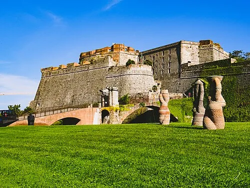 Priamar Fortress Historic site, Savona16 km S
-
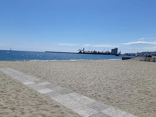 Spiaggia di Albisola Marina Beach, Albissola Marina14 km S
-
Cima Rocca Vaccaria Mountain, Sassello18 km E
-
Bric Praioli Mountain, Piedmont18 km E
-
Bric Dato Mountain, Urbe18 km E
-
Bric di Saliera Mountain, Tiglieto19 km E
-
Monte Tardia ponente Mountain, Arenzano20 km E
-
Monte Tardia levante Mountain, Genova20 km E
Sources & licences
Data last updated: