- Population
- 37
- 37
- Elevation
- 134 m
- above sea level
- Local time
- UTC+01:00
- Europe/Rome · UTC+01:00
- Airports
- BGY Il Caravaggio International Airport16 km
- LIN Milano Linate Airport28 km
About Via Bergamo
Via Bergamo is a village. Location: Treviglio, Province of Bergamo. Population: 37. Elevation: 134 m. The best months to visit are May–June, September. The nearest airport is Il Caravaggio International Airport (16 km). Nearby sights include Santuario di Caravaggio and Basilica di Santa Giulia.
Climate of Via Bergamo
Best months for sightseeingBest months for sightseeing: May–June, September.
This month · November
A cold month
Day 11° · Night 4° · Rain 82 mm
- Hottest month
- July (day 29°)
- Coldest month
- January (night -1°)
- Wettest month
- October (116 mm)
- Driest month
- February (47 mm)
Bars: average monthly low and high temperature. Below: precipitation. Monthly averages for 1970–2000 at about 18 km resolution, adjusted for elevation. Highlighted months are mild and relatively dry. Source: WorldClim 2.1 (CC BY 4.0).
Show values as a table
| Month | Jan | Feb | Mar | Apr | May | Jun | Jul | Aug | Sep | Oct | Nov | Dec |
|---|---|---|---|---|---|---|---|---|---|---|---|---|
| Average high (°C) | 6° | 9° | 14° | 17° | 22° | 26° | 29° | 28° | 24° | 18° | 11° | 7° |
| Average low (°C) | -1° | 0° | 4° | 7° | 12° | 15° | 18° | 18° | 14° | 9° | 4° | 0° |
| Precipitation (mm) | 71 | 47 | 69 | 83 | 111 | 99 | 81 | 94 | 106 | 116 | 82 | 62 |
How to get to Via Bergamo
The nearest airport is Il Caravaggio International Airport (BGY), 16 km to the northeast as the crow flies. The nearest large city is Zurich, 218 km to the north.
Airports
- Il Caravaggio International Airport (BGY) Orio al Serio (BG) 16 kmnortheast
- Milano Linate Airport (LIN) Segrate (MI) 28 kmsouthwest
- Brescia Gabriele d'Annunzio Airport (VBS) Montichiari (BS) 58 kmeast
Nearby large cities
- Zurich Population: 415.4K 218 kmnorth
- Bern Population: 121.6K 228 kmnorthwest
- Winterthur Population: 111.8K 228 kmnorth
- Innsbruck Population: 132.5K 236 kmnortheast
- Lausanne Population: 139.1K 254 kmnorthwest
Straight-line distances; road distances are longer. Airport data: OurAirports.
Day trips from Via Bergamo
Within 100 km: 82 historic and cultural sites, 961 natural sites, 74 lakes, rivers and coasts.
0–25 km4 places
- Santuario di Caravaggio Attraction 7 kmS
- Basilica di Santa Giulia Attraction 13 kmN
- Teatro San Domenico Attraction 21 kmS
- Stadio Atleti Azzurri d'Italia Landmark 19 kmN
25–60 km108 places
- Monte Nuvolone Mountain 54 kmNW
- Poncione di Cabbio Mountain 58 kmNW
- Parco delle Gole della Breggia Natural site 57 kmNW
- Fiume Ticino River 52 kmSW
60–100 km1,005 places
- Isole di Brissago Island 94 kmNW
- Sant' Apollinare Island 94 kmNW
- San Pancrazio Island 94 kmNW
- Chaviolas Island 98 kmN
Straight-line distances.
Nearby attractions & nature
Everything nearby-
Santuario di Caravaggio Attraction, Caravaggio7.2 km S
-
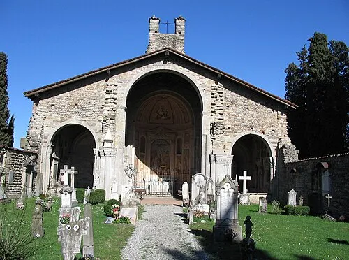 Basilica di Santa Giulia Attraction, Bonate Sotto13 km N
-
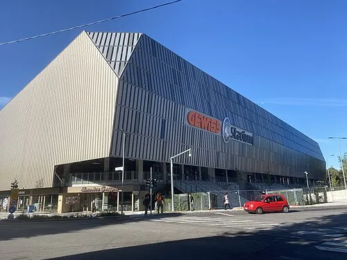 Stadio Atleti Azzurri d'Italia Landmark, Bergamo19 km N
-
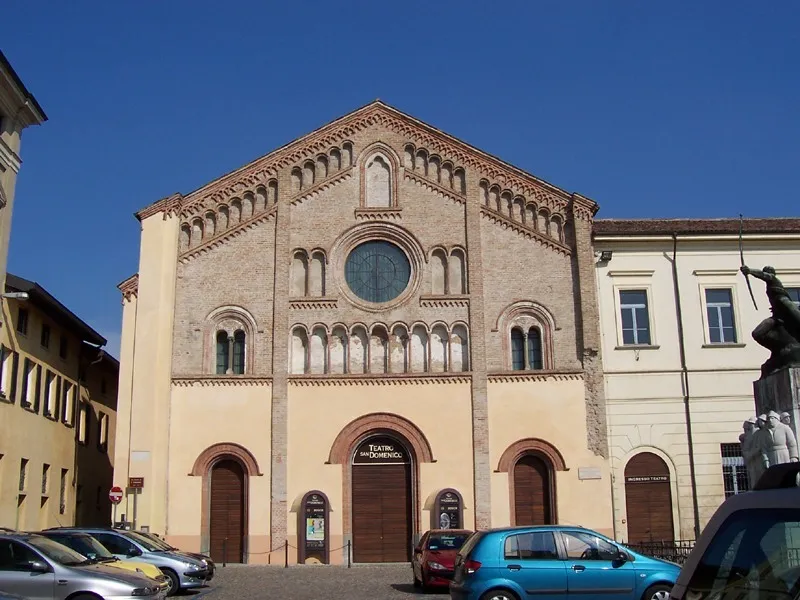 Teatro San Domenico Attraction, Crema21 km S
Sources & licences
Data last updated: · 2 independent sources