Treviso Bresciano
Located in Province of Brescia, Lombardy Coordinates: 45°42′46″ N 10°27′41″ E
- Population
- 519
- 519
- Elevation
- 682 m
- above sea level
- Local time
- UTC+01:00
- Europe/Rome · UTC+01:00
- Places inside
- 1
- listed under Treviso Bresciano
- Airports
- VBS Brescia Gabriele d'Annunzio Airport33 km
- VRN Verona Villafranca Valerio Catullo Airport49 km
About Treviso Bresciano
Treviso Bresciano is a municipality. Location: Province of Brescia, Lombardy. Population: 519. Elevation: 682 m. The best months to visit are June–September. The nearest airport is Brescia Gabriele d'Annunzio Airport (33 km). Nearby sights include Monte Manos and Monte Zingla.
Photos of Treviso Bresciano
-
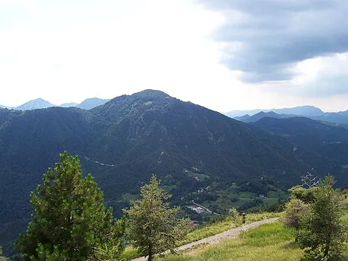
Monte Manos Cadria · Public domain

Climate of Treviso Bresciano
Best months for sightseeingBest months for sightseeing: June–September.
This month · November
A cold month
Day 9° · Night 1° · Rain 47 mm
- Hottest month
- July (day 25°)
- Coldest month
- January (night -3°)
- Wettest month
- June (77 mm)
- Driest month
- February (26 mm)
Bars: average monthly low and high temperature. Below: precipitation. Monthly averages for 1970–2000 at about 18 km resolution, adjusted for elevation. Highlighted months are mild and relatively dry. Source: WorldClim 2.1 (CC BY 4.0).
Show values as a table
| Month | Jan | Feb | Mar | Apr | May | Jun | Jul | Aug | Sep | Oct | Nov | Dec |
|---|---|---|---|---|---|---|---|---|---|---|---|---|
| Average high (°C) | 5° | 7° | 11° | 14° | 18° | 22° | 25° | 25° | 20° | 15° | 9° | 6° |
| Average low (°C) | -3° | -2° | 1° | 4° | 9° | 12° | 15° | 15° | 11° | 7° | 1° | -2° |
| Precipitation (mm) | 35 | 26 | 38 | 53 | 73 | 77 | 68 | 75 | 75 | 77 | 47 | 34 |
Other places to visit in this season: June July August September
How to get to Treviso Bresciano
The nearest airport is Brescia Gabriele d'Annunzio Airport (VBS), 33 km to the south as the crow flies. For international flights: Verona Villafranca Valerio Catullo Airport (VRN) (49 km). The nearest large city is Innsbruck, 187 km to the north.
Airports
- Brescia Gabriele d'Annunzio Airport (VBS) Montichiari (BS) 33 kmsouth
- Verona Villafranca Valerio Catullo Airport (VRN) Caselle (VR) 49 kmsoutheast
- Il Caravaggio International Airport (BGY) Orio al Serio (BG) 59 kmwest
Nearby large cities
- Innsbruck Population: 132.5K 187 kmnorth
- Zurich Population: 415.4K 235 kmnorthwest
- Winterthur Population: 111.8K 240 kmnorthwest
- Bern Population: 121.6K 270 kmnorthwest
- Munich Population: 1.5M 283 kmnorth
Straight-line distances; road distances are longer. Airport data: OurAirports.
Day trips from Treviso Bresciano
Within 100 km: 43 historic and cultural sites, 1,482 natural sites, 82 lakes, rivers and coasts.
0–25 km58 places
- Monte Maddalena Mountain 23 kmSW
- Monte Guglielmo Mountain 23 kmW
- Monte Denervo Mountain 16 kmE
- Monte Spino Mountain 8 kmSE
25–60 km379 places
- Spadalone Mountain 51 kmN
- Dosso Rotondo Mountain 41 kmE
- Monte Bronzone Mountain 37 kmW
- Lora Mountain 55 kmE
60–100 km1,170 places
- Chaviolas Island 96 kmNW
- Silvaplanersee Lake 97 kmNW
- Lake Sils Lake 97 kmNW
- Lago di Poschiavo Lake 70 kmNW
Straight-line distances.
Places in Treviso Bresciano
1 placeBar: population relative to the most populous place in this list.
Nearby attractions & nature
Everything nearby-
Monte Manos Mountain, Capovalle6.6 km NE
-
Monte Zingla Mountain, Vobarno6.1 km E
-
Corno Zeno Mountain, Trentino-Alto Adige6.3 km N
-
Monte Spino Mountain, Toscolano-Maderno7.8 km SE
-
Cima di Meghe Mountain, Anfo8.2 km N
-
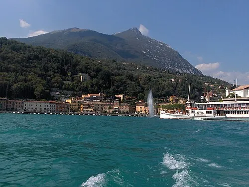 Monte Pizzocolo Mountain, Toscolano-Maderno11 km SE
-
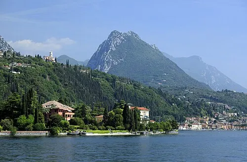 Monte Castello di Gaino Mountain, Toscolano-Maderno13 km E
-
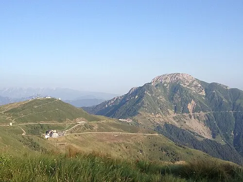 Dosso Alto Mountain, Collio12 km N
Sources & licences
Data last updated: