- Population
- 5
- 5
- Elevation
- 78 m
- above sea level
- Local time
- UTC+01:00
- Europe/Rome · UTC+01:00
- Airports
- LIN Milano Linate Airport29 km
- BGY Il Caravaggio International Airport36 km
About Il Palo
Il Palo is a village. Location: Chieve, Province of Cremona. Population: 5. Elevation: 78 m. The best months to visit are May–July, September. The nearest airport is Milano Linate Airport (29 km).
Photos of Il Palo
-
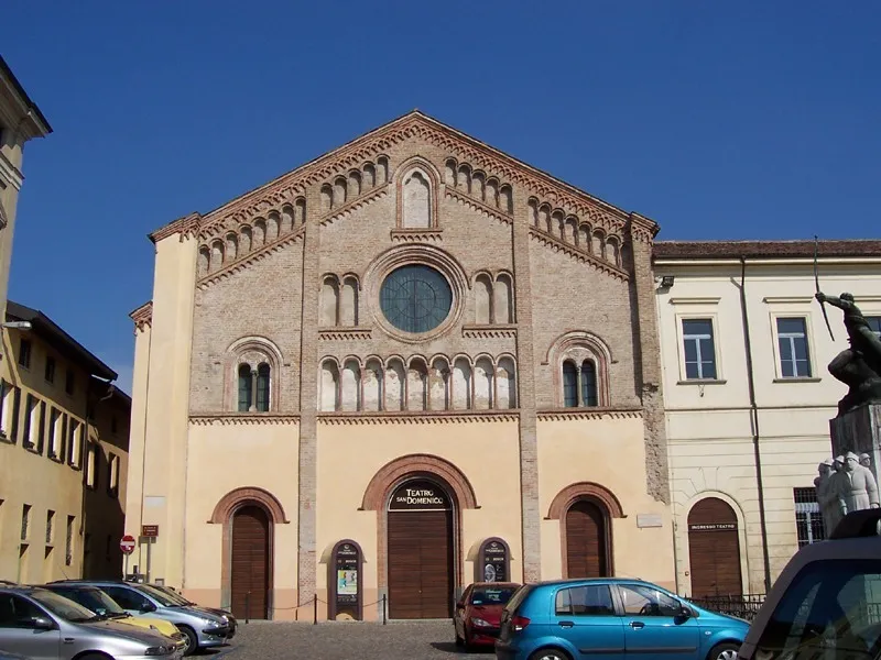
Teatro San Domenico MarkusMark · CC BY-SA 3.0

Climate of Il Palo
Best months for sightseeingBest months for sightseeing: May–July, September.
This month · November
A cold month
Day 11° · Night 3° · Rain 77 mm
- Hottest month
- July (day 28°)
- Coldest month
- January (night -2°)
- Wettest month
- October (113 mm)
- Driest month
- February (47 mm)
Bars: average monthly low and high temperature. Below: precipitation. Monthly averages for 1970–2000 at about 18 km resolution, adjusted for elevation. Highlighted months are mild and relatively dry. Source: WorldClim 2.1 (CC BY 4.0).
Show values as a table
| Month | Jan | Feb | Mar | Apr | May | Jun | Jul | Aug | Sep | Oct | Nov | Dec |
|---|---|---|---|---|---|---|---|---|---|---|---|---|
| Average high (°C) | 6° | 8° | 14° | 17° | 22° | 26° | 28° | 28° | 24° | 18° | 11° | 6° |
| Average low (°C) | -2° | 0° | 3° | 7° | 11° | 15° | 17° | 17° | 14° | 9° | 3° | -1° |
| Precipitation (mm) | 69 | 47 | 65 | 77 | 94 | 81 | 62 | 82 | 89 | 113 | 77 | 59 |
Other places to visit in this season: May June July September
How to get to Il Palo
The nearest airport is Milano Linate Airport (LIN), 29 km to the west as the crow flies. The nearest large city is Zurich, 239 km to the north.
Airports
- Milano Linate Airport (LIN) Segrate (MI) 29 kmwest
- Il Caravaggio International Airport (BGY) Orio al Serio (BG) 36 kmnorth
- Brescia Gabriele d'Annunzio Airport (VBS) Montichiari (BS) 56 kmeast
Nearby large cities
- Zurich Population: 415.4K 239 kmnorth
- Bern Population: 121.6K 244 kmnorthwest
- Winterthur Population: 111.8K 249 kmnorth
- Innsbruck Population: 132.5K 253 kmnortheast
- Nice Population: 342.7K 262 kmsouthwest
Straight-line distances; road distances are longer. Airport data: OurAirports.
Day trips from Il Palo
Within 100 km: 76 historic and cultural sites, 365 natural sites, 14 lakes, rivers and coasts.
0–25 km7 places
- Tempio Civico della Beata Vergine Incoronata Attraction 10 kmSW
- Santuario di Caravaggio Attraction 15 kmN
- Teatro San Domenico Attraction 5 kmE
- Palazzo Vescovile Historic site 10 kmSW
25–60 km56 places
- Fiume Ticino River 38 kmSW
- Monte Bronzone Mountain 49 kmNE
- Monte Maddalena Mountain 57 kmNE
- Pizzo d'Erna Mountain 59 kmN
60–100 km392 places
- Rotteri Mountain 87 kmS
- Laghetto di Muzzano Lake 90 kmNW
- Lake Lugano Lake 88 kmNW
- Laghetto Lake 99 kmNW
Straight-line distances.
Sources & licences
Data last updated: · 2 independent sources