Strada per Ottobiano
Located in Tromello, Province of Pavia Coordinates: 45°12′11″ N 8°51′52″ E
- Population
- 18
- 18
- Elevation
- 96 m
- above sea level
- Local time
- UTC+01:00
- Europe/Rome · UTC+01:00
- Airports
- LIN Milano Linate Airport42 km
- MXP Milan Malpensa International Airport49 km
About Strada per Ottobiano
Strada per Ottobiano is a village. Location: Tromello, Province of Pavia. Population: 18. Elevation: 96 m. The best months to visit are May–July, September. The nearest airport is Milano Linate Airport (42 km). Nearby sights include Certosa di Pavia and San Michele Maggiore.
Climate of Strada per Ottobiano
Best months for sightseeingBest months for sightseeing: May–July, September.
This month · November
A cold month
Day 10° · Night 3° · Rain 76 mm
- Hottest month
- July (day 28°)
- Coldest month
- January (night -2°)
- Wettest month
- October (104 mm)
- Driest month
- July (43 mm)
Bars: average monthly low and high temperature. Below: precipitation. Monthly averages for 1970–2000 at about 18 km resolution, adjusted for elevation. Highlighted months are mild and relatively dry. Source: WorldClim 2.1 (CC BY 4.0).
Show values as a table
| Month | Jan | Feb | Mar | Apr | May | Jun | Jul | Aug | Sep | Oct | Nov | Dec |
|---|---|---|---|---|---|---|---|---|---|---|---|---|
| Average high (°C) | 5° | 8° | 14° | 17° | 22° | 25° | 28° | 27° | 24° | 17° | 10° | 6° |
| Average low (°C) | -2° | -1° | 3° | 6° | 11° | 15° | 17° | 17° | 13° | 8° | 3° | -1° |
| Precipitation (mm) | 59 | 49 | 63 | 75 | 88 | 63 | 43 | 69 | 74 | 104 | 76 | 51 |
Other places to visit in this season: May June July September
How to get to Strada per Ottobiano
The nearest airport is Milano Linate Airport (LIN), 42 km to the northeast as the crow flies. The nearest large city is Nice, 210 km to the southwest.
Airports
- Milano Linate Airport (LIN) Segrate (MI) 42 kmnortheast
- Milan Malpensa International Airport (MXP) Ferno (VA) 49 kmnorth
- Il Caravaggio International Airport (BGY) Orio al Serio (BG) 84 kmnortheast
Nearby large cities
- Nice Population: 342.7K 210 kmsouthwest
- Bern Population: 121.6K 223 kmnorthwest
- Lausanne Population: 139.1K 227 kmnorthwest
- Geneva Population: 201.7K 239 kmnorthwest
- Zurich Population: 415.4K 242 kmnorth
Straight-line distances; road distances are longer. Airport data: OurAirports.
Day trips from Strada per Ottobiano
Within 100 km: 88 historic and cultural sites, 383 natural sites, 19 lakes, rivers and coasts.
0–25 km5 places
- San Pietro in Ciel d'Oro Attraction 23 kmE
- San Michele Maggiore Attraction 23 kmE
- Certosa di Pavia Attraction 23 kmE
- Santa Maria di Canepanova Attraction 23 kmE
25–60 km30 places
- Fiume Ticino River 30 kmE
- Monte Penice Mountain 59 kmSE
- Bagnolo Mountain 59 kmSE
- Piccolo Teatro Grassi Attraction 39 kmNE
60–100 km455 places
- Rotteri Mountain 81 kmSE
- Laghetto di Muzzano Lake 88 kmN
- Lake Lugano Lake 88 kmN
- Laghetto Lake 90 kmN
Straight-line distances.
Nearby attractions & nature
Everything nearby-
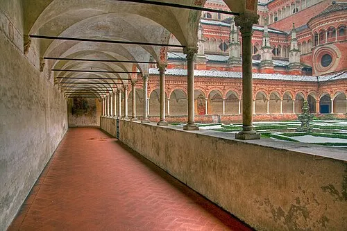 Certosa di Pavia Attraction, Certosa di Pavia23 km E
-
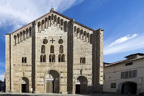 San Michele Maggiore Attraction, Pavia23 km E
-
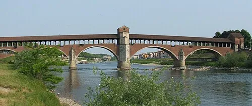 Ponte Coperto Landmark, Pavia23 km E
-
San Pietro in Ciel d'Oro Attraction, Pavia23 km E
-
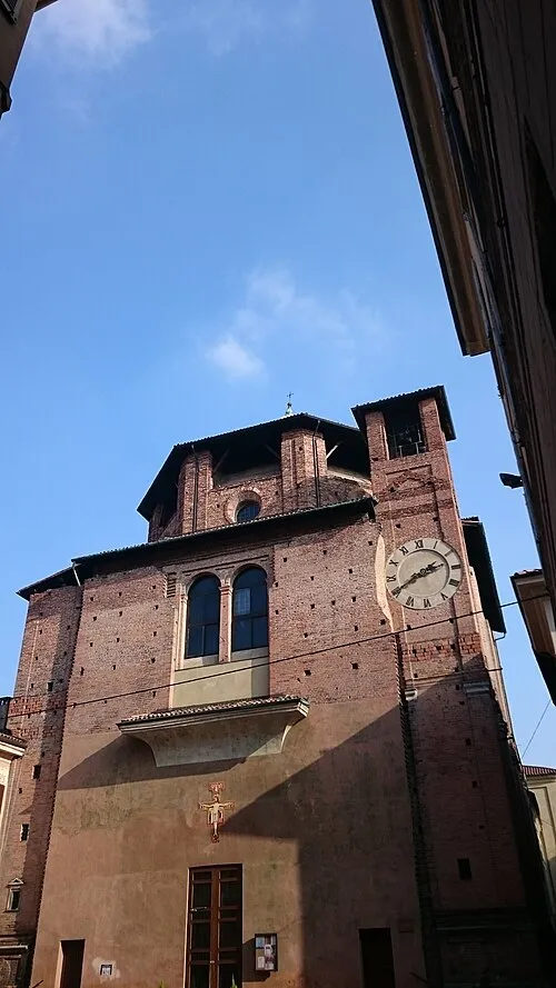 Santa Maria di Canepanova Attraction, Pavia23 km E
Sources & licences
Data last updated: · 2 independent sources