Val Masino
Located in Province of Sondrio, Lombardy Coordinates: 46°12′55″ N 9°38′17″ E
- Population
- 881
- 881
- Elevation
- 824 m
- above sea level
- Local time
- UTC+01:00
- Europe/Rome · UTC+01:00
- Places inside
- 43
- listed under Val Masino
- Airports
- BGY Il Caravaggio International Airport61 km
- LUG Lugano Airport61 km
About Val Masino
Val Masino is a municipality. Location: Province of Sondrio, Lombardy. Population: 881. Elevation: 824 m. The best months to visit are June–August. The nearest airport is Il Caravaggio International Airport (61 km). Nearby sights include Cima di Granda and Pizzo Mercantelli.
Photos of Val Masino
-
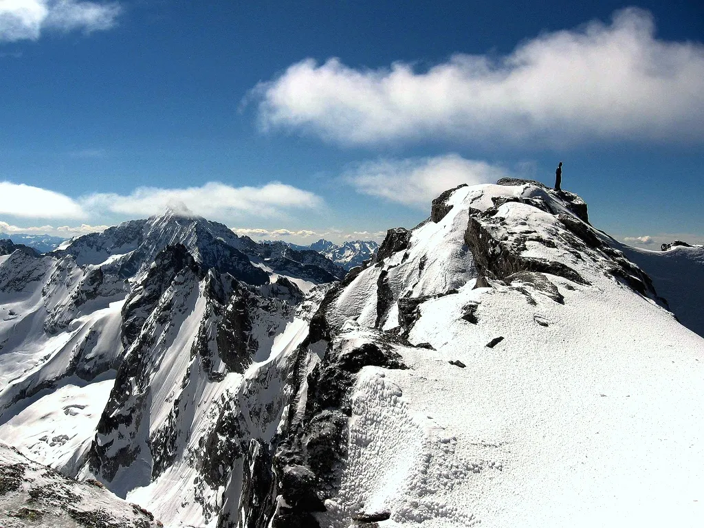
Cima di Castello Giac01 · Public domain -
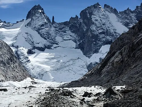
Torrone Orientale Zacharie Grossen · CC BY-SA 4.0 -
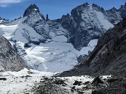
Torrone Centrale Zacharie Grossen · CC BY-SA 4.0


Climate of Val Masino
Best months for sightseeingBest months for sightseeing: June–August.
This month · November
A cold month
Day 10° · Night 2° · Rain 81 mm
- Hottest month
- July (day 23°)
- Coldest month
- February (night -2°)
- Wettest month
- August (115 mm)
- Driest month
- February (47 mm)
Bars: average monthly low and high temperature. Below: precipitation. Monthly averages for 1970–2000 at about 18 km resolution, adjusted for elevation. Highlighted months are mild and relatively dry. Source: WorldClim 2.1 (CC BY 4.0).
Show values as a table
| Month | Jan | Feb | Mar | Apr | May | Jun | Jul | Aug | Sep | Oct | Nov | Dec |
|---|---|---|---|---|---|---|---|---|---|---|---|---|
| Average high (°C) | 7° | 7° | 9° | 11° | 16° | 20° | 23° | 22° | 19° | 15° | 10° | 8° |
| Average low (°C) | -2° | -2° | 0° | 3° | 8° | 11° | 14° | 14° | 11° | 7° | 2° | -1° |
| Precipitation (mm) | 63 | 47 | 67 | 88 | 106 | 113 | 109 | 115 | 114 | 107 | 81 | 61 |
How to get to Val Masino
The nearest airport is Il Caravaggio International Airport (BGY), 61 km to the south as the crow flies. The nearest large city is Zurich, 153 km to the northwest.
Airports
- Il Caravaggio International Airport (BGY) Orio al Serio (BG) 61 kmsouth
- Lugano Airport (LUG) Agno 61 kmwest
- Milano Linate Airport (LIN) Segrate (MI) 90 kmsouth
Nearby large cities
- Zurich Population: 415.4K 153 kmnorthwest
- Winterthur Population: 111.8K 159 kmnorthwest
- Innsbruck Population: 132.5K 178 kmnortheast
- Bern Population: 121.6K 187 kmnorthwest
- Basel Population: 177.6K 217 kmnorthwest
Straight-line distances; road distances are longer. Airport data: OurAirports.
Day trips from Val Masino
Within 100 km: 99 historic and cultural sites, 4,902 natural sites, 577 lakes, rivers and coasts.
0–25 km291 places
- Chaviolas Island 24 kmN
- Lake Sils Lake 24 kmN
- Lägh da Cavloc Lake 19 kmN
- Leg Curegia Lake 23 kmN
25–60 km1,598 places
- Lajets Lake 31 kmN
- Silvaplanersee Lake 29 kmNE
- Lago di Poschiavo Lake 36 kmE
- Lake Lugano Lake 58 kmSW
60–100 km3,689 places
- Spadalone Mountain 84 kmE
- Lago Nero Lake 88 kmW
- Isole di Brissago Island 70 kmW
- Sant' Apollinare Island 70 kmW
Straight-line distances.
Places in Val Masino
43 placesBar: population relative to the most populous place in this list.
Mountains & nature40
- Cima d'Arcanzo · Mountain
- Cima degli Alli · Mountain
- Cima del Calvo · Mountain
- Cima del Cavalcorto · Mountain
- Cima di Castello · Mountain
- Cima di Cavislone · Mountain
- Cima Scingino · Mountain
- Cime delle Merdarola · Mountain
- Cime di Chiareggio · Mountain
- Cresta Cecilia · Mountain
- La Vecchia · Mountain
- Monte Boris · Mountain
- Monte Lobbia · Mountain
- Monte Pesconfio · Mountain
- Monte Piezza · Mountain
- Piz Badilet · Mountain
- Pizzi del Ferro · Mountain
- Pizzi Gemelli · Mountain
- Pizzo Basset · Mountain
- Pizzo della Remoluzza · Mountain
- Pizzo dell' Averta · Mountain
- Pizzo di Zocca · Mountain
- Pizzo Luigi Amadeo · Mountain
- Pizzo Vicima · Mountain
- Punta Baroni · Mountain
- Punta Camerozzo · Mountain
- Punta delle Sfinge · Mountain
- Punta Ferrario · Mountain
- Punta Medaccio · Mountain
- Punta Mezzola · Mountain
- Punta Rasica · Mountain
- Punta Romilla · Mountain
- Punta Sertori · Mountain
- Punta Temola · Mountain
- Sione · Mountain
- Torrione di Porro · Mountain
- Torrione di Qualido · Mountain
- Torrone Centrale · Mountain
- Torrone Occidentale · Mountain
- Torrone Orientale · Mountain
Nearby attractions & nature
Everything nearby-
Cima di Granda Mountain, Ardenno1.8 km SE
-
Pizzo Mercantelli Mountain, Buglio in Monte3.1 km E
-
Corno del Colino Mountain, Civo5.3 km SW
-
Sasso Arso Mountain, Buglio in Monte6 km E
-
Monte Spluga Mountain, Novate Mezzola6.3 km W
-
Pizzo della Vadretta Mountain, Novate Mezzola6.8 km W
-
Cima Vignone Mountain, Berbenno di Valtellina7.6 km E
-
Cima del Barbacan Mountain, Novate Mezzola7.7 km NW
Sources & licences
Data last updated: