Montelungo II
Located in Trivento, Province of Campobasso Coordinates: 41°45′05″ N 14°33′02″ E
- Population
- 58
- 58
- Elevation
- 702 m
- above sea level
- Local time
- UTC+01:00
- Europe/Rome · UTC+01:00
- Airports
- PSR Abruzzo Airport81 km
- FOG Foggia Gino Lisa Airport89 km
About Montelungo II
Montelungo II is a village. Location: Trivento, Province of Campobasso. Population: 58. Elevation: 702 m. The best months to visit are June–September. The nearest airport is Abruzzo Airport (81 km). Nearby sights include Vallone San Nicola and Monte Piano.
Climate of Montelungo II
Best months for sightseeingBest months for sightseeing: June–September.
This month · November
A cold month
Day 12° · Night 5° · Rain 71 mm
- Hottest month
- August (day 26°)
- Coldest month
- February (night 1°)
- Wettest month
- November (71 mm)
- Driest month
- July (31 mm)
Bars: average monthly low and high temperature. Below: precipitation. Monthly averages for 1970–2000 at about 18 km resolution, adjusted for elevation. Highlighted months are mild and relatively dry. Source: WorldClim 2.1 (CC BY 4.0).
Show values as a table
| Month | Jan | Feb | Mar | Apr | May | Jun | Jul | Aug | Sep | Oct | Nov | Dec |
|---|---|---|---|---|---|---|---|---|---|---|---|---|
| Average high (°C) | 8° | 8° | 10° | 14° | 18° | 23° | 26° | 26° | 22° | 17° | 12° | 9° |
| Average low (°C) | 2° | 1° | 3° | 6° | 10° | 14° | 17° | 17° | 14° | 10° | 5° | 3° |
| Precipitation (mm) | 50 | 48 | 45 | 49 | 42 | 35 | 31 | 40 | 49 | 56 | 71 | 57 |
Other places to visit in this season: June July August September
How to get to Montelungo II
The nearest airport is Abruzzo Airport (PSR), 81 km to the north as the crow flies. The nearest large city is Split, 249 km to the northeast.
Airports
- Abruzzo Airport (PSR) Pescara 81 kmnorth
- Foggia Gino Lisa Airport (FOG) Foggia (FG) 89 kmsoutheast
- Naples International Airport (NAP) Napoli 99 kmsouth
Nearby large cities
- Split Population: 149.8K 249 kmnortheast
- Mostar Population: 104.5K 321 kmnortheast
- Zenica Population: 164.4K 386 kmnortheast
- Sarajevo Population: 696.7K 389 kmnortheast
- Podgorica Population: 236.9K 397 kmeast
Straight-line distances; road distances are longer. Airport data: OurAirports.
Day trips from Montelungo II
Within 100 km: 101 historic and cultural sites, 165 natural sites, 35 lakes, rivers and coasts.
0–25 km22 places
- Vallone Grande Natural site 19 kmE
- Valle Covatta Natural site 14 kmSE
- Colle Tentale Mountain 13 kmS
- Sant'Angelo Altissimo Mountain 8 kmE
25–60 km135 places
- Spiaggia Salvo Marina Beach 40 kmNE
- Spiaggia Marina di Vasto Beach 41 kmN
- Spiaggia Scalo Ferroviario Beach 40 kmNE
- Spiaggia Litorale Nord Beach 43 kmNE
60–100 km144 places
- Torre Mileto Beach 87 kmE
- Ripari di Giobbe Beach 70 kmN
- Spiaggia dei Sassolini Beach 91 kmSW
- S.L.O Rodolfo beach Beach 98 kmSW
Straight-line distances.
Nearby attractions & nature
Everything nearby-
Vallone San Nicola Natural site, Molise4.5 km NE
-
Monte Piano Mountain, Schiavi di Abruzzo6.1 km NW
-
Sant'Angelo Altissimo Mountain, Lucito8.3 km E
-
Colle Micheluccio Mountain, Roccavivara10 km NE
-
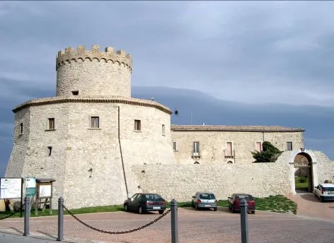 Castello marchesale Historic site, Palmoli21 km N
-
Vallone di Ponte Musa Natural site, Molise12 km NE
Sources & licences
Data last updated: · 2 independent sources