Roccamandolfi
Located in Province of Isernia, Molise Coordinates: 41°29′50″ N 14°21′14″ E
- Population
- 923
- 923
- Elevation
- 789 m
- above sea level
- Local time
- UTC+01:00
- Europe/Rome · UTC+01:00
- Places inside
- 4
- listed under Roccamandolfi
- Airports
- NAP Naples International Airport68 km
- FOG Foggia Gino Lisa Airport99 km
About Roccamandolfi
Roccamandolfi is a municipality. Location: Province of Isernia, Molise. Population: 923. Elevation: 789 m. The best months to visit are June–September. The nearest airport is Naples International Airport (68 km). Nearby sights include Montagna del Matese and Monte Cilara.
Climate of Roccamandolfi
Best months for sightseeingBest months for sightseeing: June–September.
This month · November
A cold month
Day 11° · Night 5° · Rain 90 mm
- Hottest month
- August (day 25°)
- Coldest month
- February (night 1°)
- Wettest month
- November (90 mm)
- Driest month
- July (35 mm)
Bars: average monthly low and high temperature. Below: precipitation. Monthly averages for 1970–2000 at about 18 km resolution, adjusted for elevation. Highlighted months are mild and relatively dry. Source: WorldClim 2.1 (CC BY 4.0).
Show values as a table
| Month | Jan | Feb | Mar | Apr | May | Jun | Jul | Aug | Sep | Oct | Nov | Dec |
|---|---|---|---|---|---|---|---|---|---|---|---|---|
| Average high (°C) | 6° | 6° | 9° | 12° | 18° | 22° | 25° | 25° | 21° | 16° | 11° | 8° |
| Average low (°C) | 2° | 1° | 3° | 6° | 10° | 14° | 17° | 17° | 14° | 10° | 5° | 3° |
| Precipitation (mm) | 63 | 62 | 59 | 65 | 57 | 39 | 35 | 41 | 60 | 73 | 90 | 71 |
Other places to visit in this season: June July August September
How to get to Roccamandolfi
The nearest airport is Naples International Airport (NAP), 68 km to the south as the crow flies. The nearest large city is Split, 282 km to the northeast.
Airports
- Naples International Airport (NAP) Napoli 68 kmsouth
- Foggia Gino Lisa Airport (FOG) Foggia (FG) 99 kmeast
- Abruzzo Airport (PSR) Pescara 105 kmnorth
Nearby large cities
- Split Population: 149.8K 282 kmnortheast
Straight-line distances; road distances are longer. Airport data: OurAirports.
Day trips from Roccamandolfi
Within 100 km: 110 historic and cultural sites, 208 natural sites, 52 lakes, rivers and coasts.
0–25 km21 places
- Serra di Vallelonga Mountain 10 kmSW
- Colle Tentale Mountain 20 kmNE
- Monte Sant'Angeli Mountain 23 kmSW
- Monte San Nicola Mountain 22 kmSW
25–60 km114 places
- Vallone Grande Natural site 47 kmNE
- Valle Covatta Natural site 27 kmNE
- Spiaggia Lido Villaggio Beach 59 kmSW
- Spiaggia di Mondragone Beach 59 kmSW
60–100 km235 places
- Colle Umberto Mountain 74 kmS
- Ripari di Giobbe Beach 97 kmN
- Sombrero Beach 95 kmW
- Spiaggia delle Bambole Beach 79 kmW
Straight-line distances.
Places in Roccamandolfi
4 placesBar: population relative to the most populous place in this list.
Mountains & nature2
- Colle di Mezzo · Mountain
- Monte Alto · Mountain
Nearby attractions & nature
Everything nearby-
Montagna del Matese Mountain, Molise5.3 km S
-
Monte Cilara Mountain, Longano7.6 km W
-
Serra di Vallelonga Mountain, Valle Agricola10 km SW
-
Monte Caruso Mountain, Longano11 km W
-
Monte Raspato Mountain, San Gregorio Matese11 km S
-
Monte Caselle Iannitti Mountain, Fontegreca15 km W
-
Colle S. Martino Mountain, Fontegreca16 km W
-
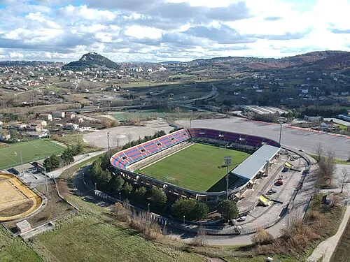 Stadio Nuovo Romagnoli Landmark, Campobasso24 km E
Sources & licences
Data last updated: