- Population
- 19
- 19
- Elevation
- 339 m
- above sea level
- Local time
- UTC+01:00
- Europe/Rome · UTC+01:00
- Airports
- TRN Turin Airport32 km
- CUF Cuneo International Airport66 km
About Serra
Serra is a village. Location: Passerano Marmorito, Province of Asti. Population: 19. Elevation: 339 m. The best months to visit are June–September. The nearest airport is Turin Airport (32 km). Nearby sights include Basilica of Superga and Gran Madre di Dio.
Climate of Serra
Best months for sightseeingBest months for sightseeing: June–September.
This month · November
A cold month
Day 10° · Night 3° · Rain 53 mm
- Hottest month
- July (day 27°)
- Coldest month
- January (night -2°)
- Wettest month
- May (96 mm)
- Driest month
- December (33 mm)
Bars: average monthly low and high temperature. Below: precipitation. Monthly averages for 1970–2000 at about 18 km resolution, adjusted for elevation. Highlighted months are mild and relatively dry. Source: WorldClim 2.1 (CC BY 4.0).
Show values as a table
| Month | Jan | Feb | Mar | Apr | May | Jun | Jul | Aug | Sep | Oct | Nov | Dec |
|---|---|---|---|---|---|---|---|---|---|---|---|---|
| Average high (°C) | 6° | 8° | 13° | 16° | 20° | 24° | 27° | 26° | 22° | 16° | 10° | 6° |
| Average low (°C) | -2° | -1° | 3° | 6° | 11° | 14° | 17° | 17° | 13° | 8° | 3° | -1° |
| Precipitation (mm) | 37 | 42 | 58 | 77 | 96 | 64 | 39 | 66 | 56 | 76 | 53 | 33 |
Other places to visit in this season: June July August September
How to get to Serra
The nearest airport is Turin Airport (TRN), 32 km to the northwest as the crow flies. The nearest large city is Nice, 164 km to the south.
Airports
- Turin Airport (TRN) Caselle Torinese (TO) 32 kmnorthwest
- Cuneo International Airport (CUF) Levaldigi (CN) 66 kmsouthwest
- Milan Malpensa International Airport (MXP) Ferno (VA) 83 kmnortheast
Nearby large cities
- Nice Population: 342.7K 164 kmsouth
- Grenoble Population: 158.6K 181 kmwest
- Geneva Population: 201.7K 192 kmnorthwest
- Lausanne Population: 139.1K 193 kmnorthwest
- Bern Population: 121.6K 213 kmnorth
Straight-line distances; road distances are longer. Airport data: OurAirports.
Day trips from Serra
Within 100 km: 33 historic and cultural sites, 449 natural sites, 28 lakes, rivers and coasts.
0–25 km2 places
- Basilica of Superga Attraction 20 kmW
- Gran Madre di Dio Attraction 25 kmW
25–60 km30 places
- Monte Pietraborga Mountain 47 kmW
- Monte San Giorgio Mountain 46 kmW
- Bec di Nona Mountain 60 kmN
- Monte Bechit Mountain 60 kmN
60–100 km478 places
- Gornersee Lake 100 kmN
- Ludwigshöhe Mountain 94 kmN
- Pollux Mountain 96 kmN
- Castor Mountain 96 kmN
Straight-line distances.
Nearby attractions & nature
Everything nearby-
 Basilica of Superga Attraction, Torino20 km W
-
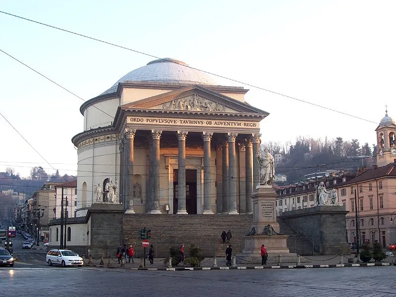 Gran Madre di Dio Attraction, San Salvario - Cavoretto - Borgo Po - Nizza Millefonti - Lingotto - Filadelfia25 km W
Other cities and towns in Passerano Marmorito
-
 Primeglio Village, Passerano Marmorito2.2 km S
-
Boscorotondo Village, Passerano Marmorito4.1 km S
Sources & licences
Data last updated: · 2 independent sources