Monterosso Grana
Located in Province of Cuneo, Piedmont Coordinates: 44°24′30″ N 7°19′23″ E
- Population
- 526
- 526
- Elevation
- 730 m
- above sea level
- Local time
- UTC+01:00
- Europe/Rome · UTC+01:00
- Places inside
- 18
- listed under Monterosso Grana
- Airports
- CUF Cuneo International Airport28 km
- NCE Nice-Côte d'Azur Airport84 km
About Monterosso Grana
Monterosso Grana is a municipality. Location: Province of Cuneo, Piedmont. Population: 526. Elevation: 730 m. The best months to visit are June–September. The nearest airport is Cuneo International Airport (28 km). Nearby sights include Punta dell'Omo and Monte Borel.
Climate of Monterosso Grana
Best months for sightseeingBest months for sightseeing: June–September.
This month · November
A cold month
Day 11° · Night 5° · Rain 94 mm
- Hottest month
- July (day 25°)
- Coldest month
- January (night 1°)
- Wettest month
- October (118 mm)
- Driest month
- July (45 mm)
Bars: average monthly low and high temperature. Below: precipitation. Monthly averages for 1970–2000 at about 18 km resolution, adjusted for elevation. Highlighted months are mild and relatively dry. Source: WorldClim 2.1 (CC BY 4.0).
Show values as a table
| Month | Jan | Feb | Mar | Apr | May | Jun | Jul | Aug | Sep | Oct | Nov | Dec |
|---|---|---|---|---|---|---|---|---|---|---|---|---|
| Average high (°C) | 8° | 8° | 11° | 14° | 18° | 22° | 25° | 25° | 21° | 16° | 11° | 9° |
| Average low (°C) | 1° | 1° | 4° | 6° | 10° | 14° | 16° | 17° | 13° | 9° | 5° | 2° |
| Precipitation (mm) | 81 | 70 | 74 | 97 | 98 | 73 | 45 | 64 | 85 | 118 | 94 | 81 |
Other places to visit in this season: June July August September
How to get to Monterosso Grana
The nearest airport is Cuneo International Airport (CUF), 28 km to the northeast as the crow flies. For international flights: Nice-Côte d'Azur Airport (NCE) (84 km). The nearest large city is Nice, 78 km to the south.
Airports
- Cuneo International Airport (CUF) Levaldigi (CN) 28 kmnortheast
- Nice-Côte d'Azur Airport (NCE) Nice, Alpes-Maritimes 84 kmsouth
- Turin Airport (TRN) Caselle Torinese (TO) 92 kmnorth
Nearby large cities
- Nice Population: 342.7K 78 kmsouth
- Grenoble Population: 158.6K 153 kmnorthwest
- Aix-en-Provence Population: 146.8K 179 kmsouthwest
- Toulon Population: 168.7K 182 kmsouthwest
- Marseille Population: 877.2K 199 kmsouthwest
Straight-line distances; road distances are longer. Airport data: OurAirports.
Day trips from Monterosso Grana
Within 100 km: 113 historic and cultural sites, 968 natural sites, 190 lakes, rivers and coasts.
0–25 km13 places
- Cima Valrossa Nord Mountain 22 kmSW
- Cima Centrale di Valrossa Mountain 23 kmS
- Cima Valrossa Sud Mountain 24 kmS
- Cima del Chiapous Mountain 24 kmS
25–60 km494 places
- Lac Premier Lake 41 kmW
- Lac Vert Lake 48 kmNW
- Lakes of Vens Lake 33 kmW
- Lacs de Ténibres Lake 32 kmSW
60–100 km764 places
- Clapes River 79 kmW
- Plage de Buse Beach 73 kmS
- Plage Petite Afrique Beach 77 kmS
- Plage des Fourmis Beach 78 kmS
Straight-line distances.
Places in Monterosso Grana
18 places- 1 Monterosso Grana 259
- 2 Villa San Pietro 84
- 3 Saretto 37
- 4 Levata 29
- 5 Istiria 15
- 6 Santa Lucia 15
- 7 Crosasso 14
- 8 Tetti Rossi 14
- 9 Braida 12
- 10 Frise 8
- 11 Saresin 8
- 12 Martini 7
- 13 Cromba-Frise 6
- 14 Figlieri 3
- 15 Oggeri 3
- 16 Albornè 2
- 17 Daniel 2
- 18 Menardo 1
Bar: population relative to the most populous place in this list.
Nearby attractions & nature
Everything nearby-
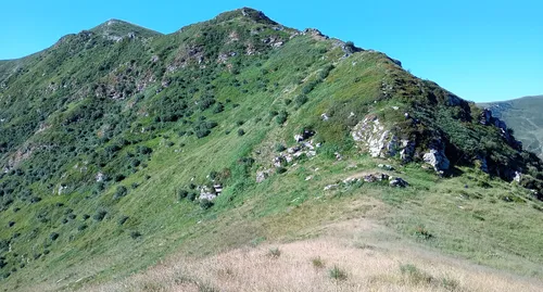 Punta dell'Omo Mountain, Castelmagno9 km W
-
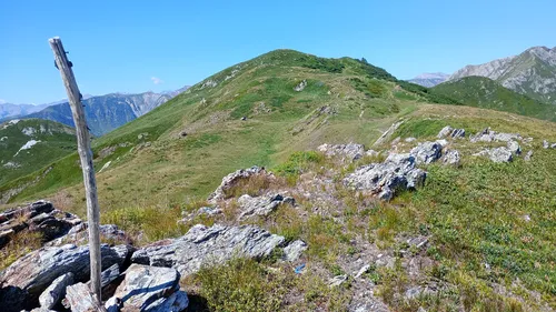 Monte Borel Mountain, Castelmagno11 km W
-
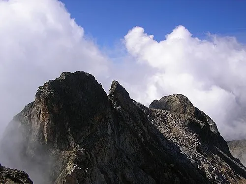 Monte Matto Mountain, Valdieri21 km S
-
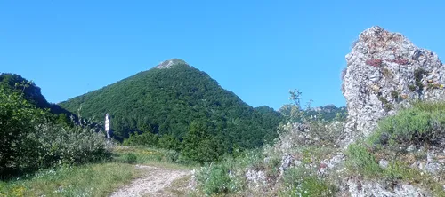 Monte Saben Mountain, Valdieri14 km SE
-
Monte Viridio Mountain, Demonte14 km W
-
Monte Croce Mountain, Moiola13 km SE
-
Monte Savi Mountain, Demonte16 km W
-
Monte Ray Mountain, Entracque20 km S
Sources & licences
Data last updated: