- Population
- 48
- 48
- Elevation
- 7 m
- above sea level
- Local time
- UTC+01:00
- Europe/Rome · UTC+01:00
- Airports
- CAG Cagliari Elmas Airport11 km
- AHO Alghero-Fertilia Airport156 km
About Is Orrus
Is Orrus is a village. Location: Decimomannu, Province of Cagliari. Population: 48. Elevation: 7 m. The best months to visit are May, October. The nearest airport is Cagliari Elmas Airport (11 km). Nearby sights include Stadio Sant'Elia and Teatro Civico di Castello.
Climate of Is Orrus
Best months for sightseeingBest months for sightseeing: May, October.
This month · November
Outside the best season
Day 18° · Night 10° · Rain 77 mm
- Hottest month
- August (day 32°)
- Coldest month
- January (night 6°)
- Wettest month
- November (77 mm)
- Driest month
- July (5 mm)
Bars: average monthly low and high temperature. Below: precipitation. Monthly averages for 1970–2000 at about 18 km resolution, adjusted for elevation. Highlighted months are mild and relatively dry. Source: WorldClim 2.1 (CC BY 4.0).
Show values as a table
| Month | Jan | Feb | Mar | Apr | May | Jun | Jul | Aug | Sep | Oct | Nov | Dec |
|---|---|---|---|---|---|---|---|---|---|---|---|---|
| Average high (°C) | 14° | 15° | 17° | 19° | 24° | 28° | 32° | 32° | 28° | 23° | 18° | 15° |
| Average low (°C) | 6° | 7° | 8° | 10° | 13° | 17° | 20° | 20° | 18° | 15° | 10° | 7° |
| Precipitation (mm) | 54 | 62 | 54 | 51 | 30 | 16 | 5 | 10 | 38 | 63 | 77 | 63 |
How to get to Is Orrus
The nearest airport is Cagliari Elmas Airport (CAG), 11 km to the southeast as the crow flies.
Airports
- Cagliari Elmas Airport (CAG) Cagliari 11 kmsoutheast
- Alghero-Fertilia Airport (AHO) Alghero 156 kmnorth
- Olbia Costa Smeralda Airport (OLB) Olbia (SS) 182 kmnorth
Straight-line distances; road distances are longer. Airport data: OurAirports.
Day trips from Is Orrus
Within 100 km: 5 historic and cultural sites, 121 natural sites, 114 lakes, rivers and coasts.
0–25 km22 places
- Poetto Beach 22 kmSE
- Punta Tiriaxeddu Mountain 24 kmS
- Spiaggia di Frutti d'Oro Beach 20 kmS
- Monte Pauliara Mountain 20 kmS
25–60 km119 places
- Spiaggia di Capo Carbonara Beach 54 kmSE
- Spiaggia delle Saline Beach 57 kmSW
- Spiaggia Grande Beach 58 kmSW
- Spiaggia della Tonnara Beach 58 kmSW
60–100 km99 places
- Spiaggia di Guidi Beach 62 kmSW
- Spiaggia di Perd'e Pera Beach 79 kmNE
- Spiaggia di Museddu Beach 80 kmNE
- Spiaggia della Marina di Cardedu Beach 80 kmNE
Straight-line distances.
Nearby attractions & nature
Everything nearby-
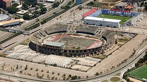 Stadio Sant'Elia Landmark, Cagliari20 km SE
-
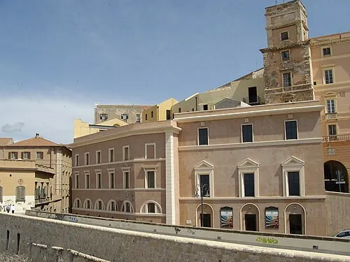 Teatro Civico di Castello Attraction, Cagliari18 km SE
-
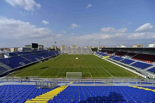 Stadio Is Arenas Landmark, Quartu Sant'Elena22 km SE
-
Su Concali Mountain, Uta13 km S
-
Cuccureddus Mountain, Uta14 km S
-
Mont'Arbu Mountain, Capoterra15 km S
Sources & licences
Data last updated: · 2 independent sources